T
Seller's Agent in 2026
Tracy Kilian
Coldwell Banker, The Property Exchange
(307) 421-4146
8 Total Sales
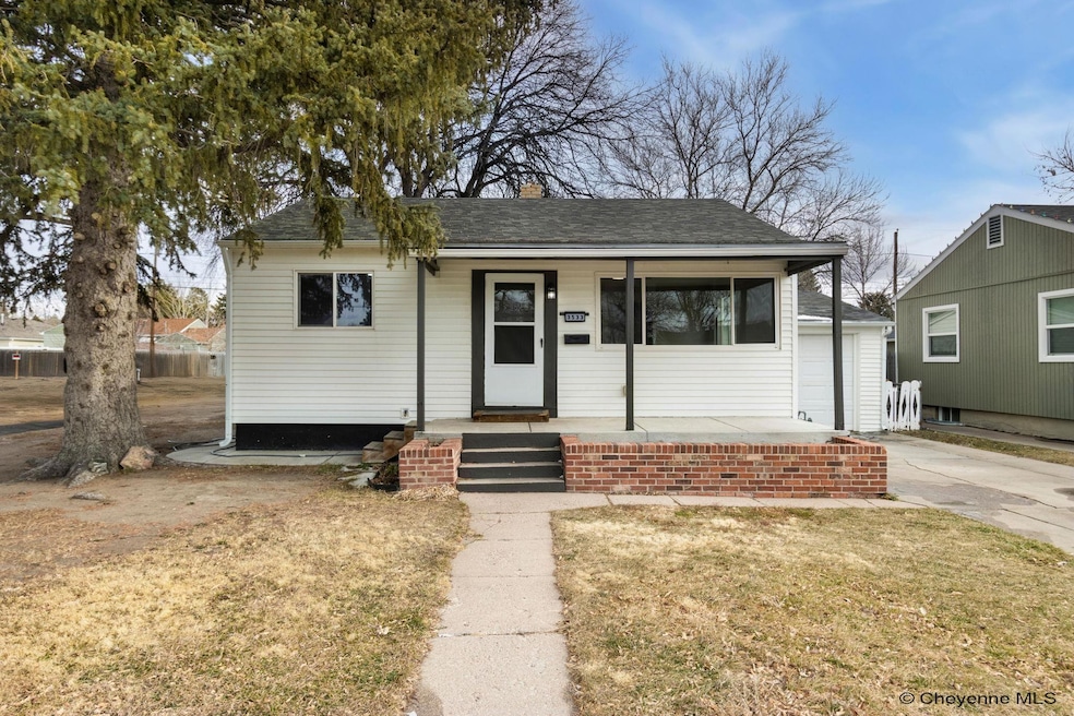
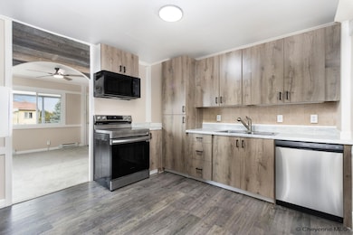
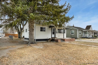
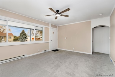
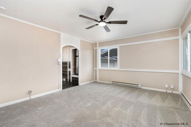

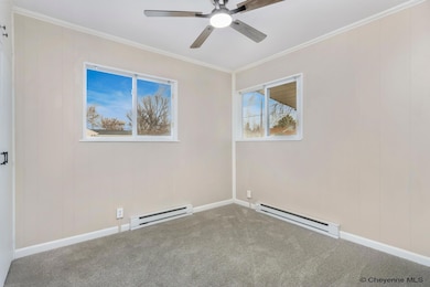
Move-In ready corner lot with dual garages! Welcome home to this centrally located, renovated corner lot property featuring 3 bedrooms and 2 full bathrooms in the East Triad. Updates include new modern kitchen cabinets, lighting, fresh paint, carpeting with Stainmaster padding, and refreshed bathrooms. Both upstairs bedrooms and hallway have built in storage; the downstairs bedroom is non-conforming (no egress). New water heater, dishwasher, microwave and refrigerator. Garages include 1 car attached and 2 car detached with electricity and alley access.
Last Agent to Sell the Property
Coldwell Banker, The Property Exchange Listed on: 12/09/2025

| Date | Type | Sale Price | Title Company |
|---|---|---|---|
| Warranty Deed | -- | First American | |
| Quit Claim Deed | -- | None Available | |
| Warranty Deed | -- | First American Title |
| Date | Status | Loan Amount | Loan Type |
|---|---|---|---|
| Open | $309,320 | FHA | |
| Previous Owner | $88,792 | Commercial |
| Date | Event | Price | List to Sale | Price per Sq Ft |
|---|---|---|---|---|
| 01/27/2026 01/27/26 | Sold | -- | -- | -- |
| 12/16/2025 12/16/25 | Pending | -- | -- | -- |
| 12/09/2025 12/09/25 | For Sale | $319,000 | -- | $237 / Sq Ft |
| Year | Tax Paid | Tax Assessment Tax Assessment Total Assessment is a certain percentage of the fair market value that is determined by local assessors to be the total taxable value of land and additions on the property. | Land | Improvement |
|---|---|---|---|---|
| 2025 | $1,549 | $17,319 | $2,827 | $14,492 |
| 2024 | $1,549 | $21,901 | $3,769 | $18,132 |
| 2023 | $1,571 | $22,217 | $3,769 | $18,448 |
| 2022 | $1,359 | $18,829 | $3,769 | $15,060 |
| 2021 | $1,287 | $17,792 | $3,769 | $14,023 |
| 2020 | $1,145 | $15,872 | $3,769 | $12,103 |
| 2019 | $1,096 | $15,180 | $3,769 | $11,411 |
| 2018 | $988 | $13,818 | $3,487 | $10,331 |
| 2017 | $1,010 | $13,990 | $3,487 | $10,503 |
| 2016 | $945 | $13,090 | $3,328 | $9,762 |
| 2015 | $883 | $12,231 | $3,328 | $8,903 |
| 2014 | $855 | $11,757 | $3,328 | $8,429 |
T
Seller's Agent in 2026
Tracy Kilian
Coldwell Banker, The Property Exchange
(307) 421-4146
8 Total Sales
Buyer's Agent in 2026
Kevin True
RE/MAX
(307) 630-8290
95 Total Sales
Source: Cheyenne Board of REALTORS®
MLS Number: 99298
APN: 1-1760-0013-0009-0
Disclaimer: Certain information contained herein is derived from information provided by parties other than Homes.com. All information provided is deemed reliable, but is not guaranteed to be accurate and should be independently verified.
![]() IDX information is provided exclusively for personal, non-commercial use, and may not be used for any purpose other than to identify prospective properties consumers may be interested in purchasing. Information is deemed reliable but not guaranteed.
IDX information is provided exclusively for personal, non-commercial use, and may not be used for any purpose other than to identify prospective properties consumers may be interested in purchasing. Information is deemed reliable but not guaranteed.
Ask me questions while you tour the home.