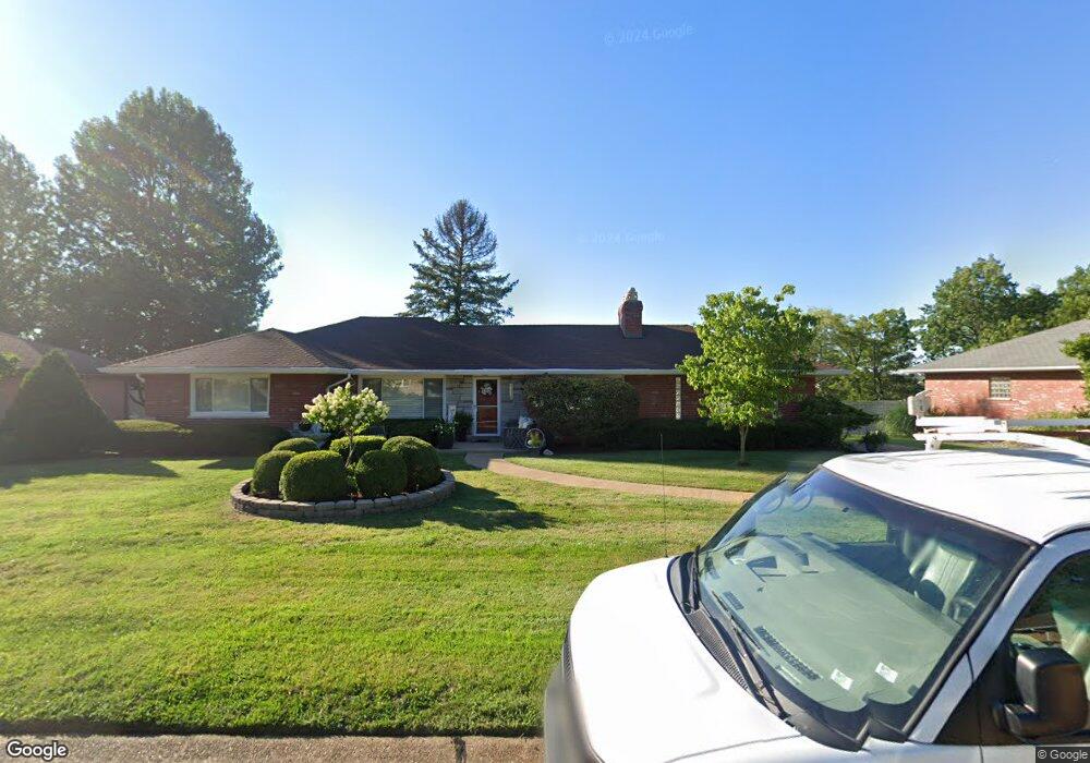
3533 Forest Dale Dr Saint Louis, MO 63125
Mehlville NeighborhoodEstimated Value: $281,000 - $334,000
2
Beds
2
Baths
1,497
Sq Ft
$202/Sq Ft
Est. Value
About This Home
This home is located at 3533 Forest Dale Dr, Saint Louis, MO 63125 and is currently estimated at $302,409, approximately $202 per square foot. 3533 Forest Dale Dr is a home located in St. Louis County with nearby schools including Bierbaum Elementary School, Margaret Buerkle Middle School, and Mehlville High School.
Ownership History
Date
Name
Owned For
Owner Type
Purchase Details
Closed on
Apr 6, 2005
Sold by
Barber Geraldine M and Barber Joseph F
Bought by
Sheshi Gentain and Sheshi Sonila
Current Estimated Value
Home Financials for this Owner
Home Financials are based on the most recent Mortgage that was taken out on this home.
Original Mortgage
$179,900
Outstanding Balance
$92,836
Interest Rate
5.78%
Mortgage Type
Purchase Money Mortgage
Estimated Equity
$209,573
Create a Home Valuation Report for This Property
The Home Valuation Report is an in-depth analysis detailing your home's value as well as a comparison with similar homes in the area
Home Values in the Area
Average Home Value in this Area
Purchase History
| Date | Buyer | Sale Price | Title Company |
|---|---|---|---|
| Sheshi Gentain | $179,900 | -- |
Source: Public Records
Mortgage History
| Date | Status | Borrower | Loan Amount |
|---|---|---|---|
| Open | Sheshi Gentain | $179,900 |
Source: Public Records
Tax History Compared to Growth
Tax History
| Year | Tax Paid | Tax Assessment Tax Assessment Total Assessment is a certain percentage of the fair market value that is determined by local assessors to be the total taxable value of land and additions on the property. | Land | Improvement |
|---|---|---|---|---|
| 2025 | $2,967 | $56,000 | $20,580 | $35,420 |
| 2024 | $2,967 | $43,720 | $10,280 | $33,440 |
| 2023 | $2,967 | $43,720 | $10,280 | $33,440 |
| 2022 | $2,427 | $33,570 | $10,280 | $23,290 |
| 2021 | $2,154 | $33,570 | $10,280 | $23,290 |
| 2020 | $2,161 | $32,040 | $10,280 | $21,760 |
| 2019 | $2,155 | $32,040 | $10,280 | $21,760 |
| 2018 | $2,073 | $27,820 | $6,370 | $21,450 |
| 2017 | $2,070 | $27,820 | $6,370 | $21,450 |
| 2016 | $2,052 | $26,460 | $6,000 | $20,460 |
| 2015 | $1,925 | $26,460 | $6,000 | $20,460 |
| 2014 | $1,709 | $23,220 | $4,050 | $19,170 |
Source: Public Records
Map
Nearby Homes
- 9201 Cedarberry Ct
- 11074 Kohrs Ln
- 4124 Lois Ln
- 4110 Lois Ln
- 10822 Antrill Dr
- 9511 Alix Dr
- 3808 Southern Manor Dr
- 4146 Crescent Dr
- 3656 Colonia Place Dr Unit C
- 10916 Arctic Dr
- 6935 Colonial Woods Dr Unit 23
- 6911 Colonial Woods Dr Unit 7
- 3724 Southern Manor Dr
- 6910 Colonial Woods Dr Unit 95
- 6904 Colonial Woods Dr Unit 100
- 11345 Revere Ln
- 6990 Colonial Woods Dr Unit 59
- 2 Burlington at Grove at Grant’s Trail Meadows
- 3301 Avenue H
- 2 Meadows
- 3541 Forest Dale Dr
- 3525 Forest Dale Dr
- 3542 Forest Dale Dr
- 3549 Forest Dale Dr
- 3534 Forest Dale Dr
- 3517 Forest Dale Dr
- 3526 Forest Dale Dr
- 19 Lone Elm Cir
- 3518 Forest Dale Dr
- 3557 Forest Dale Dr
- 15 Lone Elm Cir
- 3509 Forest Dale Dr
- 5 Lone Elm Cir
- 3608 Forest Dale Dr
- 9 Lone Elm Cir
- 3514 Forest Dale Dr
- 1 Lone Elm Cir
- 3505 Forest Dale Dr
- 3603 Forest Dale Dr
- 20 Lone Elm Cir