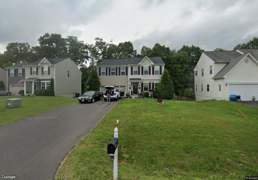
35374 Pheasant Ridge Rd Locust Grove, VA 22508
Estimated Value: $431,000 - $471,000
4
Beds
3
Baths
1,944
Sq Ft
$229/Sq Ft
Est. Value
About This Home
This home is located at 35374 Pheasant Ridge Rd, Locust Grove, VA 22508 and is currently estimated at $444,396, approximately $228 per square foot. 35374 Pheasant Ridge Rd is a home located in Orange County with nearby schools including Locust Grove Primary School, Locust Grove Elementary School, and Locust Grove Middle School.
Ownership History
Date
Name
Owned For
Owner Type
Purchase Details
Closed on
Jul 2, 2018
Sold by
Nvr Inc
Bought by
Jordan Avery and Gruber Angela
Current Estimated Value
Home Financials for this Owner
Home Financials are based on the most recent Mortgage that was taken out on this home.
Original Mortgage
$279,798
Outstanding Balance
$239,338
Interest Rate
4.12%
Mortgage Type
FHA
Estimated Equity
$205,058
Create a Home Valuation Report for This Property
The Home Valuation Report is an in-depth analysis detailing your home's value as well as a comparison with similar homes in the area
Home Values in the Area
Average Home Value in this Area
Purchase History
| Date | Buyer | Sale Price | Title Company |
|---|---|---|---|
| Jordan Avery | $284,960 | None Available |
Source: Public Records
Mortgage History
| Date | Status | Borrower | Loan Amount |
|---|---|---|---|
| Open | Jordan Avery | $279,798 |
Source: Public Records
Tax History Compared to Growth
Tax History
| Year | Tax Paid | Tax Assessment Tax Assessment Total Assessment is a certain percentage of the fair market value that is determined by local assessors to be the total taxable value of land and additions on the property. | Land | Improvement |
|---|---|---|---|---|
| 2025 | $2,147 | $284,800 | $60,000 | $224,800 |
| 2024 | $2,147 | $284,800 | $60,000 | $224,800 |
| 2023 | $2,147 | $284,800 | $60,000 | $224,800 |
| 2022 | $2,147 | $284,800 | $60,000 | $224,800 |
| 2021 | $2,061 | $286,300 | $60,000 | $226,300 |
| 2020 | $2,061 | $286,300 | $60,000 | $226,300 |
| 2019 | $2,246 | $279,400 | $55,000 | $224,400 |
| 2018 | $362 | $279,400 | $55,000 | $224,400 |
| 2017 | $362 | $45,000 | $45,000 | $0 |
| 2016 | $362 | $45,000 | $45,000 | $0 |
| 2015 | $324 | $45,000 | $45,000 | $0 |
| 2014 | $324 | $45,000 | $45,000 | $0 |
Source: Public Records
Map
Nearby Homes
- 2188 Mallard Ln
- 35049 Mansours Dr
- 35342 Hawks Nest Ct
- 35460 Quail Meadow Ln
- 2082 Mallard Ln
- 35291 Gosling Ln
- 35326 Gosling Ln
- 2036 Mourning Dove Dr
- 35121 Wilderness Shores Way
- 35305 Wilderness Shores Way
- 36032 Coyote Trail
- 35615 Pine Needle Ln
- 35603 Pine Needle Ln
- 35599 Pine Needle Ln
- 36101 Wilderness Shores Way
- 36109 Wilderness Shores Way
- 36113 Wilderness Shores Way
- 36117 Wilderness Shores Way
- 36121 Wilderness Shores Way
- Coral Plan at Wilderness Shores - Seasons Collection
- 35380 Pheasant Ridge Rd
- 35366 Pheasant Ridge Rd
- 35373 Pheasant Ridge Rd
- 35373 Pheasant Ridge Rd
- 35388 Pheasant Ridge Rd
- 35381 Pheasant Ridge Rd
- 35360 Pheasant Ridge Rd
- 35394 Pheasant Ridge Rd
- 35391 Pheasant Ridge Rd
- 35352 Pheasant Ridge Rd
- 35355 Pheasant Ridge Rd
- 2206 Mallard Ln
- 35400 Pheasant Ridge Rd
- 2196 Mallard Ln
- 35346 Pheasant Ridge Rd
- 35313 Quail Meadow Ln
- 35347 Pheasant Ridge Rd
- 35401 Pheasant Ridge Rd
- 35309 Quail Meadow Ln
- 35363 Quail Meadow Ln