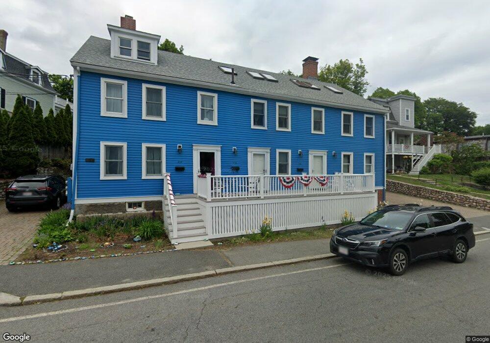
354 Nahant Rd Unit 358 Nahant, MA 01908
Estimated Value: $905,000 - $1,345,000
7
Beds
3
Baths
4,248
Sq Ft
$278/Sq Ft
Est. Value
About This Home
This home is located at 354 Nahant Rd Unit 358, Nahant, MA 01908 and is currently estimated at $1,179,667, approximately $277 per square foot. 354 Nahant Rd Unit 358 is a home located in Essex County with nearby schools including Johnson Elementary School, Swampscott Middle School, and Swampscott High School.
Ownership History
Date
Name
Owned For
Owner Type
Purchase Details
Closed on
Aug 31, 1995
Sold by
Pendergast Judith A and Oneil John M
Bought by
Inglis Jean M and Obrien Joan
Current Estimated Value
Create a Home Valuation Report for This Property
The Home Valuation Report is an in-depth analysis detailing your home's value as well as a comparison with similar homes in the area
Home Values in the Area
Average Home Value in this Area
Purchase History
| Date | Buyer | Sale Price | Title Company |
|---|---|---|---|
| Inglis Jean M | $190,000 | -- | |
| Inglis Jean M | $190,000 | -- |
Source: Public Records
Mortgage History
| Date | Status | Borrower | Loan Amount |
|---|---|---|---|
| Open | Inglis Jean M | $165,000 | |
| Closed | Inglis Jean M | $266,000 | |
| Closed | Inglis Jean M | $22,600 |
Source: Public Records
Tax History
| Year | Tax Paid | Tax Assessment Tax Assessment Total Assessment is a certain percentage of the fair market value that is determined by local assessors to be the total taxable value of land and additions on the property. | Land | Improvement |
|---|---|---|---|---|
| 2025 | $10,779 | $1,178,000 | $572,000 | $606,000 |
| 2024 | $10,108 | $1,114,400 | $551,900 | $562,500 |
| 2023 | $9,435 | $1,038,000 | $541,900 | $496,100 |
| 2022 | $9,767 | $997,600 | $541,900 | $455,700 |
| 2021 | $9,704 | $923,300 | $521,800 | $401,500 |
| 2020 | $10,129 | $923,300 | $521,800 | $401,500 |
| 2019 | $9,266 | $849,300 | $501,700 | $347,600 |
| 2018 | $8,192 | $799,200 | $451,600 | $347,600 |
| 2017 | $8,368 | $799,200 | $451,600 | $347,600 |
| 2016 | $7,655 | $727,700 | $381,300 | $346,400 |
| 2015 | $7,700 | $705,100 | $358,700 | $346,400 |
| 2014 | $7,418 | $672,500 | $326,100 | $346,400 |
Source: Public Records
Map
Nearby Homes
- 6 Desmond Dr
- 162 Willow Rd Unit 11
- 303 Nahant Rd
- 51 Cliff St
- 5 Cottage St
- 66 Ocean St
- 85 Willow Rd
- 1 Goddard Dr
- 51 Fox Hill Rd
- 75 Castle Rd
- 30 Sherman Ave
- 43 Maple Ave
- 36 Lennox Rd
- 129A Wilson Rd
- 285 Lynn Shore Dr Unit 203
- 285 Lynn Shore Dr Unit 304
- 295 Lynn Shore Dr Unit 702
- 31 Lincoln House Point
- 98 Lynnway
- 15 Grosvenor Park
Your Personal Tour Guide
Ask me questions while you tour the home.