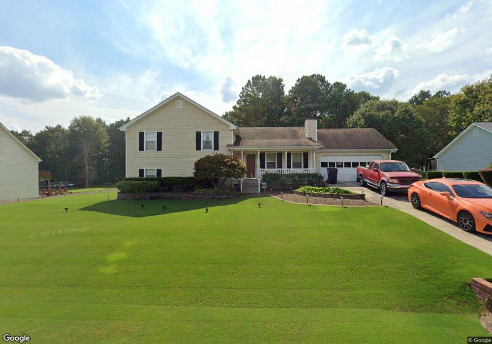
354 Rowan Ct Unit 2 Auburn, GA 30011
Estimated Value: $319,000 - $346,581
3
Beds
3
Baths
2,052
Sq Ft
$164/Sq Ft
Est. Value
About This Home
This home is located at 354 Rowan Ct Unit 2, Auburn, GA 30011 and is currently estimated at $336,645, approximately $164 per square foot. 354 Rowan Ct Unit 2 is a home located in Barrow County with nearby schools including Auburn Elementary School, Westside Middle School, and Apalachee High School.
Ownership History
Date
Name
Owned For
Owner Type
Purchase Details
Closed on
Jun 15, 2005
Sold by
Dukes Dukes P and Dukes Angela
Bought by
Kelley John A
Current Estimated Value
Home Financials for this Owner
Home Financials are based on the most recent Mortgage that was taken out on this home.
Original Mortgage
$146,500
Outstanding Balance
$75,989
Interest Rate
5.66%
Mortgage Type
VA
Estimated Equity
$260,656
Purchase Details
Closed on
Jul 13, 1992
Bought by
Dukes Dukes P and Dukes Ange
Create a Home Valuation Report for This Property
The Home Valuation Report is an in-depth analysis detailing your home's value as well as a comparison with similar homes in the area
Home Values in the Area
Average Home Value in this Area
Purchase History
| Date | Buyer | Sale Price | Title Company |
|---|---|---|---|
| Kelley John A | $147,000 | -- | |
| Dukes Dukes P | $79,900 | -- |
Source: Public Records
Mortgage History
| Date | Status | Borrower | Loan Amount |
|---|---|---|---|
| Open | Kelley John A | $146,500 |
Source: Public Records
Tax History Compared to Growth
Tax History
| Year | Tax Paid | Tax Assessment Tax Assessment Total Assessment is a certain percentage of the fair market value that is determined by local assessors to be the total taxable value of land and additions on the property. | Land | Improvement |
|---|---|---|---|---|
| 2024 | $3,137 | $105,462 | $24,000 | $81,462 |
| 2023 | $2,179 | $105,462 | $24,000 | $81,462 |
| 2022 | $1,834 | $65,638 | $12,000 | $53,638 |
| 2021 | $1,959 | $65,638 | $12,000 | $53,638 |
| 2020 | $1,967 | $65,638 | $12,000 | $53,638 |
| 2019 | $1,934 | $63,714 | $10,000 | $53,714 |
| 2018 | $1,774 | $59,046 | $8,800 | $50,246 |
| 2017 | $256 | $47,859 | $8,800 | $39,059 |
| 2016 | $1,286 | $44,501 | $12,800 | $31,701 |
| 2015 | $1,313 | $45,282 | $12,800 | $32,482 |
| 2014 | $1,063 | $39,145 | $6,272 | $32,873 |
| 2013 | -- | $37,710 | $6,272 | $31,438 |
Source: Public Records
Map
Nearby Homes
- 2063 Blackberry Ln
- 2057 Blackberry Ln
- 270 E Union Grove Cir
- 539 Hayes Rd
- 335 Wages Rd
- 331 Wages Rd
- 491 Glen Terrace Rd
- 1778 Wynfield Ln
- 494 Courtney Ln Unit 2
- 1587 Cronic Town Rd Unit 1
- 60 Wood Chuck Ct
- 70 Wood Chuck Ct
- 1923 Westfall Landing
- 4001 Triton Ives Dr
- 692 W Union Grove Cir
- 4165 Whitfield Oak Way
- 738 Key Largo Ct NE
- 280 Etheridge Rd
- 356 Rowan Ct
- 352 Rowan Ct Unit 2
- 352 Ardell Ct
- 358 Rowan Ct Unit 2
- 350 Rowan Ct Unit 2
- 357 Rowan Ct
- 359 Rowan Ct
- 360 Rowan Ct
- 337 Blackberry Ln
- 354 Ardell Ct Unit 2
- 347 Rowan Ct
- 353 Ardell Ct Unit 2
- 348 Rowan Ct
- 2080 Blackberry Ln Unit 1
- 339 Blackberry Ln
- 361 Rowan Ct
- 335 Blackberry Ln
- 346 Rowan Ct
- 355 Ardell Ct
- 2092 Blackberry Ln Unit 3