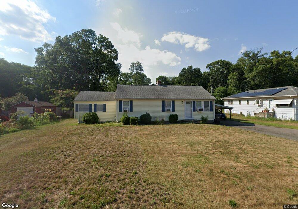
354 Scantic Rd East Windsor, CT 06088
Estimated Value: $228,000 - $359,000
3
Beds
2
Baths
1,606
Sq Ft
$192/Sq Ft
Est. Value
About This Home
This home is located at 354 Scantic Rd, East Windsor, CT 06088 and is currently estimated at $308,297, approximately $191 per square foot. 354 Scantic Rd is a home located in Hartford County with nearby schools including Broad Brook Elementary School, East Windsor Middle School, and East Windsor High School.
Ownership History
Date
Name
Owned For
Owner Type
Purchase Details
Closed on
Mar 15, 2004
Sold by
Breton Timothy
Bought by
Furrow Edward
Current Estimated Value
Home Financials for this Owner
Home Financials are based on the most recent Mortgage that was taken out on this home.
Original Mortgage
$168,743
Outstanding Balance
$77,653
Interest Rate
5.67%
Mortgage Type
Purchase Money Mortgage
Estimated Equity
$230,644
Purchase Details
Closed on
Jul 28, 2003
Sold by
Robinson Essie Est
Bought by
Breton Timothy
Create a Home Valuation Report for This Property
The Home Valuation Report is an in-depth analysis detailing your home's value as well as a comparison with similar homes in the area
Home Values in the Area
Average Home Value in this Area
Purchase History
| Date | Buyer | Sale Price | Title Company |
|---|---|---|---|
| Furrow Edward | $175,000 | -- | |
| Furrow Edward | $175,000 | -- | |
| Breton Timothy | $29,935 | -- | |
| Breton Timothy | $29,935 | -- |
Source: Public Records
Mortgage History
| Date | Status | Borrower | Loan Amount |
|---|---|---|---|
| Open | Breton Timothy | $168,743 | |
| Closed | Breton Timothy | $168,743 |
Source: Public Records
Tax History Compared to Growth
Tax History
| Year | Tax Paid | Tax Assessment Tax Assessment Total Assessment is a certain percentage of the fair market value that is determined by local assessors to be the total taxable value of land and additions on the property. | Land | Improvement |
|---|---|---|---|---|
| 2025 | $5,034 | $186,240 | $52,950 | $133,290 |
| 2024 | $4,872 | $186,240 | $52,950 | $133,290 |
| 2023 | $3,594 | $98,250 | $42,770 | $55,480 |
| 2022 | $3,569 | $98,250 | $42,770 | $55,480 |
| 2021 | $3,576 | $98,250 | $42,770 | $55,480 |
| 2020 | $3,603 | $98,930 | $42,770 | $56,160 |
| 2019 | $3,527 | $98,930 | $42,770 | $56,160 |
| 2018 | $3,492 | $98,930 | $42,770 | $56,160 |
| 2017 | $3,638 | $106,770 | $52,980 | $53,790 |
| 2016 | $3,431 | $106,770 | $52,980 | $53,790 |
| 2015 | $3,236 | $106,770 | $52,980 | $53,790 |
| 2014 | $3,180 | $106,770 | $52,980 | $53,790 |
Source: Public Records
Map
Nearby Homes
- 34 W River Rd
- 27 W River Rd
- 372 Scantic Rd Unit 8
- 18 Cathy (Lot 17) Ln
- 20 Cathy (Lot 16) Ln
- 17 Cathy (Lot 18) Ln
- 24 Cathy (Lot 14) Ln
- 22 Cathy (Lot 15) Ln
- 19 Cathy (Lot 19) Ln
- 26 Cathy (Lot 13) Ln
- 29 W River Rd
- 21 Ln
- 23 Cathy (Lot 21) Ln
- 43 W River Rd
- 47 Ferry Ln
- 74 Alison Dr
- 1638 Main St
- 1333 Palisado Ave
- 625 Palisado Ave Unit 310
- 24 MacKtown Rd