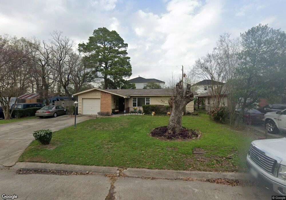
354 Surratt Dr Houston, TX 77091
Northside-Northline NeighborhoodEstimated Value: $190,000 - $327,000
2
Beds
2
Baths
1,537
Sq Ft
$170/Sq Ft
Est. Value
About This Home
This home is located at 354 Surratt Dr, Houston, TX 77091 and is currently estimated at $261,040, approximately $169 per square foot. 354 Surratt Dr is a home located in Harris County with nearby schools including Wesley Elementary School, Williams Middle, and Booker T Washington Sr High.
Ownership History
Date
Name
Owned For
Owner Type
Purchase Details
Closed on
Mar 11, 2009
Sold by
Turbyfill Johnny G
Bought by
Turbyfill Barbara A
Current Estimated Value
Purchase Details
Closed on
Nov 1, 2000
Sold by
Blair Donald L
Bought by
Turbyfill Johnny G
Home Financials for this Owner
Home Financials are based on the most recent Mortgage that was taken out on this home.
Original Mortgage
$169,000
Interest Rate
7.87%
Mortgage Type
Seller Take Back
Purchase Details
Closed on
May 6, 1998
Sold by
Williams Marcella and Jensen Marcella
Bought by
Blackwell Johnie A and Blackwell Margaret R
Home Financials for this Owner
Home Financials are based on the most recent Mortgage that was taken out on this home.
Original Mortgage
$52,318
Interest Rate
7.09%
Mortgage Type
FHA
Create a Home Valuation Report for This Property
The Home Valuation Report is an in-depth analysis detailing your home's value as well as a comparison with similar homes in the area
Home Values in the Area
Average Home Value in this Area
Purchase History
| Date | Buyer | Sale Price | Title Company |
|---|---|---|---|
| Turbyfill Barbara A | -- | None Available | |
| Turbyfill Johnny G | -- | Stewart Title Company | |
| Blackwell Johnie A | -- | First American Title |
Source: Public Records
Mortgage History
| Date | Status | Borrower | Loan Amount |
|---|---|---|---|
| Closed | Turbyfill Johnny G | $169,000 | |
| Previous Owner | Blackwell Johnie A | $52,318 |
Source: Public Records
Tax History Compared to Growth
Tax History
| Year | Tax Paid | Tax Assessment Tax Assessment Total Assessment is a certain percentage of the fair market value that is determined by local assessors to be the total taxable value of land and additions on the property. | Land | Improvement |
|---|---|---|---|---|
| 2025 | $14 | $235,627 | $70,967 | $164,660 |
| 2024 | $14 | $235,627 | $70,967 | $164,660 |
| 2023 | $14 | $218,594 | $70,967 | $147,627 |
| 2022 | $3,272 | $165,761 | $49,677 | $116,084 |
| 2021 | $3,148 | $158,760 | $49,677 | $109,083 |
| 2020 | $2,974 | $148,734 | $49,677 | $99,057 |
| 2019 | $2,825 | $137,291 | $35,484 | $101,807 |
| 2018 | $177 | $101,484 | $10,645 | $90,839 |
| 2017 | $2,566 | $101,484 | $10,645 | $90,839 |
| 2016 | $2,451 | $101,484 | $10,645 | $90,839 |
| 2015 | $297 | $88,139 | $10,645 | $77,494 |
| 2014 | $297 | $88,139 | $10,645 | $77,494 |
Source: Public Records
Map
Nearby Homes
- 427 Yale Oaks Ln
- 434 Yale Oaks Ln
- 422 Yale Oaks Ln
- 406 Red Ripple Rd
- 410 Yale Oaks Ln
- 422 Surratt Dr
- 6057 Yale St
- 334 Yale Oaks Ln
- 327 Yale Oaks Ln
- 6100 Stuebner Airline Rd
- 522 Surratt Dr
- 615 Northew St Unit J
- 615 Northew St Unit K
- 201 W Rosamond St Unit 41
- 201 W Rosamond St Unit 53
- 201 W Rosamond St Unit 61
- 0 Pickering St
- 304 W Hamilton Lot B St
- 304 W St
- 304 W St E
- 350 Surratt Dr
- 6013 Yale Garden Ln
- 6015 Yale Garden Ln
- 346 Surratt Dr
- 431 Yale Oaks Ln
- 402 Surratt Dr
- 6017 Yale Garden Ln
- 355 Surratt Dr
- 359 Surratt Dr
- 351 Surratt Dr
- 342 Surratt Dr
- 423 Yale Oaks Ln
- 406 Surratt Dr
- 363 Surratt Dr
- 6019 Yale Garden Ln
- 347 Surratt Dr
- 419 Yale Oaks Ln
- 410 Yale Oak Ln
- 403 Surratt Dr
- 338 Surratt Dr