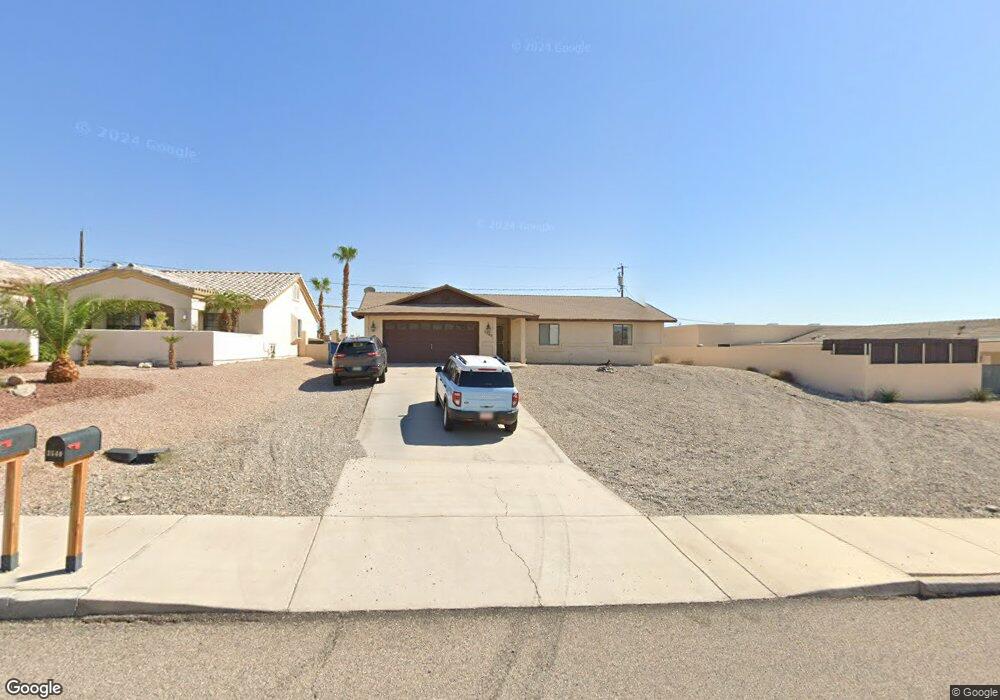
3540 Kiowa Blvd S Lake Havasu City, AZ 86404
Estimated Value: $284,000 - $527,000
3
Beds
2
Baths
1,549
Sq Ft
$252/Sq Ft
Est. Value
About This Home
This home is located at 3540 Kiowa Blvd S, Lake Havasu City, AZ 86404 and is currently estimated at $389,854, approximately $251 per square foot. 3540 Kiowa Blvd S is a home located in Mohave County with nearby schools including Jamaica Elementary School, Thunderbolt Middle School, and Lake Havasu High School.
Ownership History
Date
Name
Owned For
Owner Type
Purchase Details
Closed on
Dec 3, 2007
Sold by
Jarrah Omar
Bought by
Jarrah Omar
Current Estimated Value
Home Financials for this Owner
Home Financials are based on the most recent Mortgage that was taken out on this home.
Original Mortgage
$120,000
Interest Rate
6.26%
Mortgage Type
Stand Alone Refi Refinance Of Original Loan
Purchase Details
Closed on
Nov 23, 2001
Sold by
Jarrah Omar
Bought by
Jarrah Omar
Create a Home Valuation Report for This Property
The Home Valuation Report is an in-depth analysis detailing your home's value as well as a comparison with similar homes in the area
Home Values in the Area
Average Home Value in this Area
Purchase History
| Date | Buyer | Sale Price | Title Company |
|---|---|---|---|
| Jarrah Omar | -- | Land America Transnation Tit | |
| Jarrah Omar | -- | -- |
Source: Public Records
Mortgage History
| Date | Status | Borrower | Loan Amount |
|---|---|---|---|
| Closed | Jarrah Omar | $120,000 |
Source: Public Records
Tax History Compared to Growth
Tax History
| Year | Tax Paid | Tax Assessment Tax Assessment Total Assessment is a certain percentage of the fair market value that is determined by local assessors to be the total taxable value of land and additions on the property. | Land | Improvement |
|---|---|---|---|---|
| 2026 | $661 | -- | -- | -- |
| 2025 | $1,339 | $30,995 | $0 | $0 |
| 2024 | $1,339 | $32,447 | $0 | $0 |
| 2023 | $1,339 | $28,327 | $0 | $0 |
| 2022 | $1,282 | $19,195 | $0 | $0 |
| 2021 | $1,445 | $18,171 | $0 | $0 |
| 2019 | $1,375 | $14,753 | $0 | $0 |
| 2018 | $1,329 | $14,434 | $0 | $0 |
| 2017 | $1,316 | $13,167 | $0 | $0 |
| 2016 | $1,195 | $12,638 | $0 | $0 |
| 2015 | $1,147 | $10,798 | $0 | $0 |
Source: Public Records
Map
Nearby Homes
- 3525 Kiowa Blvd S
- 340 Opossum Dr
- 3501 Amberwood Place
- 3646 Yazoo Ln
- 3461 Antelope Dr
- 3550 Tecumseh Dr
- 3610 Pontchartrain Dr
- 3410 Kiowa Blvd S
- 3446 S Amberwood Bay
- 3691 Yazoo Dr
- 3851 Texoma Dr
- 3861 Texoma Dr
- 3390 Amberwood Ave
- 3493 Mitchell Ln
- 3780 Hiawatha Dr
- 3776 Hiawatha Dr
- 3630 Yucca Dr
- 3811 Canyon Cove Dr
- 250 Geronimo Blvd
- 3481 Pocahontas Dr
- 3544 Kiowa Blvd S
- 336 Driftwood Dr
- 3541 Kiowa Blvd S
- 330 Driftwood Dr
- 3553 Buckboard Ln
- 3548 Kiowa Blvd S
- 3559 Buckboard Ln
- 320 Driftwood Dr
- 3541 Kiowa Blvd S
- 3537 S Kiowa Blvd S
- 3552 Kiowa Blvd S
- 3547 Kiowa Blvd S
- 3533 Kiowa Blvd S
- 3565 Buckboard Ln
- 3565 Buckboard Ln
- 310 Driftwood Dr
- 357 Driftwood Dr
- 3553 Kiowa Blvd S
- 347 Driftwood Dr
- 3529 Kiowa Blvd S