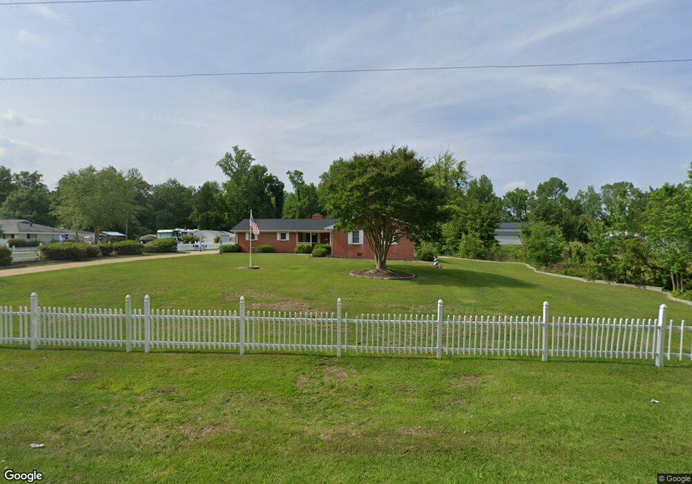
3540 Pauls Path Rd La Grange, NC 28551
Estimated Value: $277,000 - $348,000
3
Beds
3
Baths
2,367
Sq Ft
$136/Sq Ft
Est. Value
About This Home
This home is located at 3540 Pauls Path Rd, La Grange, NC 28551 and is currently estimated at $321,061, approximately $135 per square foot. 3540 Pauls Path Rd is a home located in Lenoir County with nearby schools including La Grange Elementary School, E.B. Frink Middle School, and North Lenoir High School.
Ownership History
Date
Name
Owned For
Owner Type
Purchase Details
Closed on
Oct 8, 2012
Sold by
Runschlag Glennie P
Bought by
Stacy Gerald K and Stacy Sandra K
Current Estimated Value
Home Financials for this Owner
Home Financials are based on the most recent Mortgage that was taken out on this home.
Original Mortgage
$125,100
Outstanding Balance
$86,605
Interest Rate
3.58%
Mortgage Type
New Conventional
Estimated Equity
$234,456
Create a Home Valuation Report for This Property
The Home Valuation Report is an in-depth analysis detailing your home's value as well as a comparison with similar homes in the area
Home Values in the Area
Average Home Value in this Area
Purchase History
| Date | Buyer | Sale Price | Title Company |
|---|---|---|---|
| Stacy Gerald K | $141,000 | None Available |
Source: Public Records
Mortgage History
| Date | Status | Borrower | Loan Amount |
|---|---|---|---|
| Open | Stacy Gerald K | $125,100 |
Source: Public Records
Tax History
| Year | Tax Paid | Tax Assessment Tax Assessment Total Assessment is a certain percentage of the fair market value that is determined by local assessors to be the total taxable value of land and additions on the property. | Land | Improvement |
|---|---|---|---|---|
| 2025 | $1,693 | $233,770 | $25,954 | $207,816 |
| 2024 | $1,311 | $145,218 | $18,400 | $126,818 |
| 2023 | $1,401 | $145,218 | $18,400 | $126,818 |
| 2022 | $1,401 | $145,218 | $18,400 | $126,818 |
| 2021 | $1,397 | $145,218 | $18,400 | $126,818 |
| 2020 | $1,397 | $145,218 | $18,400 | $126,818 |
| 2019 | $1,401 | $145,218 | $18,400 | $126,818 |
| 2018 | $1,379 | $145,218 | $18,400 | $126,818 |
| 2017 | $1,380 | $145,218 | $18,400 | $126,818 |
| 2014 | $1,365 | $145,623 | $18,400 | $127,223 |
| 2013 | -- | $145,623 | $18,400 | $127,223 |
| 2011 | -- | $154,462 | $18,400 | $136,062 |
Source: Public Records
Map
Nearby Homes
- 3670 Drew Farmer Rd
- 3745 Chatsworth Dr
- 3684 Drew Farmer Rd
- 3696 Drew Farmer Rd
- 3763 Huntcliff Dr
- 4569 Hunter Creek Dr
- 2806 Cornell Ct
- 3205 Deanswood Dr
- 3729 Bryan Hardy Rd
- 2526 Moulton Dr
- 3216 Dexter Cir
- 3145 Lakewood Dr Unit 3155
- 3118 Kelly Rd
- 3128 Kelly Rd
- 3306 Alton Phillips Rd
- 3178 Alton Phillips Rd
- Lot 1 Alton Phillips Rd
- 3344 Danfield Dr
- 2142 Carriage Dr
- 2134 Carriage Dr
- 3558 Pauls Path Rd
- 3616 Drew Farmer Rd
- 3640 Drew Farmer Rd
- 3565 Pauls Path Rd
- 3580 Pauls Path Rd
- 3912 Fred Jones Rd
- 3509 Pauls Path Rd
- 3613 Drew Farmer Rd
- 3658 Drew Farmer Rd
- 0 Pauls Path Rd
- 3631 Drew Farmer Rd
- 3735 Ginos Way
- 00 Huntcliff
- 3499 Pauls Path Rd
- 3599 Pauls Path Rd
- 3626 Pauls Path Rd
- 3736 Ginos Way
- Lot 52 Huntcliff
- 3727 Dawson Path Dr
- 3750 Huntcliff Dr
Your Personal Tour Guide
Ask me questions while you tour the home.