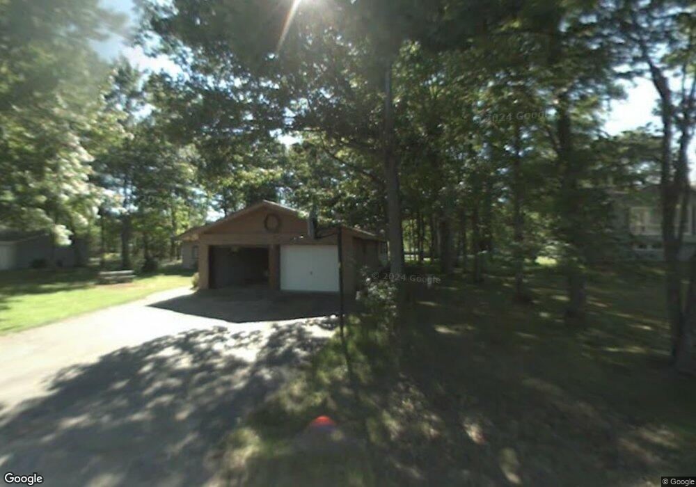
3540 William Harwood Rd Sault Sainte Marie, MI 49783
Estimated Value: $246,000 - $326,000
3
Beds
2
Baths
1,844
Sq Ft
$151/Sq Ft
Est. Value
About This Home
This home is located at 3540 William Harwood Rd, Sault Sainte Marie, MI 49783 and is currently estimated at $278,371, approximately $150 per square foot. 3540 William Harwood Rd is a home with nearby schools including Sault Area Middle School, Sault Area High School, and Immanuel Lutheran School.
Ownership History
Date
Name
Owned For
Owner Type
Purchase Details
Closed on
Apr 8, 2013
Sold by
Secretary Of Housing & Urban Development
Bought by
Gordon Michael J and Gordon Erica C
Current Estimated Value
Home Financials for this Owner
Home Financials are based on the most recent Mortgage that was taken out on this home.
Original Mortgage
$9,500
Outstanding Balance
$6,745
Interest Rate
3.6%
Estimated Equity
$271,626
Purchase Details
Closed on
Nov 1, 2012
Sold by
Bac Home Loan Servicing Lp
Bought by
Secretary Of Housing & Urban Development
Purchase Details
Closed on
Jul 20, 2012
Sold by
Henry Susan
Bought by
Bank Of America Na
Purchase Details
Closed on
Nov 25, 2005
Sold by
Gary W Gary W and Devalk Linda J
Bought by
Henry Susan
Home Financials for this Owner
Home Financials are based on the most recent Mortgage that was taken out on this home.
Original Mortgage
$124,000
Interest Rate
6.36%
Mortgage Type
Purchase Money Mortgage
Create a Home Valuation Report for This Property
The Home Valuation Report is an in-depth analysis detailing your home's value as well as a comparison with similar homes in the area
Home Values in the Area
Average Home Value in this Area
Purchase History
| Date | Buyer | Sale Price | Title Company |
|---|---|---|---|
| Gordon Michael J | $86,313 | -- | |
| Secretary Of Housing & Urban Development | -- | -- | |
| Bank Of America Na | $160,813 | -- | |
| Henry Susan | $155,000 | Eastern Upper Peninsula |
Source: Public Records
Mortgage History
| Date | Status | Borrower | Loan Amount |
|---|---|---|---|
| Open | Gordon Michael J | $9,500 | |
| Open | Gordon Michael J | $125,921 | |
| Previous Owner | Henry Susan | $124,000 |
Source: Public Records
Tax History Compared to Growth
Tax History
| Year | Tax Paid | Tax Assessment Tax Assessment Total Assessment is a certain percentage of the fair market value that is determined by local assessors to be the total taxable value of land and additions on the property. | Land | Improvement |
|---|---|---|---|---|
| 2025 | $3,347 | $124,900 | $0 | $0 |
| 2024 | $1,025 | $108,100 | $0 | $0 |
| 2023 | $928 | $94,000 | $0 | $0 |
| 2022 | $928 | $86,900 | $0 | $0 |
| 2021 | $1,604 | $75,200 | $0 | $0 |
| 2020 | $1,569 | $75,200 | $0 | $0 |
| 2019 | $1,540 | $75,100 | $0 | $0 |
| 2018 | $1,504 | $70,100 | $0 | $0 |
| 2017 | $849 | $69,900 | $0 | $0 |
| 2016 | $978 | $80,500 | $0 | $0 |
| 2011 | $929 | $75,700 | $0 | $0 |
Source: Public Records
Map
Nearby Homes
- 3546 S Radar Rd
- 1605 S Mulligan Row
- 1605 S Mulligan Row Unit 1605
- 3438 S Reynolds Ln
- 3601 S Radar Rd
- 647 W Ford Dr Unit 647
- 4538 S Baker Side Rd
- 3805 I 75 Business Spur
- 2550 W 14th St
- 0 W 24th St
- 0 W 24th Ave
- 0000 W 11th Ave
- 0000 W 11th Ave
- 00 W 16th Ave
- 1427 W 14th St
- 1811 Chestnut St
- 2245 W 5th Ave
- 123 25th Ave E
- 3715 Bermuda Ave
- 3105 Sherman Park Dr
- 3582 William Harwood Rd
- 3501 William Harwood Rd
- 3521 William Harwood Rd
- 3541 William Harwood Rd
- 3565 William Harwood Rd
- 3585 William Harwood Rd
- 3491 William Harwood Rd
- 3521 William Harwood Rd
- 3585 S William Harwood Dr
- 3540 Wm Harwood Rd
- 3520 William Harwood Rd
- 3508 William Harwood Rd
- 3541 S William Harwood Dr
- 3521 S William Harwood Dr Unit 3521
- 3532 S Teneyck Rd
- 3451 S Teneyck Rd
- 3498 S Teneyck Rd
- 1592 W Storey Row
- 3494 S Teneyck Rd
- 3600 S Teneyck Rd