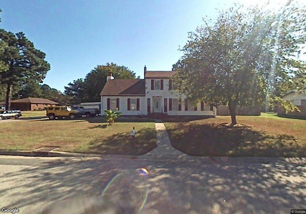
3541 Carter Rd Portsmouth, VA 23703
Churchland NeighborhoodEstimated Value: $408,000 - $457,000
4
Beds
4
Baths
2,608
Sq Ft
$165/Sq Ft
Est. Value
About This Home
This home is located at 3541 Carter Rd, Portsmouth, VA 23703 and is currently estimated at $429,463, approximately $164 per square foot. 3541 Carter Rd is a home located in Portsmouth City with nearby schools including Churchland Elementary School, Churchland Academy Elementary School, and Churchland Middle School.
Ownership History
Date
Name
Owned For
Owner Type
Purchase Details
Closed on
Nov 6, 2015
Sold by
Askew Claudia J
Bought by
Crain David P and Crain Stacey L
Current Estimated Value
Home Financials for this Owner
Home Financials are based on the most recent Mortgage that was taken out on this home.
Original Mortgage
$260,000
Outstanding Balance
$204,496
Interest Rate
3.87%
Mortgage Type
VA
Estimated Equity
$224,967
Purchase Details
Closed on
Oct 3, 2013
Sold by
Askew Clyde W
Bought by
Askew Claudia J
Create a Home Valuation Report for This Property
The Home Valuation Report is an in-depth analysis detailing your home's value as well as a comparison with similar homes in the area
Home Values in the Area
Average Home Value in this Area
Purchase History
| Date | Buyer | Sale Price | Title Company |
|---|---|---|---|
| Crain David P | $260,000 | Landmark Title Llc | |
| Askew Claudia J | -- | -- |
Source: Public Records
Mortgage History
| Date | Status | Borrower | Loan Amount |
|---|---|---|---|
| Open | Crain David P | $260,000 |
Source: Public Records
Tax History Compared to Growth
Tax History
| Year | Tax Paid | Tax Assessment Tax Assessment Total Assessment is a certain percentage of the fair market value that is determined by local assessors to be the total taxable value of land and additions on the property. | Land | Improvement |
|---|---|---|---|---|
| 2025 | $4,479 | $352,290 | $97,200 | $255,090 |
| 2024 | $4,479 | $350,220 | $97,200 | $253,020 |
| 2023 | $4,067 | $325,330 | $97,200 | $228,130 |
| 2022 | $4,154 | $319,500 | $81,000 | $238,500 |
| 2021 | $3,353 | $257,940 | $65,070 | $192,870 |
| 2020 | $3,313 | $254,840 | $61,970 | $192,870 |
| 2019 | $3,286 | $252,770 | $61,970 | $190,800 |
| 2018 | $3,286 | $252,770 | $61,970 | $190,800 |
| 2017 | $3,286 | $252,770 | $61,970 | $190,800 |
| 2016 | $3,286 | $252,770 | $61,970 | $190,800 |
| 2015 | $3,052 | $234,760 | $61,970 | $172,790 |
| 2014 | $2,981 | $234,760 | $61,970 | $172,790 |
Source: Public Records
Map
Nearby Homes
- 3315 Camellia Dr
- 5516 Bingham Dr
- 3432 Carter Rd
- 3509 Spence Rd
- 5304 High St W
- 5302 High St W
- 3604 Lilac Dr
- 4959 Briarwood Ln
- 5220 Clover Hill Dr
- 3101 Laurel Ln
- 4955 Briarwood Ln
- 3110 Sterling Way Unit 62
- 3425 Cedar Ln
- 5221 High St W
- 10AC Cedar Ln
- 3233 Clover Hill Dr
- 3205 Clover Hill Dr
- 5300 Larkspur Rd
- 1004 Christiana Cir
- 5806 Fawkes St
- 5629 Springwood Dr
- 3537 Carter Rd
- 5628 Greenefield Dr N
- 5632 Springwood Dr
- 5400 Daisy Dr
- 3536 Carter Rd
- 5625 Springwood Dr
- 5628 Springwood Dr
- 5624 Greenefield Dr N
- 3532 Carter Rd
- 3604 Carter Rd
- 3609 Carter Rd
- 5635 Greenefield Dr N
- 5621 Springwood Dr
- 3604 Sagewood Dr
- 5631 Greenefield Dr N
- 5620 Greenefield Dr N
- 3237 Dogwood Dr
- 3301 Dogwood Dr
- 5620 Springwood Dr