Estimated Value: $292,537
4
Beds
2
Baths
1,728
Sq Ft
$169/Sq Ft
Est. Value
About This Home
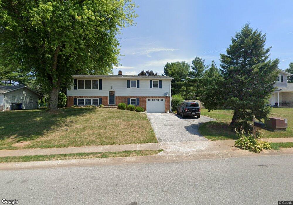
This home is located at 3541 Tower Dr, Dover, PA 17315 and is currently estimated at $292,537, approximately $169 per square foot. 3541 Tower Dr is a home located in York County with nearby schools including Dover Area High School and Lighthouse Christian School.
Ownership History
Date
Name
Owned For
Owner Type
Purchase Details
Closed on
Jan 19, 2022
Sold by
Smith Christopher D
Bought by
Smith Christopher D and Smith Clarissa
Current Estimated Value
Purchase Details
Closed on
Jun 17, 2009
Sold by
Smith Christopher D and Smith Holly L
Bought by
Smith Christopher D
Purchase Details
Closed on
May 18, 2001
Sold by
Greaves Frederick W and Greaves Thelma L
Bought by
Smith Christopher D and Smith Holly L
Home Financials for this Owner
Home Financials are based on the most recent Mortgage that was taken out on this home.
Original Mortgage
$94,000
Interest Rate
7.03%
Create a Home Valuation Report for This Property
The Home Valuation Report is an in-depth analysis detailing your home's value as well as a comparison with similar homes in the area
Home Values in the Area
Average Home Value in this Area
Purchase History
| Date | Buyer | Sale Price | Title Company |
|---|---|---|---|
| Smith Christopher D | -- | Rosenberg Jay A | |
| Smith Christopher D | -- | None Available | |
| Smith Christopher D | $117,500 | -- |
Source: Public Records
Mortgage History
| Date | Status | Borrower | Loan Amount |
|---|---|---|---|
| Previous Owner | Smith Christopher D | $94,000 | |
| Closed | Smith Christopher D | $17,625 |
Source: Public Records
Tax History
| Year | Tax Paid | Tax Assessment Tax Assessment Total Assessment is a certain percentage of the fair market value that is determined by local assessors to be the total taxable value of land and additions on the property. | Land | Improvement |
|---|---|---|---|---|
| 2025 | -- | $0 | $0 | $0 |
| 2024 | -- | $0 | $0 | $0 |
| 2023 | $3,771 | $0 | $0 | $0 |
| 2022 | $3,406 | $106,710 | $24,900 | $81,810 |
| 2021 | $3,213 | $106,710 | $24,900 | $81,810 |
| 2020 | $3,185 | $106,710 | $24,900 | $81,810 |
| 2019 | $3,145 | $106,710 | $24,900 | $81,810 |
| 2018 | $3,066 | $106,710 | $24,900 | $81,810 |
| 2017 | $3,066 | $106,710 | $24,900 | $81,810 |
| 2016 | $0 | $106,710 | $24,900 | $81,810 |
| 2015 | -- | $106,710 | $24,900 | $81,810 |
| 2014 | -- | $106,710 | $24,900 | $81,810 |
Source: Public Records
Map
Nearby Homes
- 3541 Village Rd
- 3711 AB Tiffany Dr
- 2510 Redwood Rd
- 2601 Village Rd
- 3700 Castle Dr
- 3460 Sycamore Rd
- 3570 Carlisle Rd
- 3510 Carlisle Rd
- 3720 Davidsburg Rd
- 2602 Brownstone Dr
- 2975 Cypress Rd S
- 2632 Brownstone Dr
- 3706 Wheatland Dr
- 2629 Brownstone Dr
- 3847 Country Dr
- 3836 Country Dr
- 3807 Castle Dr
- 3843 Castle Dr
- 3805 Castle Dr
- 3811 Castle Dr
- 3531 Tower Dr
- 3551 Tower Dr
- 3540 Middleboro Rd
- 3550 Middleboro Rd
- 3521 Tower Dr
- 3561 Tower Dr
- 3530 Tower Dr
- 3520 Tower Dr
- 3540 Tower Dr
- 3560 Middleboro Rd
- 3511 Tower Dr
- 3510 Tower Dr
- 3571 Tower Dr
- 3520 Middleboro Rd
- 3550 Tower Dr
- 3570 Middleboro Rd
- 3521 Wyngate Rd
- 3511 Wyngate Rd
- 3531 Middleboro Rd
- 3531 Wyngate Rd
Your Personal Tour Guide
Ask me questions while you tour the home.