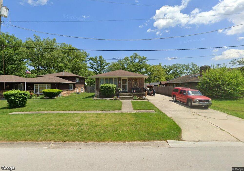
3543 Ashland Ave Steger, IL 60475
Estimated Value: $177,000 - $294,000
--
Bed
--
Bath
1,244
Sq Ft
$179/Sq Ft
Est. Value
About This Home
This home is located at 3543 Ashland Ave, Steger, IL 60475 and is currently estimated at $222,652, approximately $178 per square foot. 3543 Ashland Ave is a home located in Will County with nearby schools including Steger Primary Center, Columbia Central School, and Steger Intermediate Center.
Ownership History
Date
Name
Owned For
Owner Type
Purchase Details
Closed on
Oct 14, 2004
Sold by
Broccardo Donald J and Broccardo Janice E
Bought by
Garcia Robert and Garcia Jennie H
Current Estimated Value
Home Financials for this Owner
Home Financials are based on the most recent Mortgage that was taken out on this home.
Original Mortgage
$126,400
Outstanding Balance
$63,270
Interest Rate
5.93%
Mortgage Type
Purchase Money Mortgage
Estimated Equity
$159,382
Create a Home Valuation Report for This Property
The Home Valuation Report is an in-depth analysis detailing your home's value as well as a comparison with similar homes in the area
Home Values in the Area
Average Home Value in this Area
Purchase History
| Date | Buyer | Sale Price | Title Company |
|---|---|---|---|
| Garcia Robert | $158,000 | Chicago Title Insurance Co |
Source: Public Records
Mortgage History
| Date | Status | Borrower | Loan Amount |
|---|---|---|---|
| Open | Garcia Robert | $126,400 |
Source: Public Records
Tax History Compared to Growth
Tax History
| Year | Tax Paid | Tax Assessment Tax Assessment Total Assessment is a certain percentage of the fair market value that is determined by local assessors to be the total taxable value of land and additions on the property. | Land | Improvement |
|---|---|---|---|---|
| 2024 | $6,724 | $71,399 | $11,957 | $59,442 |
| 2023 | $6,724 | $63,755 | $10,677 | $53,078 |
| 2022 | $5,874 | $56,661 | $9,489 | $47,172 |
| 2021 | $5,525 | $51,878 | $8,688 | $43,190 |
| 2020 | $5,311 | $48,620 | $8,142 | $40,478 |
| 2019 | $5,029 | $45,695 | $7,652 | $38,043 |
| 2018 | $4,852 | $44,711 | $7,487 | $37,224 |
| 2017 | $4,745 | $41,189 | $6,897 | $34,292 |
| 2016 | $4,975 | $40,923 | $6,852 | $34,071 |
| 2015 | $4,832 | $39,828 | $6,669 | $33,159 |
| 2014 | $4,832 | $40,230 | $6,736 | $33,494 |
| 2013 | $4,832 | $44,104 | $7,059 | $37,045 |
Source: Public Records
Map
Nearby Homes
- 23614 S Ashland Ave
- 3533 Ashland Ave
- 23627 S Ashland Ave
- 200 Crystal Ln
- 3514 Ashland Ave
- 3512 John St
- 188 Cedarwood Dr
- 186 Cedarwood Dr
- 23751 S Loomis St
- 3813 Morgan St
- 23810 S Ashland Ave
- 3436 Sally Dr
- 173 Cedarwood Dr
- 1750 Richton Rd
- 92 W 37th St
- 3541 Peoria St
- 23922 S Cretewood Ln
- 3439 Sangamon St
- 3505 Peoria St
- 3606 Emerald Ave
- 3541 Ashland Ave
- 315 W Richton Rd
- 315 Richton Rd
- 307 Richton Rd
- 3539 Ashland Ave
- 3537 Ashland Ave
- 305 Richton Rd
- 391 Richton Rd
- 306 Craig Ct
- 401 W Richton Rd
- 304 Craig Ct
- 3535 Ashland Ave
- 303 Richton Rd
- 303 W Richton Rd
- 302 Craig Ct
- 1507 W Richton Rd
- 1465 W Richton Rd
- 401 Richton Rd
- 401 Richton Rd
- 3540 Ashland Ave