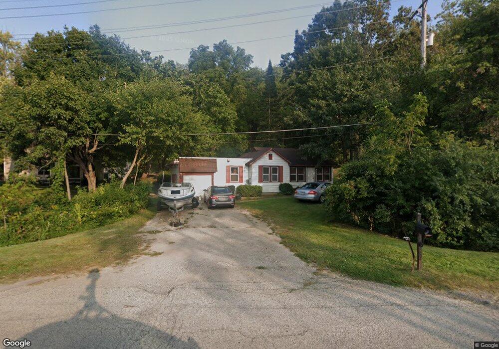
35441 N Il Route 59 Ingleside, IL 60041
Estimated Value: $130,000 - $183,000
2
Beds
1
Bath
850
Sq Ft
$181/Sq Ft
Est. Value
About This Home
This home is located at 35441 N Il Route 59, Ingleside, IL 60041 and is currently estimated at $153,742, approximately $180 per square foot. 35441 N Il Route 59 is a home located in Lake County with nearby schools including Big Hollow Primary School, Big Hollow Elementary School, and Big Hollow Middle School.
Ownership History
Date
Name
Owned For
Owner Type
Purchase Details
Closed on
Jan 1, 2021
Sold by
Berg Brian
Bought by
Bjcbbc Llc
Current Estimated Value
Purchase Details
Closed on
Sep 9, 2005
Sold by
Mccluskey Toby
Bought by
Berg Brian D
Home Financials for this Owner
Home Financials are based on the most recent Mortgage that was taken out on this home.
Original Mortgage
$71,100
Interest Rate
5.89%
Mortgage Type
Fannie Mae Freddie Mac
Create a Home Valuation Report for This Property
The Home Valuation Report is an in-depth analysis detailing your home's value as well as a comparison with similar homes in the area
Home Values in the Area
Average Home Value in this Area
Purchase History
| Date | Buyer | Sale Price | Title Company |
|---|---|---|---|
| Bjcbbc Llc | -- | None Available | |
| Berg Brian D | $79,000 | Multiple |
Source: Public Records
Mortgage History
| Date | Status | Borrower | Loan Amount |
|---|---|---|---|
| Previous Owner | Berg Brian D | $71,100 |
Source: Public Records
Tax History Compared to Growth
Tax History
| Year | Tax Paid | Tax Assessment Tax Assessment Total Assessment is a certain percentage of the fair market value that is determined by local assessors to be the total taxable value of land and additions on the property. | Land | Improvement |
|---|---|---|---|---|
| 2024 | $2,375 | $34,319 | $7,433 | $26,886 |
| 2023 | $2,699 | $32,330 | $7,002 | $25,328 |
| 2022 | $2,699 | $31,884 | $5,967 | $25,917 |
| 2021 | $2,669 | $30,053 | $5,624 | $24,429 |
| 2020 | $2,668 | $29,091 | $5,544 | $23,547 |
| 2019 | $2,580 | $27,897 | $5,316 | $22,581 |
| 2018 | $2,225 | $23,737 | $6,672 | $17,065 |
| 2017 | $2,130 | $21,940 | $6,167 | $15,773 |
| 2016 | $2,171 | $20,066 | $5,640 | $14,426 |
| 2015 | $2,106 | $18,725 | $5,263 | $13,462 |
| 2014 | $2,585 | $23,481 | $10,841 | $12,640 |
| 2012 | $2,417 | $24,467 | $11,296 | $13,171 |
Source: Public Records
Map
Nearby Homes
- 649 Windsor Dr Unit 3D
- 994 Reserve Ct
- 616 Windsor Dr Unit D
- 35403 N 2nd Ave
- 541 Foxridge Dr Unit 13D
- 35060 N Hilldale Dr
- 26931 W Marion Ct
- 35675 N Marine Dr
- 411 Kings Rd
- 605 Rollins Rd
- 532 Circle Dr
- 38 S Maple Ave
- 35105 N Ingleside Dr
- 37 Hillcrest Ave
- 545 Blue Springs Dr
- 29 S Hickory Ave
- 314 Mastodon Dr
- 1370 U S 12
- 69 Washington St
- 642 Key Largo Dr Unit 82
- 35449 N Il Route 59
- 35395 N Il Route 59
- 27357 W Longwood Dr
- 103 Longwood Dr
- 27519 W Chris Larkin Rd
- 195 Longwood Dr
- 890 Talismon Ct
- 103 Wildwood Dr
- 888 Talismon Ct
- 129 Wildwood Dr
- 109 W Longwood Dr
- 109 Longwood Dr
- 36 Chris Larkin Rd
- 996 Talismon Way
- 111 Wildwood Dr
- 111 Wildwood Dr
- 718 Crestview Dr
- 5008 Wildwood Dr
- 716 Il Route 59
- 892 Talismon Ct