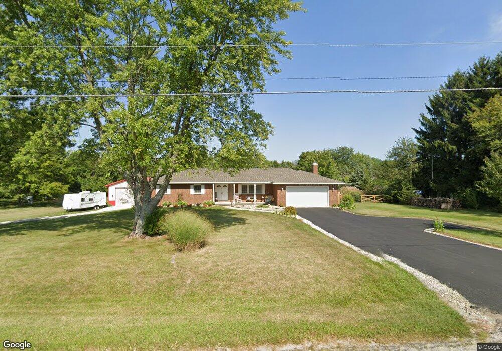
3545 Olmstead Rd West Jefferson, OH 43162
Estimated Value: $366,467 - $432,000
3
Beds
2
Baths
1,712
Sq Ft
$230/Sq Ft
Est. Value
About This Home
This home is located at 3545 Olmstead Rd, West Jefferson, OH 43162 and is currently estimated at $393,867, approximately $230 per square foot. 3545 Olmstead Rd is a home located in Madison County with nearby schools including Madison-Plains Elementary School, Madison-Plains Intermediate School, and Madison-Plains Junior High School.
Ownership History
Date
Name
Owned For
Owner Type
Purchase Details
Closed on
Nov 30, 2009
Sold by
Marx Sheryl A
Bought by
Cocanour Steven F and Cocanour Renee E
Current Estimated Value
Home Financials for this Owner
Home Financials are based on the most recent Mortgage that was taken out on this home.
Original Mortgage
$135,900
Outstanding Balance
$89,322
Interest Rate
5.05%
Mortgage Type
Purchase Money Mortgage
Estimated Equity
$304,545
Create a Home Valuation Report for This Property
The Home Valuation Report is an in-depth analysis detailing your home's value as well as a comparison with similar homes in the area
Home Values in the Area
Average Home Value in this Area
Purchase History
| Date | Buyer | Sale Price | Title Company |
|---|---|---|---|
| Cocanour Steven F | $169,900 | Midland Title |
Source: Public Records
Mortgage History
| Date | Status | Borrower | Loan Amount |
|---|---|---|---|
| Open | Cocanour Steven F | $135,900 |
Source: Public Records
Tax History Compared to Growth
Tax History
| Year | Tax Paid | Tax Assessment Tax Assessment Total Assessment is a certain percentage of the fair market value that is determined by local assessors to be the total taxable value of land and additions on the property. | Land | Improvement |
|---|---|---|---|---|
| 2024 | $2,802 | $97,290 | $15,920 | $81,370 |
| 2023 | $2,802 | $97,290 | $15,920 | $81,370 |
| 2022 | $2,356 | $71,650 | $11,730 | $59,920 |
| 2021 | $2,347 | $71,650 | $11,730 | $59,920 |
| 2020 | $2,350 | $71,650 | $11,730 | $59,920 |
| 2019 | $2,056 | $65,890 | $13,860 | $52,030 |
| 2018 | $2,057 | $65,890 | $13,860 | $52,030 |
| 2017 | $1,597 | $65,890 | $13,860 | $52,030 |
| 2016 | $1,597 | $53,830 | $13,860 | $39,970 |
| 2015 | $1,597 | $53,830 | $13,860 | $39,970 |
| 2014 | $1,597 | $53,830 | $13,860 | $39,970 |
| 2013 | -- | $59,130 | $13,860 | $45,270 |
Source: Public Records
Map
Nearby Homes
- 3370 Seaman Rd
- 4550 Lc Opossum Rd
- 2793 Ohio St
- 2731 Sandusky St
- 5930 Lilly Chapel Opossum Run Rd
- 5765 Lilly Chapel Opossum Run Rd
- 3388 Harrisburg Georgesville Rd
- 125 Dogwood Ct
- 0 Kiousville Georgesvl Rd
- 7750 Alkire Rd
- 1890 Wilson Rd SE
- 3100 Kropp Rd
- 0 W Jeff Kiousville Rd Unit 225000725
- 700 Shawn Dr Unit 88
- 10763 Southwood Rd
- 304 Middle Dr
- 0 Graessle Rd
- 63 Jones St
- 622 Brookdale Dr
- 5653 Norton Rd
- 3515 Olmstead Rd
- 3575 Olmstead Rd
- 3485 Olmstead Rd
- 10186 Lilly Chapel Georgesville Rd
- 3455 Olmstead Rd
- 10211 Lilly Chapel Georgesville Rd
- 9462 Alkire Rd
- 10211 Lilly Chapel Geo Rd
- 10211 Alkire Rd
- 9990 Lc Geo Rd
- 10125 Lilly Chapel Georgesville Rd
- 10135 Lc Geo Rd
- 10075 Lilly Chapel Georgesville Rd
- 9469 Alkire Rd
- 9426 Alkire Rd
- 9439 Alkire Rd
- 3375 Olmstead Rd
- 9382 Alkire Rd
- 9423 Alkire Rd
- 3420 Olmstead Rd