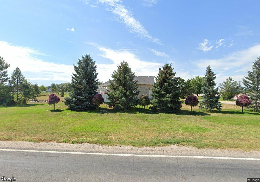
3545 W 1800 N Clearfield, UT 84015
Estimated Value: $668,000 - $721,000
--
Bed
3
Baths
1,918
Sq Ft
$358/Sq Ft
Est. Value
About This Home
This home is located at 3545 W 1800 N, Clearfield, UT 84015 and is currently estimated at $687,000, approximately $358 per square foot. 3545 W 1800 N is a home with nearby schools including West Point School, West Point Junior High School, and Syracuse High School.
Ownership History
Date
Name
Owned For
Owner Type
Purchase Details
Closed on
Apr 22, 2016
Sold by
Flint Bart Paul and Flint Valery S
Bought by
Flint Bart and Flint Family Trust
Current Estimated Value
Create a Home Valuation Report for This Property
The Home Valuation Report is an in-depth analysis detailing your home's value as well as a comparison with similar homes in the area
Home Values in the Area
Average Home Value in this Area
Purchase History
| Date | Buyer | Sale Price | Title Company |
|---|---|---|---|
| Flint Bart | -- | None Available |
Source: Public Records
Tax History Compared to Growth
Tax History
| Year | Tax Paid | Tax Assessment Tax Assessment Total Assessment is a certain percentage of the fair market value that is determined by local assessors to be the total taxable value of land and additions on the property. | Land | Improvement |
|---|---|---|---|---|
| 2025 | $3,892 | $364,735 | $129,773 | $234,962 |
| 2024 | $3,711 | $356,399 | $162,662 | $193,737 |
| 2023 | $3,552 | $335,500 | $126,171 | $209,328 |
| 2022 | $3,795 | $649,000 | $231,517 | $417,483 |
| 2021 | $3,369 | $474,000 | $169,137 | $304,863 |
| 2020 | $2,979 | $414,000 | $146,694 | $267,306 |
| 2019 | $2,960 | $405,000 | $141,583 | $263,417 |
| 2018 | $2,704 | $365,000 | $130,278 | $234,722 |
| 2016 | $2,453 | $175,495 | $52,820 | $122,675 |
| 2015 | $2,310 | $156,630 | $52,820 | $103,810 |
| 2014 | $2,344 | $161,175 | $52,392 | $108,783 |
| 2013 | -- | $135,359 | $45,903 | $89,456 |
Source: Public Records
Map
Nearby Homes
- 3656 W 1800 N
- 2413 N Eurasian Crane Rd
- 2118 Snowy Crane Dr
- 1403 N 3850 W
- 3892 W 1450 N
- Torino Farmhouse Plan at Cranefield Estates
- 2000 Traditional Plan at Cranefield Estates - Estates Collection
- Murano Traditional Plan at Cranefield Estates - Estates Collection
- 2400 Farmhouse Plan at Cranefield Estates - Estates Collection
- 1825 Traditional Plan at Cranefield Estates - Estates Collection
- 1550 Craftsman Plan at Cranefield Estates - Estates Collection
- 2050 Craftsman Plan at Cranefield Estates - Estates Collection
- Murano Traditional Plan at Cranefield Estates
- San Marino Traditional Plan at Cranefield Estates
- 3000 Traditional Plan at Cranefield Estates - Estates Collection
- 2000 Farmhouse Plan at Cranefield Estates - Estates Collection
- 2500 Traditional Plan at Cranefield Estates - Estates Collection
- 2000 Garden Plan at Cranefield Estates - Estates Collection
- 3941 W 1800 N
- 3762 W 2300 N
- 3477 W 1850 N
- 3638 W 1800 N
- 3638 W 1800 N Unit 21
- 3614 W 1800 N
- 3589 W 1800 N
- 3459 W 1850 N
- 3656 W 1800 N Unit 20
- 3611 W 1800 N
- 3432 W 1850 N
- 3468 W 1850 N
- 1529 N 3420 W Unit 50
- 1593 N 3420 W Unit 44
- 1627 N 3420 W Unit 43
- 3476 W 1650 N
- 3476 W 1650 N Unit 40
- 1863 N 3420 W
- 3468 W 1650 N
- 3468 W 1650 N Unit 39
- 3534 W 1600 N
- 3522 W 1600 N