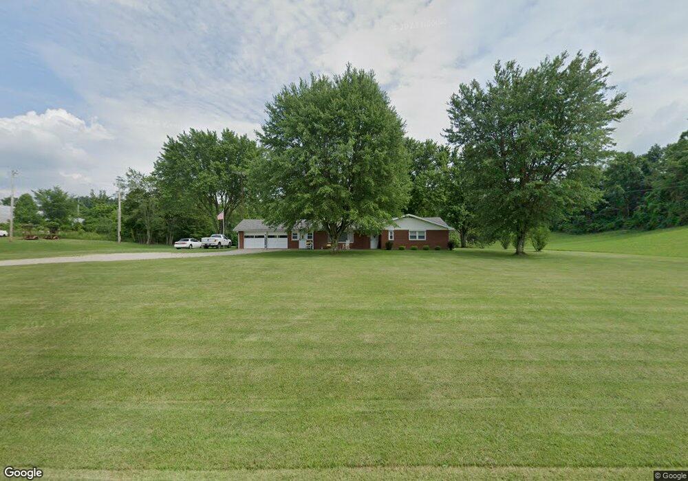
35467 State Route 78 Lewisville, OH 43754
Estimated Value: $170,000 - $253,183
3
Beds
2
Baths
1,581
Sq Ft
$127/Sq Ft
Est. Value
About This Home
This home is located at 35467 State Route 78, Lewisville, OH 43754 and is currently estimated at $200,394, approximately $126 per square foot. 35467 State Route 78 is a home located in Monroe County with nearby schools including Woodsfield Elementary School, River Elementary School, and Monroe Central High School.
Ownership History
Date
Name
Owned For
Owner Type
Purchase Details
Closed on
Apr 6, 2025
Sold by
Reed Stacy L and Reed Gregory D
Bought by
Scott Family Trust and Scott
Current Estimated Value
Purchase Details
Closed on
Mar 25, 2025
Sold by
Scott Sharon K
Bought by
Scott Family Trust and Scott
Purchase Details
Closed on
Sep 21, 2021
Sold by
Scott Sharon K
Bought by
Reed Stacy L and Scott Michael A
Purchase Details
Closed on
Mar 8, 2016
Bought by
Scott Sharon K and Scott Scott
Home Financials for this Owner
Home Financials are based on the most recent Mortgage that was taken out on this home.
Interest Rate
3.64%
Purchase Details
Closed on
Jul 2, 2002
Bought by
Scott Sharon K
Purchase Details
Closed on
Nov 8, 1996
Bought by
Scott Sharon K
Create a Home Valuation Report for This Property
The Home Valuation Report is an in-depth analysis detailing your home's value as well as a comparison with similar homes in the area
Home Values in the Area
Average Home Value in this Area
Purchase History
| Date | Buyer | Sale Price | Title Company |
|---|---|---|---|
| Scott Family Trust | -- | None Listed On Document | |
| Scott Family Trust | -- | None Listed On Document | |
| Reed Stacy L | -- | None Available | |
| Scott Sharon K | -- | -- | |
| Scott Sharon K | -- | -- | |
| Scott Sharon K | -- | -- |
Source: Public Records
Mortgage History
| Date | Status | Borrower | Loan Amount |
|---|---|---|---|
| Previous Owner | Scott Sharon K | -- |
Source: Public Records
Tax History Compared to Growth
Tax History
| Year | Tax Paid | Tax Assessment Tax Assessment Total Assessment is a certain percentage of the fair market value that is determined by local assessors to be the total taxable value of land and additions on the property. | Land | Improvement |
|---|---|---|---|---|
| 2024 | $1,502 | $52,170 | $13,940 | $38,230 |
| 2023 | $1,502 | $52,170 | $13,940 | $38,230 |
| 2022 | $1,501 | $52,170 | $13,940 | $38,230 |
| 2021 | $1,166 | $49,780 | $11,420 | $38,360 |
| 2020 | $1,414 | $49,780 | $11,420 | $38,360 |
| 2019 | $1,410 | $49,850 | $11,490 | $38,360 |
| 2018 | $1,354 | $46,110 | $9,570 | $36,540 |
| 2017 | $1,359 | $46,110 | $9,570 | $36,540 |
| 2016 | $1,412 | $46,110 | $9,570 | $36,540 |
| 2015 | $1,201 | $37,240 | $7,070 | $30,170 |
| 2014 | $1,201 | $37,240 | $7,070 | $30,170 |
| 2013 | $925 | $36,080 | $6,860 | $29,220 |
Source: Public Records
Map
Nearby Homes
- 0 Township Road 272
- 46218 Ohio 145
- 46017 Ohio 145
- 44800 Jim Stimpert Rd
- 0 Barber Ridge Rd
- 34108 Edwina Rd
- 34695 Edwina Rd
- 220 Oaklawn Ave
- 333 S Main St
- 218 Oaklawn Ave
- 208 Center St
- 198 N Monroe St
- 108 Oaklawn Ave
- 206 Ohio St
- 108 S Paul St
- 108.5 S Paul Alley
- 303 High St
- 210 E Church St
- 302 High St
- 407 High St
- 35281 State Route 78
- 35535 State Route 78
- 35226 State Route 78
- 35200 State Route 78
- 35200 State Route 78
- 35546 State Route 78
- 35600 State Route 78
- 35106 State Route 78
- 36215 State Route 78
- 35737 State Route 78
- 35087 State Route 78
- 36311 State Route 78
- 36357 State Route 78
- 34950 Township Road 1030
- 35038 State Route 78
- 0 St Rt 78
- 36575 State Route 78
- 36588 State Route 78
- 36570 State Route 78
- 35873 State Route 78