Estimated Value: $198,000 - $216,000
2
Beds
1
Bath
960
Sq Ft
$215/Sq Ft
Est. Value
About This Home
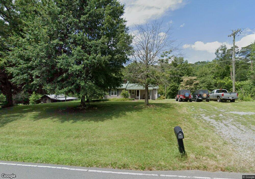
This home is located at 3548 Nc 66 Hwy S, King, NC 27021 and is currently estimated at $206,122, approximately $214 per square foot. 3548 Nc 66 Hwy S is a home located in Stokes County with nearby schools including Mount Olive Elementary School, Chestnut Grove Middle, and West Stokes High.
Ownership History
Date
Name
Owned For
Owner Type
Purchase Details
Closed on
Apr 27, 2007
Sold by
Skeens Robert M and Skeens Terrinalynn N T
Bought by
Crigger Terry Wayne
Current Estimated Value
Home Financials for this Owner
Home Financials are based on the most recent Mortgage that was taken out on this home.
Original Mortgage
$91,800
Outstanding Balance
$55,625
Interest Rate
6.1%
Mortgage Type
New Conventional
Estimated Equity
$150,497
Create a Home Valuation Report for This Property
The Home Valuation Report is an in-depth analysis detailing your home's value as well as a comparison with similar homes in the area
Home Values in the Area
Average Home Value in this Area
Purchase History
| Date | Buyer | Sale Price | Title Company |
|---|---|---|---|
| Crigger Terry Wayne | $102,000 | None Available |
Source: Public Records
Mortgage History
| Date | Status | Borrower | Loan Amount |
|---|---|---|---|
| Open | Crigger Terry Wayne | $91,800 |
Source: Public Records
Tax History Compared to Growth
Tax History
| Year | Tax Paid | Tax Assessment Tax Assessment Total Assessment is a certain percentage of the fair market value that is determined by local assessors to be the total taxable value of land and additions on the property. | Land | Improvement |
|---|---|---|---|---|
| 2025 | $1,090 | $152,400 | $45,800 | $106,600 |
| 2024 | $1,090 | $110,700 | $33,600 | $77,100 |
| 2023 | $897 | $110,700 | $33,600 | $77,100 |
| 2022 | $819 | $110,700 | $33,600 | $77,100 |
| 2021 | $819 | $110,700 | $33,600 | $77,100 |
| 2020 | $735 | $99,300 | $32,600 | $66,700 |
| 2019 | $735 | $99,300 | $32,600 | $66,700 |
| 2018 | $735 | $99,300 | $32,600 | $66,700 |
| 2017 | $730 | $99,300 | $32,600 | $66,700 |
| 2016 | $712 | $96,900 | $32,600 | $64,300 |
| 2015 | $707 | $96,900 | $32,600 | $64,300 |
| 2014 | $718 | $96,900 | $32,600 | $64,300 |
Source: Public Records
Map
Nearby Homes
- 1065 Reid Rd
- 0 Reid Rd
- 3125 YMcA Camp Rd
- 7.99 Mickey Rd
- 0 Nance Rd
- 0 Marshall Ridge Rd
- .64 Ac Kentland Dr Unit .64 Ac
- 1508 Johnson Rd
- 1506 Johnson Rd
- +/- 17.06 Johnson Rd
- 00 Thore Rd
- 5.25 Ac Capella Ridge Rd Unit 5.25 Ac
- 1125 Woodbury Rd
- 1078 Nc 66 Hwy S
- 1458 Merridon Dr
- 108 Nova Ln
- 1041 Luke St
- Lot 18 Roaring Creek Spur St
- Lot 17 Roaring Creek Spur St
- Lot 16 Roaring Creek Spur St
- 3508 Nc 66 Hwy S
- 1030 Capella Rd
- 3591 Nc 66 Hwy S
- 3615 Nc 66 Hwy S
- 1013 Capella Rd
- 1073 Charlie Hartgrove Rd
- 1005 Capella Rd
- 1175 Charlie Hartgrove Rd
- 1090 Capella Rd
- 3465 Nc 66 Hwy S
- 3625 Nc 66 Hwy S
- 1008 Charlie Hartgrove Rd
- 3657 Nc 66 Hwy S
- 1104 Capella Rd
- 1003 Capella Rd
- 1120 Capella Rd
- 1186 Charlie Hartgrove Rd
- 1060 Charlie Hartgrove Rd
- 1225 Charlie Hartgrove Rd
- 3699 Nc 66 Hwy S