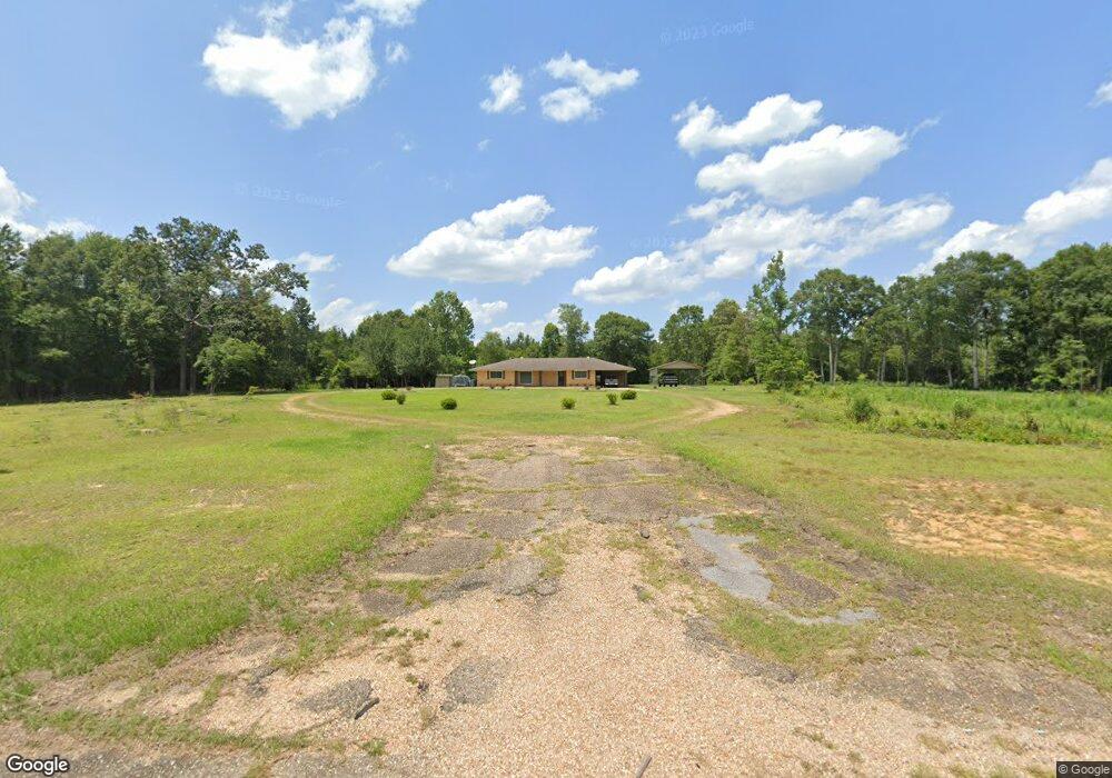
35487 Highway 38 Mount Hermon, LA 70450
Estimated Value: $193,901 - $268,000
3
Beds
2
Baths
1,600
Sq Ft
$147/Sq Ft
Est. Value
About This Home
This home is located at 35487 Highway 38, Mount Hermon, LA 70450 and is currently estimated at $235,634, approximately $147 per square foot. 35487 Highway 38 is a home located in Washington Parish with nearby schools including Mt. Hermon School.
Ownership History
Date
Name
Owned For
Owner Type
Purchase Details
Closed on
Jan 22, 2021
Sold by
Dauzat Steve J and Dauzat Paula A
Bought by
Dauzat Steve J
Current Estimated Value
Purchase Details
Closed on
Feb 9, 2017
Sold by
Kerbow Taylor Christopher Lavon and Kerbow Taylor Tabitha
Bought by
Dauzat Steve John and Dauzat Paula A
Purchase Details
Closed on
Dec 13, 2011
Sold by
Mcdonald Todd Edward and Mcdonald Karen Gill
Bought by
Kerbow Taylor Christopher Lavon and Kerbow Taylor Tabitha
Home Financials for this Owner
Home Financials are based on the most recent Mortgage that was taken out on this home.
Original Mortgage
$130,000
Interest Rate
4.03%
Mortgage Type
Purchase Money Mortgage
Purchase Details
Closed on
Jan 19, 2010
Sold by
Stafford Deveda Taylor and Stafford Keith N
Bought by
Mcdonald Todd Edward and Mcdonald Karen Gill
Create a Home Valuation Report for This Property
The Home Valuation Report is an in-depth analysis detailing your home's value as well as a comparison with similar homes in the area
Home Values in the Area
Average Home Value in this Area
Purchase History
| Date | Buyer | Sale Price | Title Company |
|---|---|---|---|
| Dauzat Steve J | -- | None Available | |
| Dauzat Steve John | $158,000 | First American Title | |
| Kerbow Taylor Christopher Lavon | $129,900 | None Available | |
| Mcdonald Todd Edward | $1,152 | None Available |
Source: Public Records
Mortgage History
| Date | Status | Borrower | Loan Amount |
|---|---|---|---|
| Previous Owner | Kerbow Taylor Christopher Lavon | $130,000 |
Source: Public Records
Tax History Compared to Growth
Tax History
| Year | Tax Paid | Tax Assessment Tax Assessment Total Assessment is a certain percentage of the fair market value that is determined by local assessors to be the total taxable value of land and additions on the property. | Land | Improvement |
|---|---|---|---|---|
| 2024 | $1,161 | $11,030 | $0 | $0 |
| 2023 | $374 | $11,030 | $970 | $10,060 |
| 2022 | $1,167 | $11,030 | $970 | $10,060 |
| 2021 | $1,167 | $11,030 | $970 | $10,060 |
| 2020 | $1,166 | $11,030 | $970 | $10,060 |
| 2019 | $1,163 | $11,030 | $970 | $10,060 |
| 2018 | $372 | $11,030 | $970 | $10,060 |
| 2017 | $1,201 | $11,030 | $970 | $10,060 |
| 2015 | $1,340 | $11,510 | $1,450 | $10,060 |
| 2013 | $1,352 | $11,510 | $1,450 | $10,060 |
Source: Public Records
Map
Nearby Homes
- 0 Louisiana 438
- 35866 Dock Butler Rd
- 29380 Archie Simmons Rd
- 0 B F Roberts Rd Unit 2516039
- 34.9 Acres Algie Miller Rd
- 31653 A Miller Rd
- 38006 La 438 Unit LotWP001
- 35218 Sunny Hill Rd
- TBD Bennie Morris Rd
- 1079 Mount Herman Rd
- 31248 Holmesville Rd
- 0 Louisiana 450
- 76555 Wilson Rd
- 0 Lonnie Duncan Rd
- 3033 Silver Dr
- 26383 Firetower Rd
- 2028 Smithburg Rd
- 35487 Highway 38
- 35487 Highway 38
- 35488 Highway 38
- 35542 Highway 38
- 35609 Highway 38
- 35609 Highway 38
- 35357 Highway 38
- 36012 Louisiana 38
- 36012 Highway 38
- 30259 W Wt Ott Rd
- 36012 Hwy 38
- 35684 Louisiana 38
- 35684 Highway 38
- 36010 Highway 38
- 38301 Louisiana 438
- 38351 Louisiana 438
- 36020 Highway 38
- 30437 Spurlock Rd
- 36239 Louisiana 1055
- 36413 Louisiana 1055