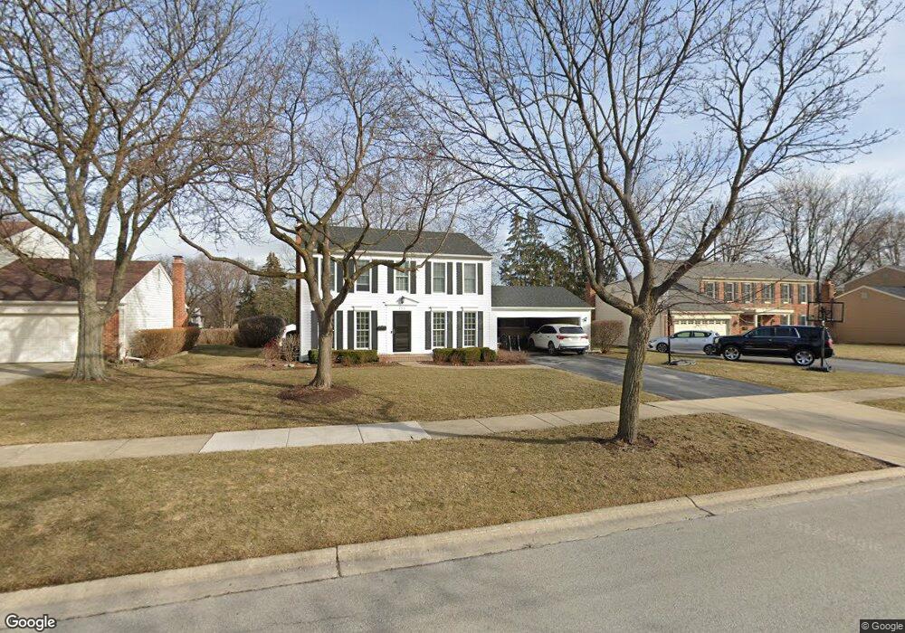
355 Ambleside Dr Roselle, IL 60172
Estimated Value: $476,000 - $524,000
4
Beds
3
Baths
2,048
Sq Ft
$244/Sq Ft
Est. Value
About This Home
This home is located at 355 Ambleside Dr, Roselle, IL 60172 and is currently estimated at $499,494, approximately $243 per square foot. 355 Ambleside Dr is a home located in DuPage County with nearby schools including Spring Hills Elementary School, Roselle Middle School, and Lake Park High School.
Ownership History
Date
Name
Owned For
Owner Type
Purchase Details
Closed on
Feb 4, 2025
Sold by
Harris James Michael and Harris Tameko J
Bought by
Harris Family Revocable Living Trust and Harris
Current Estimated Value
Purchase Details
Closed on
Oct 7, 2021
Sold by
Harris James Michael and Harris James Mike
Bought by
Harris James Michael and Harris Tameko J
Home Financials for this Owner
Home Financials are based on the most recent Mortgage that was taken out on this home.
Original Mortgage
$296,000
Interest Rate
2.88%
Mortgage Type
New Conventional
Purchase Details
Closed on
Dec 18, 2011
Sold by
Walsh Stephen V and Walsh Nancy M
Bought by
Harris James Mike and Harris Tameko J
Home Financials for this Owner
Home Financials are based on the most recent Mortgage that was taken out on this home.
Original Mortgage
$331,381
Interest Rate
3.75%
Mortgage Type
FHA
Create a Home Valuation Report for This Property
The Home Valuation Report is an in-depth analysis detailing your home's value as well as a comparison with similar homes in the area
Home Values in the Area
Average Home Value in this Area
Purchase History
| Date | Buyer | Sale Price | Title Company |
|---|---|---|---|
| Harris Family Revocable Living Trust | -- | None Listed On Document | |
| Harris James Michael | -- | Burnett Title | |
| Harris James Mike | $340,000 | Ctic |
Source: Public Records
Mortgage History
| Date | Status | Borrower | Loan Amount |
|---|---|---|---|
| Previous Owner | Harris James Michael | $296,000 | |
| Previous Owner | Harris James Mike | $331,381 |
Source: Public Records
Tax History
| Year | Tax Paid | Tax Assessment Tax Assessment Total Assessment is a certain percentage of the fair market value that is determined by local assessors to be the total taxable value of land and additions on the property. | Land | Improvement |
|---|---|---|---|---|
| 2024 | $10,321 | $145,348 | $39,136 | $106,212 |
| 2023 | $9,554 | $132,920 | $35,790 | $97,130 |
| 2022 | $9,508 | $132,150 | $35,560 | $96,590 |
| 2021 | $9,104 | $125,560 | $33,790 | $91,770 |
| 2020 | $9,149 | $122,500 | $32,970 | $89,530 |
| 2019 | $8,891 | $117,720 | $31,680 | $86,040 |
| 2018 | $9,315 | $122,950 | $33,090 | $89,860 |
| 2017 | $8,953 | $113,960 | $30,670 | $83,290 |
| 2016 | $8,639 | $105,460 | $28,380 | $77,080 |
| 2015 | $7,806 | $98,410 | $26,480 | $71,930 |
| 2014 | $7,189 | $90,230 | $24,280 | $65,950 |
| 2013 | $7,124 | $93,320 | $25,110 | $68,210 |
Source: Public Records
Map
Nearby Homes
- 366 Ventura Club Dr
- 380 Ventura Club Dr
- 455 E Granville Ave
- 219 N Prospect St
- 56 Salt Creek Rd Unit A
- 2235 Lake Shore Dr
- 2239 Lake Shore Dr
- 2237 Lake Shore Dr
- 2226 Lake Shore Dr
- 2225 Lake Shore Dr
- 2220 Lake Shore Dr
- 2228 Lake Shore Dr
- 2224 Lake Shore Dr
- 100 N Bokelman St Unit 329
- 50 N Bokelman St Unit 234
- 656 Rosner Dr Unit B
- 1630 Myrtle Park St
- 460 W Irving Park Rd
- 100 Pratt Blvd
- 647 Cumberland Trail Unit AA1
- 347 Ambleside Dr
- 363 Ambleside Dr
- 346 Ventura Club Dr
- 344 Ventura Club Dr
- 341 Ambleside Dr
- 371 Ambleside Dr
- 364 Ventura Club Dr
- 350 Ventura Club Dr
- 356 Ambleside Dr
- 348 Ambleside Dr
- 340 Ventura Club Dr
- 364 Ambleside Dr
- 360 Ventura Club Dr
- 333 Ambleside Dr
- 379 Ambleside Dr
- 342 Ambleside Dr
- 374 Ambleside Dr
- 326 Ventura Club Dr
- 330 Ventura Club Dr
- 334 Ambleside Dr
Your Personal Tour Guide
Ask me questions while you tour the home.