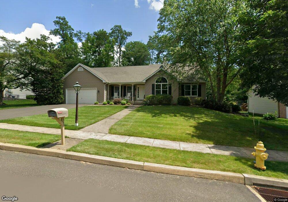
355 Birdsong Way Doylestown, PA 18901
Estimated Value: $674,000 - $740,620
3
Beds
2
Baths
1,559
Sq Ft
$458/Sq Ft
Est. Value
About This Home
This home is located at 355 Birdsong Way, Doylestown, PA 18901 and is currently estimated at $714,405, approximately $458 per square foot. 355 Birdsong Way is a home located in Bucks County with nearby schools including Linden El School, Lenape Middle School, and Central Bucks High School-West.
Ownership History
Date
Name
Owned For
Owner Type
Purchase Details
Closed on
Nov 21, 2003
Sold by
Stone Evans H and Stone Dorothy S
Bought by
Westfield James and Westfield Elizabeth
Current Estimated Value
Purchase Details
Closed on
Jul 27, 1998
Sold by
Johnson Katharine K
Bought by
Stone Evans H and Stone Dorothy S
Home Financials for this Owner
Home Financials are based on the most recent Mortgage that was taken out on this home.
Original Mortgage
$200,000
Interest Rate
6.87%
Create a Home Valuation Report for This Property
The Home Valuation Report is an in-depth analysis detailing your home's value as well as a comparison with similar homes in the area
Home Values in the Area
Average Home Value in this Area
Purchase History
| Date | Buyer | Sale Price | Title Company |
|---|---|---|---|
| Westfield James | $359,000 | -- | |
| Stone Evans H | $275,500 | -- |
Source: Public Records
Mortgage History
| Date | Status | Borrower | Loan Amount |
|---|---|---|---|
| Previous Owner | Stone Evans H | $200,000 |
Source: Public Records
Tax History Compared to Growth
Tax History
| Year | Tax Paid | Tax Assessment Tax Assessment Total Assessment is a certain percentage of the fair market value that is determined by local assessors to be the total taxable value of land and additions on the property. | Land | Improvement |
|---|---|---|---|---|
| 2025 | $7,567 | $39,720 | $9,360 | $30,360 |
| 2024 | $7,567 | $42,760 | $9,360 | $33,400 |
| 2023 | $7,215 | $42,760 | $9,360 | $33,400 |
| 2022 | $7,135 | $42,760 | $9,360 | $33,400 |
| 2021 | $6,988 | $42,760 | $9,360 | $33,400 |
| 2020 | $7,698 | $47,320 | $9,360 | $37,960 |
| 2019 | $7,615 | $47,320 | $9,360 | $37,960 |
| 2018 | $7,591 | $47,320 | $9,360 | $37,960 |
| 2017 | $7,532 | $47,320 | $9,360 | $37,960 |
| 2016 | $7,485 | $47,320 | $9,360 | $37,960 |
| 2015 | -- | $47,320 | $9,360 | $37,960 |
| 2014 | -- | $47,320 | $9,360 | $37,960 |
Source: Public Records
Map
Nearby Homes
- 195 Lafayette St
- 3 Steeplechase Dr
- 403 S Main St Unit S201
- 89 Homestead Dr
- 236 Green St
- 272 Fox Chase Ln
- 9 Mill Creek Dr
- 37 N Clinton St
- 110 E Ashland St
- 69 E Oakland Ave
- 78 Tower Hill Rd
- 20 E Court St
- 130 N Clinton St
- 1 Barnes Ct
- 155 E Oakland Ave
- 114 Progress Dr
- 146 E Court St
- 146 N Church St
- 32 Hibiscus Ct Unit 32
- 2320 Turk Rd
- 357 Birdsong Way
- 353 Birdsong Way
- 174 Hart Ave
- 359 Birdsong Way
- 170 Hart Ave
- 176 Hart Ave
- 360 Birdsong Way
- 356 Birdsong Way
- 358 Birdsong Way
- 354 Birdsong Way
- 361 Birdsong Way
- 352 Birdsong Way
- 201 Woodspring Cir
- 366 Birdsong Way
- 200 Woodspring Cir
- 16 Steeplechase Dr
- 350 S Main St Unit 309
- 350 S Main St Unit A10
- 350 S Main St Unit 211
- 350 S Main St Unit C3 308