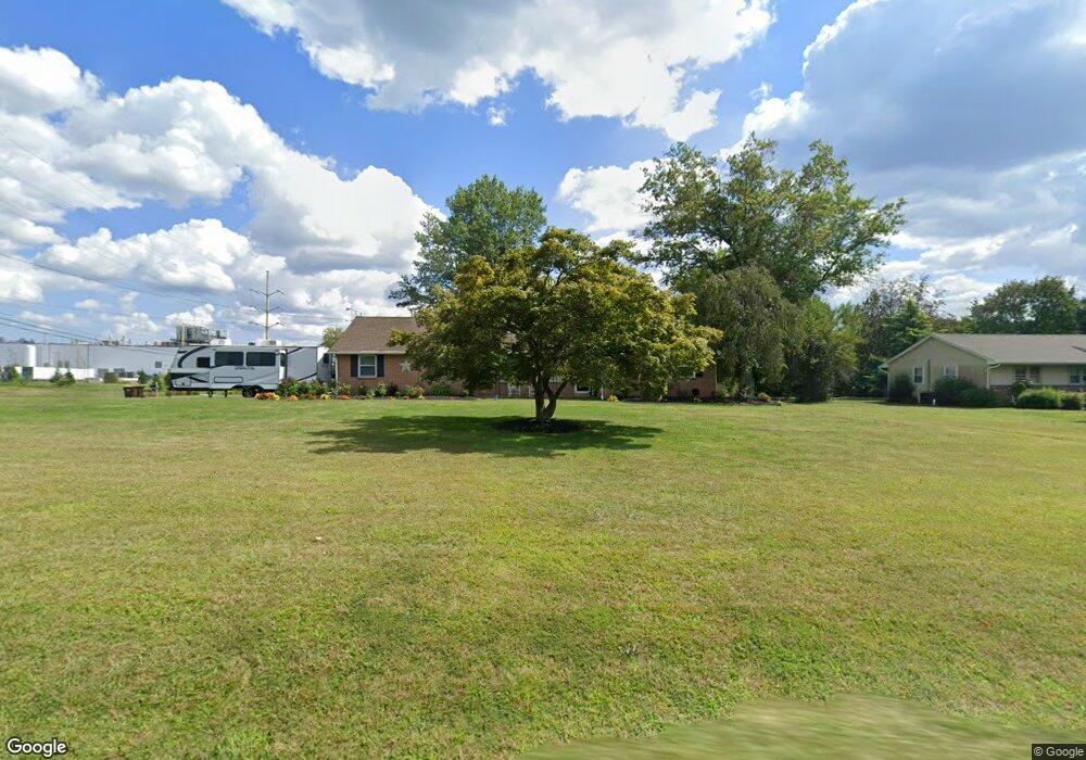
355 Derstine Rd Hatfield, PA 19440
Estimated Value: $490,000 - $625,000
4
Beds
2
Baths
1,932
Sq Ft
$274/Sq Ft
Est. Value
About This Home
This home is located at 355 Derstine Rd, Hatfield, PA 19440 and is currently estimated at $529,010, approximately $273 per square foot. 355 Derstine Rd is a home located in Montgomery County with nearby schools including Walton Farm El School, Pennfield Middle School, and North Penn Senior High School.
Ownership History
Date
Name
Owned For
Owner Type
Purchase Details
Closed on
Apr 19, 2022
Sold by
Kratz Donald Leon and Kratz Carolyn K
Bought by
Kratz Cory T and Kratz Kaitlyn E
Current Estimated Value
Home Financials for this Owner
Home Financials are based on the most recent Mortgage that was taken out on this home.
Original Mortgage
$320,000
Outstanding Balance
$297,697
Interest Rate
4.16%
Mortgage Type
New Conventional
Estimated Equity
$231,313
Purchase Details
Closed on
Jan 1, 1965
Bought by
Kratz Donald Leon and Kratz Carolyn K
Create a Home Valuation Report for This Property
The Home Valuation Report is an in-depth analysis detailing your home's value as well as a comparison with similar homes in the area
Home Values in the Area
Average Home Value in this Area
Purchase History
| Date | Buyer | Sale Price | Title Company |
|---|---|---|---|
| Kratz Cory T | $400,000 | None Listed On Document | |
| Kratz Cory T | $400,000 | None Listed On Document | |
| Kratz Donald Leon | -- | -- |
Source: Public Records
Mortgage History
| Date | Status | Borrower | Loan Amount |
|---|---|---|---|
| Open | Kratz Cory T | $320,000 | |
| Closed | Kratz Cory T | $320,000 |
Source: Public Records
Tax History
| Year | Tax Paid | Tax Assessment Tax Assessment Total Assessment is a certain percentage of the fair market value that is determined by local assessors to be the total taxable value of land and additions on the property. | Land | Improvement |
|---|---|---|---|---|
| 2025 | $7,749 | $193,550 | $60,220 | $133,330 |
| 2024 | $7,749 | $193,550 | $60,220 | $133,330 |
| 2023 | $7,417 | $193,550 | $60,220 | $133,330 |
| 2022 | $7,175 | $193,550 | $60,220 | $133,330 |
| 2021 | $6,971 | $193,550 | $60,220 | $133,330 |
| 2020 | $6,806 | $193,550 | $60,220 | $133,330 |
| 2019 | $6,693 | $193,550 | $60,220 | $133,330 |
| 2018 | $6,692 | $193,550 | $60,220 | $133,330 |
| 2017 | $6,437 | $193,550 | $60,220 | $133,330 |
| 2016 | $6,362 | $193,550 | $60,220 | $133,330 |
| 2015 | $6,108 | $193,550 | $60,220 | $133,330 |
| 2014 | $6,108 | $193,550 | $60,220 | $133,330 |
Source: Public Records
Map
Nearby Homes
- 2810 Truman Dr
- 2807 Truman Dr
- 2848 Grant Ave
- 700 Alexander Dr
- 103 Allentown Rd
- 1095 Owen Ln
- 635 Elroy Rd
- 1165 Mason Rd
- 1520 Fairgrounds Rd
- 3225 Carina St
- 171 Vernon Ct
- 306 Sherwood Ct N
- 2801 Denbeigh Dr
- 480 Tanner Way
- 708 Finlay Dr
- 111 Clemens Ct
- 113 Hickory Dr
- 109 Hickory Dr
- 2208 Mulberry Ct
- 369 Wheatfield Cir
- 113 Derstine Rd
- 2984 Funks Rd
- 97 Derstine Rd
- 2968 Funks Rd
- 81 Derstine Rd
- 2952 Funks Rd
- 416 Derstine Rd
- 65 Derstine Rd
- 424 Derstine Rd
- 49 Derstine Rd
- 48 Derstine Rd
- 438 Derstine Rd
- 17 Derstine Rd
- 450 Derstine Rd
- 2 Derstine Rd
- 18 Derstine Rd
- 2936 Funks Rd
- 3151 Funks Rd
- 103 Kimberly Way
- 101 Kimberly Way
Your Personal Tour Guide
Ask me questions while you tour the home.