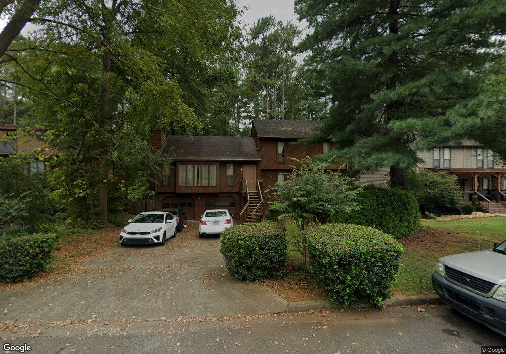
355 McKees Rock Ln Unit 2 Lawrenceville, GA 30044
Gwinnett Place NeighborhoodEstimated Value: $322,748 - $371,000
3
Beds
2
Baths
1,515
Sq Ft
$225/Sq Ft
Est. Value
About This Home
This home is located at 355 McKees Rock Ln Unit 2, Lawrenceville, GA 30044 and is currently estimated at $341,187, approximately $225 per square foot. 355 McKees Rock Ln Unit 2 is a home located in Gwinnett County with nearby schools including Craig Elementary School, Five Forks Middle School, and Brookwood High School.
Ownership History
Date
Name
Owned For
Owner Type
Purchase Details
Closed on
Apr 26, 2000
Sold by
Garner Garfield G
Bought by
Garner Garfield G and Garner Karin A
Current Estimated Value
Home Financials for this Owner
Home Financials are based on the most recent Mortgage that was taken out on this home.
Original Mortgage
$140,750
Outstanding Balance
$48,940
Interest Rate
8.23%
Mortgage Type
FHA
Estimated Equity
$292,247
Create a Home Valuation Report for This Property
The Home Valuation Report is an in-depth analysis detailing your home's value as well as a comparison with similar homes in the area
Home Values in the Area
Average Home Value in this Area
Purchase History
| Date | Buyer | Sale Price | Title Company |
|---|---|---|---|
| Garner Garfield G | -- | -- | |
| Garner Garfield G | $142,000 | -- |
Source: Public Records
Mortgage History
| Date | Status | Borrower | Loan Amount |
|---|---|---|---|
| Open | Garner Garfield G | $140,750 |
Source: Public Records
Tax History Compared to Growth
Tax History
| Year | Tax Paid | Tax Assessment Tax Assessment Total Assessment is a certain percentage of the fair market value that is determined by local assessors to be the total taxable value of land and additions on the property. | Land | Improvement |
|---|---|---|---|---|
| 2024 | $3,202 | $121,680 | $26,120 | $95,560 |
| 2023 | $3,202 | $124,840 | $31,200 | $93,640 |
| 2022 | $2,813 | $104,160 | $24,800 | $79,360 |
| 2021 | $2,257 | $75,120 | $18,000 | $57,120 |
| 2020 | $2,236 | $73,360 | $18,000 | $55,360 |
| 2019 | $2,093 | $69,000 | $18,000 | $51,000 |
| 2018 | $1,947 | $60,040 | $14,000 | $46,040 |
| 2016 | $1,901 | $56,840 | $12,800 | $44,040 |
| 2015 | $1,619 | $43,480 | $9,200 | $34,280 |
| 2014 | -- | $37,280 | $8,000 | $29,280 |
Source: Public Records
Map
Nearby Homes
- 270 Saint Simons Cove
- 316 Coopers Pond Dr
- 2493 Barndale Dr
- 275 Sageglen Rd Unit 2
- 2518 Candlewood Way
- 305 Melanie Way
- 280 Hayward Ln Unit 1
- 509 Arnold Rd
- 450 Battersea Dr
- 2575 Kentshire Way
- 353 Ansley Brook Dr
- 280 Kentshire Place
- 546 Wagon Wheel Climb Unit 2
- 506 Ridgedale Way
- 2532 Gloster Mill Dr SW
- 582 Arnold Rd
- 345 McKees Rock Ln Unit 2
- 365 McKees Rock Ln
- 335 McKees Rock Ln
- 375 McKees Rock Ln
- 400 Saint Simons Cove
- 0 McKees Rock Ln Unit 8417406
- 0 McKees Rock Ln Unit 7322636
- 0 McKees Rock Ln Unit 8691226
- 0 McKees Rock Ln Unit 8035935
- 0 McKees Rock Ln Unit 8738151
- 0 McKees Rock Ln Unit 8750456
- 0 McKees Rock Ln Unit 8896097
- 0 McKees Rock Ln Unit 7056833
- 0 McKees Rock Ln Unit 7107123
- 0 McKees Rock Ln Unit 7591250
- 0 McKees Rock Ln
- 390 Saint Simons Cove
- 354 McKees Rock Ln
- 410 Saint Simons Cove
- 364 McKees Rock Ln Unit 364