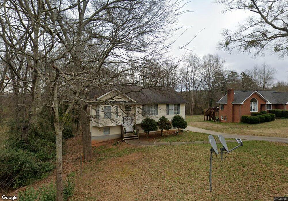
355 Miles Patrick Rd Winder, GA 30680
Estimated Value: $318,308 - $335,000
4
Beds
3
Baths
1,704
Sq Ft
$193/Sq Ft
Est. Value
About This Home
This home is located at 355 Miles Patrick Rd, Winder, GA 30680 and is currently estimated at $329,577, approximately $193 per square foot. 355 Miles Patrick Rd is a home located in Barrow County with nearby schools including County Line Elementary School, Russell Middle School, and Winder-Barrow High School.
Ownership History
Date
Name
Owned For
Owner Type
Purchase Details
Closed on
Jan 16, 2019
Sold by
Helmatana Llc
Bought by
Jade Homes & Apts Llc
Current Estimated Value
Purchase Details
Closed on
Jul 26, 2017
Sold by
Homes Jade
Bought by
Helmatana Llc
Purchase Details
Closed on
Jul 27, 2009
Sold by
Doyle James E
Bought by
Townsend James W
Home Financials for this Owner
Home Financials are based on the most recent Mortgage that was taken out on this home.
Original Mortgage
$78,900
Interest Rate
5.37%
Mortgage Type
New Conventional
Purchase Details
Closed on
Dec 10, 1999
Sold by
Osborne Patrick
Bought by
Doyle Mary E
Home Financials for this Owner
Home Financials are based on the most recent Mortgage that was taken out on this home.
Original Mortgage
$104,300
Interest Rate
7.85%
Mortgage Type
New Conventional
Create a Home Valuation Report for This Property
The Home Valuation Report is an in-depth analysis detailing your home's value as well as a comparison with similar homes in the area
Home Values in the Area
Average Home Value in this Area
Purchase History
| Date | Buyer | Sale Price | Title Company |
|---|---|---|---|
| Jade Homes & Apts Llc | -- | -- | |
| Helmatana Llc | $245,700 | -- | |
| Townsend James W | $80,000 | -- | |
| Doyle Mary E | $115,900 | -- |
Source: Public Records
Mortgage History
| Date | Status | Borrower | Loan Amount |
|---|---|---|---|
| Previous Owner | Townsend James W | $78,900 | |
| Previous Owner | Doyle Mary E | $104,300 |
Source: Public Records
Tax History
| Year | Tax Paid | Tax Assessment Tax Assessment Total Assessment is a certain percentage of the fair market value that is determined by local assessors to be the total taxable value of land and additions on the property. | Land | Improvement |
|---|---|---|---|---|
| 2025 | $2,806 | $100,830 | $20,000 | $80,830 |
| 2024 | $2,792 | $98,559 | $20,000 | $78,559 |
| 2023 | $2,784 | $98,559 | $20,000 | $78,559 |
| 2022 | $2,612 | $76,387 | $18,000 | $58,387 |
| 2021 | $2,244 | $61,190 | $14,400 | $46,790 |
| 2020 | $2,012 | $57,324 | $14,400 | $42,924 |
| 2019 | $1,819 | $50,658 | $11,600 | $39,058 |
| 2018 | $1,814 | $50,658 | $11,600 | $39,058 |
| 2017 | $1,297 | $43,484 | $11,600 | $31,884 |
| 2016 | $1,499 | $43,854 | $11,600 | $32,254 |
| 2015 | $1,513 | $44,225 | $11,600 | $32,625 |
| 2014 | $1,376 | $39,855 | $6,860 | $32,995 |
| 2013 | -- | $37,918 | $6,860 | $31,058 |
Source: Public Records
Map
Nearby Homes
- 326 Miles Patrick Rd
- 154 Williamsburg Way
- 197 Buena Vista St
- 223 Lacey Ln
- 27 Creekside Dr
- 421 N 5th Ave
- 222 Ryan Rd
- 303 Rocky Point Ct
- 0 E Northcrest Dr Unit 10648147
- 136 Alexander Ct
- 236 6th Ave
- 436 Northcrest Dr
- 326 Fayette Dr
- 469 Plantation Dr
- 284 E 5th Ave
- 2050 Whispering Way
- 206 E 5th Ave
- 352 3rd Ave
- 273 Partridge Trail
- 171 Brookview Terrace
- 351 Miles Patrick Rd
- 349 Miles Patrick Rd
- 345 Miles Patrick Rd
- 363 Miles Patrick Rd
- 352 Miles Patrick Rd
- 367 Miles Patrick Rd Unit 1
- 362 Miles Patrick Rd
- 341 Miles Patrick Rd
- 340 Miles Patrick Rd
- 375 Miles Patrick Rd Unit 1
- 368 Miles Patrick Rd
- 337 Miles Patrick Rd Unit 4
- 337 Miles Patrick Rd
- 321 Harrison Ln Unit 15
- 321 Harrison Ln
- 377 Miles Patrick Rd Unit 1
- 333 Miles Patrick Rd
- 129 Sims Rd
- 2.23 ACRES Miles Patrick Rd
- 319 Harrison Ln
Your Personal Tour Guide
Ask me questions while you tour the home.