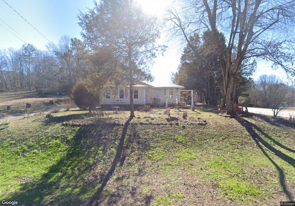
355 Prior Station Rd Cedartown, GA 30125
Estimated Value: $189,670 - $278,000
4
Beds
1
Bath
2,020
Sq Ft
$122/Sq Ft
Est. Value
About This Home
This home is located at 355 Prior Station Rd, Cedartown, GA 30125 and is currently estimated at $246,168, approximately $121 per square foot. 355 Prior Station Rd is a home located in Polk County with nearby schools including Cedar Christian School.
Ownership History
Date
Name
Owned For
Owner Type
Purchase Details
Closed on
May 9, 2001
Sold by
Welchel Larry C
Bought by
Welchel Larry C and Colline Welche
Current Estimated Value
Purchase Details
Closed on
Jul 6, 1974
Sold by
1St Federal Sav&Loan
Bought by
Welchel Larry C
Purchase Details
Closed on
Feb 5, 1974
Sold by
Wheeler Julia E
Bought by
1St Federal Sav&Loan
Purchase Details
Closed on
Feb 3, 1973
Sold by
Rogers Clayton
Bought by
Wheeler Julia E
Purchase Details
Closed on
Nov 5, 1962
Sold by
Hardy Walter A
Bought by
Rogers Clayton
Purchase Details
Closed on
Mar 12, 1946
Bought by
Hardy Walter A
Create a Home Valuation Report for This Property
The Home Valuation Report is an in-depth analysis detailing your home's value as well as a comparison with similar homes in the area
Home Values in the Area
Average Home Value in this Area
Purchase History
| Date | Buyer | Sale Price | Title Company |
|---|---|---|---|
| Welchel Larry C | -- | -- | |
| Welchel Larry C | -- | -- | |
| 1St Federal Sav&Loan | -- | -- | |
| Wheeler Julia E | -- | -- | |
| Rogers Clayton | -- | -- | |
| Hardy Walter A | -- | -- |
Source: Public Records
Tax History Compared to Growth
Tax History
| Year | Tax Paid | Tax Assessment Tax Assessment Total Assessment is a certain percentage of the fair market value that is determined by local assessors to be the total taxable value of land and additions on the property. | Land | Improvement |
|---|---|---|---|---|
| 2024 | $1,096 | $67,155 | $2,297 | $64,858 |
| 2023 | $1,027 | $56,682 | $2,297 | $54,385 |
| 2022 | $821 | $47,996 | $1,532 | $46,464 |
| 2021 | $832 | $47,996 | $1,532 | $46,464 |
| 2020 | $834 | $47,996 | $1,532 | $46,464 |
| 2019 | $394 | $27,991 | $1,532 | $26,459 |
| 2018 | $381 | $27,164 | $1,532 | $25,632 |
| 2017 | $383 | $27,560 | $1,928 | $25,632 |
| 2016 | $360 | $26,716 | $1,084 | $25,632 |
| 2015 | $180 | $20,098 | $1,084 | $19,014 |
| 2014 | $181 | $20,098 | $1,084 | $19,014 |
Source: Public Records
Map
Nearby Homes
- 0 Old Potash Rd Unit 7675402
- 0 Old Potash Rd Unit 10636176
- 382 5th St
- 293 4th St
- 119 Jackson St
- 0 Mountain Home Rd Unit 1020-B 10351940
- 0 Mountain Home Rd Unit 1020-C 10351948
- 0 Mountain Home Rd Unit 1020-A 10351930
- 323 Mountain Home Rd
- 2460 Hidden Creek Rd
- 309 Walnut St
- 605 W Girard Ave
- 1003 Fairview Ave
- 634 Georgia Ave
- 634 Georgia Ave Unit 123
- 421 Wissahickon Ave
- 325 Fairview Ave
- 258 Chestnut St
- 305 N Cave Spring St
- 234 Brooks St
- 341 Prior Station Rd
- 0 Mississippi Dr Unit 2814287
- 374 Prior Station Rd
- 323 Prior Station Rd
- 10 Mississippi Dr
- 10 Mississippi Dr
- 10 Mississippi Dr
- 383 Prior Station Rd
- 319 Prior Station Rd
- 974 Canal St
- 401 Prior Station Rd
- 35 Mississippi Dr
- 411 Prior Station Rd
- 960 Canal St
- 43 Mississippi Dr
- 297 Prior Station Rd
- 417 Prior Station Rd
- 287 Prior Station Rd
- 946 Canal St
- 435 Prior Station Rd