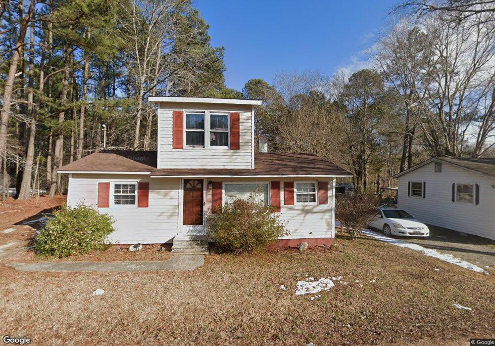
355 S Square Dr Littleton, NC 27850
Estimated Value: $112,764 - $213,000
4
Beds
2
Baths
1,200
Sq Ft
$148/Sq Ft
Est. Value
About This Home
This home is located at 355 S Square Dr, Littleton, NC 27850 and is currently estimated at $177,691, approximately $148 per square foot. 355 S Square Dr is a home located in Halifax County with nearby schools including Everetts Elementary School, William R. Davie Middle School, and Northwest Halifax High School.
Ownership History
Date
Name
Owned For
Owner Type
Purchase Details
Closed on
Jun 7, 2021
Sold by
Wrr Properties Llc
Bought by
Williams Ramar Delon
Current Estimated Value
Home Financials for this Owner
Home Financials are based on the most recent Mortgage that was taken out on this home.
Original Mortgage
$328,000
Outstanding Balance
$98,149
Interest Rate
2.9%
Mortgage Type
Stand Alone Second
Estimated Equity
$79,542
Purchase Details
Closed on
Mar 3, 2016
Sold by
Williams Wilson and Williams Ruby Lee M
Bought by
Wrr Properties Llc
Purchase Details
Closed on
Dec 6, 1999
Bought by
Williams Wilson and Williams Williams,Ruby
Create a Home Valuation Report for This Property
The Home Valuation Report is an in-depth analysis detailing your home's value as well as a comparison with similar homes in the area
Home Values in the Area
Average Home Value in this Area
Purchase History
| Date | Buyer | Sale Price | Title Company |
|---|---|---|---|
| Williams Ramar Delon | $337,000 | None Available | |
| Wrr Properties Llc | $13,000 | None Available | |
| Williams Wilson | $23,000 | -- |
Source: Public Records
Mortgage History
| Date | Status | Borrower | Loan Amount |
|---|---|---|---|
| Open | Williams Ramar Delon | $328,000 |
Source: Public Records
Tax History Compared to Growth
Tax History
| Year | Tax Paid | Tax Assessment Tax Assessment Total Assessment is a certain percentage of the fair market value that is determined by local assessors to be the total taxable value of land and additions on the property. | Land | Improvement |
|---|---|---|---|---|
| 2025 | $8 | $66,100 | $5,700 | $60,400 |
| 2024 | $8 | $66,100 | $5,700 | $60,400 |
| 2023 | $694 | $50,900 | $5,700 | $45,200 |
| 2022 | $710 | $50,900 | $5,700 | $45,200 |
| 2021 | $685 | $50,900 | $5,700 | $45,200 |
| 2020 | $688 | $50,900 | $5,700 | $45,200 |
| 2019 | $656 | $45,600 | $5,700 | $39,900 |
| 2018 | $642 | $47,000 | $5,700 | $41,300 |
| 2017 | $645 | $47,000 | $5,700 | $41,300 |
| 2016 | $607 | $47,000 | $5,700 | $41,300 |
| 2015 | $570 | $47,000 | $5,700 | $41,300 |
| 2014 | $508 | $42,740 | $6,110 | $36,630 |
Source: Public Records
Map
Nearby Homes
- 0 Short St
- 332 Ferguson St
- 401 Mosby Ave
- 328 Mosby Ave
- 114 College St
- 110 Johnston St
- 100 Miles St
- 9 Shadowbrook Dr
- 27 Mulberry Cir
- Lot 1 U S 158
- 6472 Us Highway 158 E
- 1019 Bowers Rd
- 0 Oak St
- 0 E End Ave
- Tbd E End
- 0 Hwy 903 Elams Rd Unit 138748
- 0 Bill Skinner Rd Unit LotWP002
- TBD Highway 903
- 1227 Roanoke Chapel Rd
- 1291 Roanoke Chapel Rd
- 367 S Square Dr
- 405 S Square Dr Unit 407
- 377 S Square Dr
- 321 S Square Dr
- 404 S Square Dr
- 410 S Square Dr
- 25 Rose St
- 311 S Square Dr
- 391 S Square Dr
- 27 Rose St
- 315 Short St
- 395 S Square Dr
- 301 S Square Dr
- 434 S Square Dr
- 291 S Square Dr
- 300 S Square Dr
- 431 S Square Dr
- 28 Short St
- 50 Rose St
- 260 S Square Dr