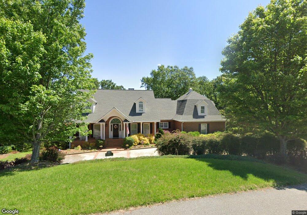
355 Smoke Rise Dr Unit 8G&8H Baldwin, GA 30511
Estimated Value: $547,378 - $612,000
3
Beds
4
Baths
3,024
Sq Ft
$194/Sq Ft
Est. Value
About This Home
This home is located at 355 Smoke Rise Dr Unit 8G&8H, Baldwin, GA 30511 and is currently estimated at $586,345, approximately $193 per square foot. 355 Smoke Rise Dr Unit 8G&8H is a home located in Banks County with nearby schools including Banks County Primary School, Banks County Elementary School, and Banks County Middle School.
Ownership History
Date
Name
Owned For
Owner Type
Purchase Details
Closed on
May 13, 2019
Sold by
Willis Terry Kenneth
Bought by
Fannin Gerald A and Fannin Elizabeth W
Current Estimated Value
Purchase Details
Closed on
Nov 18, 2005
Sold by
Thompson Richard S
Bought by
Willis Terry Kenneth and Willis Brenda Charlene
Home Financials for this Owner
Home Financials are based on the most recent Mortgage that was taken out on this home.
Original Mortgage
$159,000
Interest Rate
6.04%
Mortgage Type
New Conventional
Create a Home Valuation Report for This Property
The Home Valuation Report is an in-depth analysis detailing your home's value as well as a comparison with similar homes in the area
Home Values in the Area
Average Home Value in this Area
Purchase History
| Date | Buyer | Sale Price | Title Company |
|---|---|---|---|
| Fannin Gerald A | $355,000 | -- | |
| Willis Terry Kenneth | $353,000 | -- |
Source: Public Records
Mortgage History
| Date | Status | Borrower | Loan Amount |
|---|---|---|---|
| Previous Owner | Willis Terry Kenneth | $159,000 |
Source: Public Records
Tax History Compared to Growth
Tax History
| Year | Tax Paid | Tax Assessment Tax Assessment Total Assessment is a certain percentage of the fair market value that is determined by local assessors to be the total taxable value of land and additions on the property. | Land | Improvement |
|---|---|---|---|---|
| 2025 | $3,726 | $223,881 | $13,848 | $210,033 |
| 2024 | $3,726 | $215,150 | $13,848 | $201,302 |
| 2023 | $2,801 | $175,593 | $13,848 | $161,745 |
| 2022 | $2,884 | $157,277 | $13,848 | $143,429 |
| 2021 | $2,761 | $143,566 | $9,232 | $134,334 |
| 2020 | $2,796 | $141,952 | $9,232 | $132,720 |
| 2019 | $3,224 | $141,920 | $9,200 | $132,720 |
| 2018 | $2,647 | $114,970 | $6,064 | $108,906 |
| 2017 | $2,805 | $116,818 | $6,064 | $110,754 |
| 2016 | $2,886 | $116,818 | $6,064 | $110,754 |
| 2015 | $2,808 | $121,046 | $10,292 | $110,754 |
| 2014 | $2,808 | $121,046 | $10,292 | $110,754 |
| 2013 | -- | $121,046 | $10,292 | $110,754 |
Source: Public Records
Map
Nearby Homes
- 0 Summit St Unit 10602892
- 0 Georgia 105
- 0 Highway 105 Unit 10421143
- 0 Baldwin Falls Rd Unit 10563823
- 0 Planters Pointe Terrace Unit 10570102
- 103 Baldwin Falls Rd
- 600 Ivory Dr
- 800 Park Ave
- 392 King St
- 0 Baldwin Heights Rd Unit 10650492
- 111 Davison St
- LOT 6 Parker Point
- 0 Sterling Dr Unit 10554788
- 313 Kimsey St
- 167 Cash St
- 283 Yonah St
- 0 Highway 441 Bypass Unit 10428967
- 134 Hillcrest St
- 175 Hillcrest St
- 266 Short Ave
- 355 Smoke Rise Dr
- 355 Smokerise Dr Unit 8G&8H
- 164 Crooked Pine Trail
- 1100 Smoke Rise Dr
- 115 Crooked Pine Trail
- 0 Crooked Pine Trail Unit 8355915
- 0 Crooked Pine Trail Unit 7485174
- 0 Crooked Pine Trail Unit 7523455
- 0 Crooked Pine Trail Unit 9026236
- 0 Crooked Pine Trail Unit 7027663
- 332 Smoke Rise Dr
- 151 Crooked Pine Trail
- 360 Smokerise Dr
- 360 Smoke Rise Dr
- 354 Smoke Rise Dr
- 165 Crooked Pine Trail
- 168 Crooked Pine Trail Unit 2,3,4,5,14+
- 168 Crooked Pine Trail Unit 2
- 168 Crooked Pine Trail
- 179 Crooked Pine Trail Unit 14&15