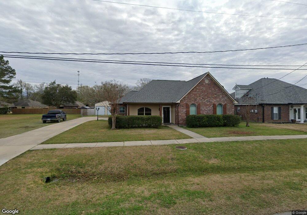
3552 Camelia St Zachary, LA 70791
Estimated Value: $251,000 - $276,000
--
Bed
--
Bath
1,801
Sq Ft
$146/Sq Ft
Est. Value
About This Home
This home is located at 3552 Camelia St, Zachary, LA 70791 and is currently estimated at $263,203, approximately $146 per square foot. 3552 Camelia St is a home located in East Baton Rouge Parish with nearby schools including Northwestern Elementary School, Rollins Place Elementary School, and Zachary Elementary School.
Ownership History
Date
Name
Owned For
Owner Type
Purchase Details
Closed on
Nov 3, 2000
Sold by
Wheeler Construction Inc
Bought by
White Lannis and White Sandra Yvette Wilson
Current Estimated Value
Home Financials for this Owner
Home Financials are based on the most recent Mortgage that was taken out on this home.
Original Mortgage
$134,045
Outstanding Balance
$49,358
Interest Rate
7.87%
Estimated Equity
$213,845
Purchase Details
Closed on
Aug 22, 2000
Sold by
Bank Of Zachary
Bought by
Wheeler Construction Inc
Home Financials for this Owner
Home Financials are based on the most recent Mortgage that was taken out on this home.
Original Mortgage
$150,000
Interest Rate
8.15%
Mortgage Type
Seller Take Back
Create a Home Valuation Report for This Property
The Home Valuation Report is an in-depth analysis detailing your home's value as well as a comparison with similar homes in the area
Home Values in the Area
Average Home Value in this Area
Purchase History
| Date | Buyer | Sale Price | Title Company |
|---|---|---|---|
| White Lannis | $141,100 | -- | |
| Wheeler Construction Inc | $12,500 | -- |
Source: Public Records
Mortgage History
| Date | Status | Borrower | Loan Amount |
|---|---|---|---|
| Open | White Lannis | $134,045 | |
| Previous Owner | Wheeler Construction Inc | $150,000 |
Source: Public Records
Tax History Compared to Growth
Tax History
| Year | Tax Paid | Tax Assessment Tax Assessment Total Assessment is a certain percentage of the fair market value that is determined by local assessors to be the total taxable value of land and additions on the property. | Land | Improvement |
|---|---|---|---|---|
| 2024 | $1,945 | $22,513 | $2,400 | $20,113 |
| 2023 | $1,945 | $18,910 | $2,400 | $16,510 |
| 2022 | $2,372 | $18,910 | $2,400 | $16,510 |
| 2021 | $2,372 | $18,910 | $2,400 | $16,510 |
| 2020 | $2,394 | $18,910 | $2,400 | $16,510 |
| 2019 | $2,312 | $16,600 | $2,400 | $14,200 |
| 2018 | $2,320 | $16,600 | $2,400 | $14,200 |
| 2017 | $2,320 | $16,600 | $2,400 | $14,200 |
| 2016 | $1,286 | $16,600 | $2,400 | $14,200 |
| 2015 | $1,193 | $16,200 | $2,400 | $13,800 |
| 2014 | $1,190 | $16,200 | $2,400 | $13,800 |
| 2013 | -- | $16,200 | $2,400 | $13,800 |
Source: Public Records
Map
Nearby Homes
- 3508 Ash St
- 3243 Camelia St
- 6647 Maple St
- 3411 Chien St
- 3420 Chien St
- 3430 Chien St
- 3421 Chien St
- 3410 Chien St
- 3440 Chien St
- 3014 Camelia St
- 3542 Chien St
- 7043 Brook Hollow Dr
- 7003 Brook Hollow Dr
- 7013 Brook Hollow Dr
- 6961 Brook Hollow Dr
- 7023 Brook Hollow Dr
- Kenner Plan at Brook Hollow
- 3523 Chien St
- Lacombe Plan at Brook Hollow
- Ozark Plan at Brook Hollow
- 3528 Camelia St
- 3551 Redbud St
- 3612 Camelia St
- 3553 Camelia St
- 3577 Camelia St
- 3527 Redbud St
- 3575 Redbud St
- 3529 Camelia St
- 3482 Camelia St
- 3613 Camelia St
- 3503 Redbud St
- 3505 Camelia St
- 3611 Redbud St
- 3550 Redbud St
- 3526 Redbud St
- 3574 Redbud St
- 3639 Camelia St
- 3481 Redbud St
- 3468 Camelia St
- 3662 Camelia St