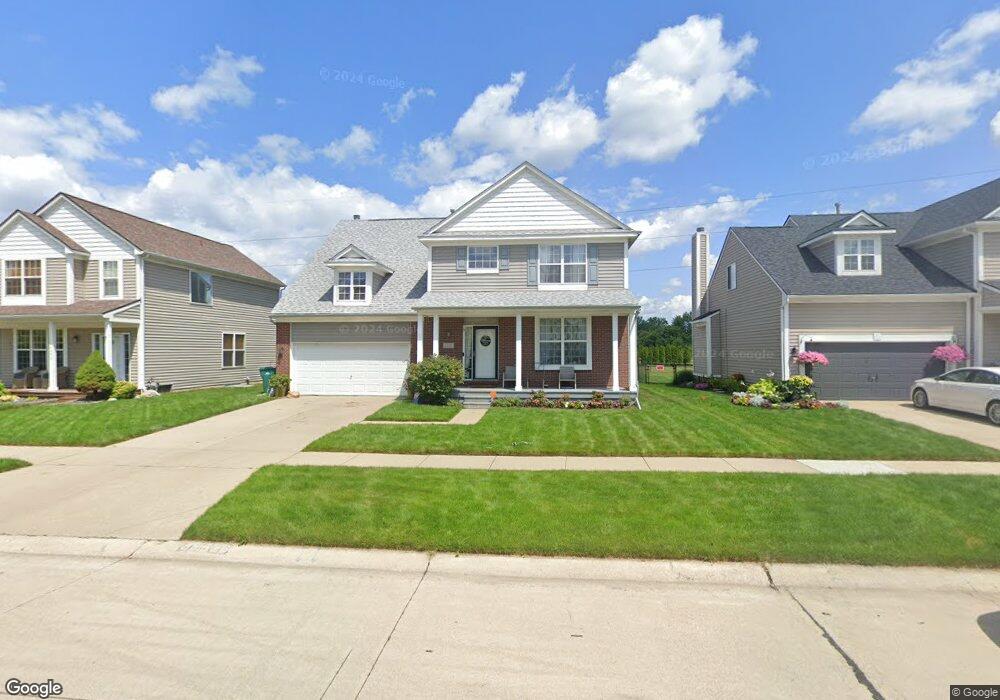
35526 Hawthorne Dr Unit Bldg-Unit Romulus, MI 48174
Estimated Value: $331,000 - $391,000
3
Beds
3
Baths
2,596
Sq Ft
$138/Sq Ft
Est. Value
About This Home
This home is located at 35526 Hawthorne Dr Unit Bldg-Unit, Romulus, MI 48174 and is currently estimated at $357,391, approximately $137 per square foot. 35526 Hawthorne Dr Unit Bldg-Unit is a home located in Wayne County with nearby schools including Wick Elementary School, Romulus Middle School, and Romulus Senior High School.
Ownership History
Date
Name
Owned For
Owner Type
Purchase Details
Closed on
Apr 30, 2018
Sold by
Branch Maria Faith and Branch Charles Edward
Bought by
Highsmit Gino
Current Estimated Value
Home Financials for this Owner
Home Financials are based on the most recent Mortgage that was taken out on this home.
Original Mortgage
$214,515
Outstanding Balance
$184,875
Interest Rate
4.44%
Mortgage Type
VA
Estimated Equity
$172,516
Purchase Details
Closed on
Oct 20, 2011
Sold by
Austin Lasal
Bought by
Branch Maria Faith
Purchase Details
Closed on
Apr 14, 2006
Sold by
Gerald Roux Homes Inc
Bought by
Austin Lasal
Purchase Details
Closed on
Nov 10, 2003
Sold by
Elro Corp
Bought by
Gerald Roux Homes Inc
Create a Home Valuation Report for This Property
The Home Valuation Report is an in-depth analysis detailing your home's value as well as a comparison with similar homes in the area
Home Values in the Area
Average Home Value in this Area
Purchase History
| Date | Buyer | Sale Price | Title Company |
|---|---|---|---|
| Highsmit Gino | $210,000 | None Available | |
| Branch Maria Faith | $90,000 | Title One Inc | |
| Austin Lasal | $199,990 | Multiple | |
| Gerald Roux Homes Inc | $47,500 | Greco |
Source: Public Records
Mortgage History
| Date | Status | Borrower | Loan Amount |
|---|---|---|---|
| Open | Highsmit Gino | $214,515 |
Source: Public Records
Tax History Compared to Growth
Tax History
| Year | Tax Paid | Tax Assessment Tax Assessment Total Assessment is a certain percentage of the fair market value that is determined by local assessors to be the total taxable value of land and additions on the property. | Land | Improvement |
|---|---|---|---|---|
| 2025 | $4,818 | $172,800 | $0 | $0 |
| 2024 | $4,818 | $163,300 | $0 | $0 |
| 2023 | $4,613 | $148,000 | $0 | $0 |
| 2022 | $5,491 | $131,800 | $0 | $0 |
| 2021 | $5,313 | $119,600 | $0 | $0 |
| 2020 | $5,210 | $108,600 | $0 | $0 |
| 2019 | $5,225 | $95,400 | $0 | $0 |
| 2018 | $1,836 | $87,900 | $0 | $0 |
| 2017 | $1,269 | $87,100 | $0 | $0 |
| 2016 | $3,254 | $68,600 | $0 | $0 |
| 2015 | $4,836 | $52,600 | $0 | $0 |
| 2013 | $4,810 | $52,500 | $0 | $0 |
| 2012 | $2,156 | $58,400 | $5,000 | $53,400 |
Source: Public Records
Map
Nearby Homes
- 7197 Cambridge Dr
- 35773 Surrey Dr
- 35901 Abbey Ct
- 35209 Atlas St
- 35344 Ecorse Rd
- 000 Waynecorse
- 00 Cypress St
- 35841 Vinewood St
- 35872 Vinewood St
- 35511 Beverly Rd
- 35740 Beverly Rd
- 0000 Park Place
- 6358 Dexter St
- Lot 215 2nd St
- Lot 214 2nd St
- 7063 Sargent St
- 9405 Chamberlain St
- 6130 Wayne Rd
- Lot 227 Dexter St
- Lot 226 Dexter St
- 35526 Hawthorne Dr
- 35552 Hawthorne Dr
- 35486 Hawthorne Dr
- 35570 Hawthorne Dr
- 35474 Hawthorne Dr
- 35598 Hawthorne Dr
- 35527 Hawthorne Dr
- 35450 Hawthorne Dr
- 35553 Hawthorne Dr
- 35545 Concord Dr
- 35519 Concord Dr
- 35569 Concord Dr
- 35622 Hawthorne Dr
- 35475 Hawthorne Dr
- 35571 Hawthorne Dr
- 7305 Townsend Dr
- 35424 Hawthorne Dr
- 35599 Hawthorne Dr
- 35451 Hawthorne Dr
- 7798 Hawthorne Ct