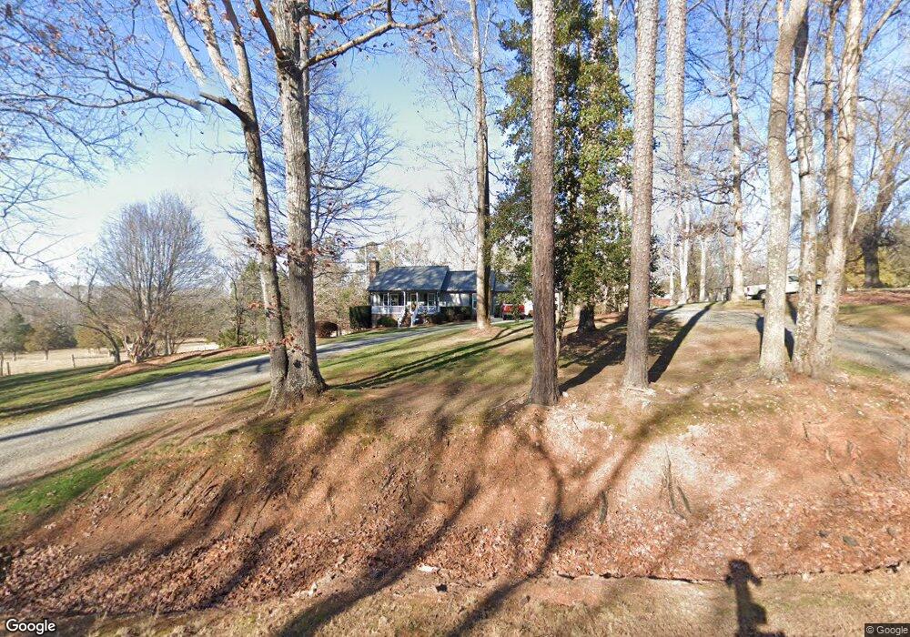
3553 Sam Usry Rd Oxford, NC 27565
Estimated Value: $229,000 - $295,431
3
Beds
2
Baths
1,476
Sq Ft
$172/Sq Ft
Est. Value
About This Home
This home is located at 3553 Sam Usry Rd, Oxford, NC 27565 and is currently estimated at $253,358, approximately $171 per square foot. 3553 Sam Usry Rd is a home located in Granville County with nearby schools including Tar River Elementary School, G.C. Hawley Middle School, and South Granville High School.
Ownership History
Date
Name
Owned For
Owner Type
Purchase Details
Closed on
May 2, 2012
Sold by
Johnson Vickie Land and Johnson Arthur Taylor
Bought by
Johnson Vickie Land and Johnson Arthur Taylor
Current Estimated Value
Home Financials for this Owner
Home Financials are based on the most recent Mortgage that was taken out on this home.
Original Mortgage
$145,000
Outstanding Balance
$19,917
Interest Rate
3.34%
Mortgage Type
New Conventional
Estimated Equity
$233,441
Create a Home Valuation Report for This Property
The Home Valuation Report is an in-depth analysis detailing your home's value as well as a comparison with similar homes in the area
Home Values in the Area
Average Home Value in this Area
Purchase History
| Date | Buyer | Sale Price | Title Company |
|---|---|---|---|
| Johnson Vickie Land | -- | None Available |
Source: Public Records
Mortgage History
| Date | Status | Borrower | Loan Amount |
|---|---|---|---|
| Open | Johnson Vickie Land | $145,000 |
Source: Public Records
Tax History Compared to Growth
Tax History
| Year | Tax Paid | Tax Assessment Tax Assessment Total Assessment is a certain percentage of the fair market value that is determined by local assessors to be the total taxable value of land and additions on the property. | Land | Improvement |
|---|---|---|---|---|
| 2025 | $1,837 | $250,974 | $31,406 | $219,568 |
| 2024 | $1,837 | $250,974 | $31,406 | $219,568 |
| 2023 | $1,832 | $149,223 | $19,715 | $129,508 |
| 2022 | $1,440 | $149,223 | $19,715 | $129,508 |
| 2021 | $1,345 | $149,223 | $19,715 | $129,508 |
| 2020 | $1,345 | $149,223 | $19,715 | $129,508 |
| 2019 | $1,345 | $149,223 | $19,715 | $129,508 |
| 2018 | $1,345 | $149,223 | $19,715 | $129,508 |
| 2016 | $1,318 | $139,366 | $19,743 | $119,623 |
| 2015 | $1,244 | $139,366 | $19,743 | $119,623 |
| 2014 | $1,244 | $139,366 | $19,743 | $119,623 |
| 2013 | -- | $139,366 | $19,743 | $119,623 |
Source: Public Records
Map
Nearby Homes
- 3652 Cannady Mill Rd
- 3287 Runner Stone Ln
- 3288 Runner Stone Ln
- 0 River Mill Ln
- 3830 Furrow Ln
- 4173 Cannady Mill Rd
- 3855 Furrow Ln
- 3806 River Mill Ln
- 3847 Furrow Ln
- 3848 Furrow Ln
- 0 Cannady Mill Rd
- 4304 S Greg Allen Way
- 4334 N Greg Allen Way
- 4535 Gresham Dr
- 4562 Hight Rd
- 0000 Fielding Knott Rd
- 3566 U S 15
- 3129 Montague Centre Rd
- 3700 Lark Farm Rd
- 4285 Belltown Rd
- 3669 Nc Highway 96
- 3653 Nc Highway 96
- 3673 Nc Highway 96
- 3678 Nc Highway 96
- 3648 Nc Highway 96
- 3685 Nc Highway 96
- 3642 Nc Highway 96
- 3639 Nc Highway 96
- 3859 Fishing Creek Ln
- 3690 Nc Highway 96
- 3688 Mercer Ln
- 3890 Fishing Creek Ln
- 3632 Nc Highway 96
- 3627 State Highway 96
- 3698 Nc Highway 96
- 3627 Nc Highway 96
- 3636 Nc Highway 96
- 3636 Nc Highway 96
- 3626 Nc 96 Hwy
- 3561 Eaton Rd