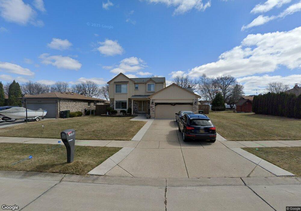
35542 Buxton Dr Sterling Heights, MI 48310
Estimated Value: $361,000 - $402,000
--
Bed
1
Bath
2,007
Sq Ft
$188/Sq Ft
Est. Value
About This Home
This home is located at 35542 Buxton Dr, Sterling Heights, MI 48310 and is currently estimated at $377,026, approximately $187 per square foot. 35542 Buxton Dr is a home located in Macomb County with nearby schools including Harwood Elementary School, Carleton Middle School, and Sterling Heights Senior H.S..
Ownership History
Date
Name
Owned For
Owner Type
Purchase Details
Closed on
Dec 17, 2003
Sold by
Watson Michael T and Watson Kathy L
Bought by
Shamoon Andy
Current Estimated Value
Create a Home Valuation Report for This Property
The Home Valuation Report is an in-depth analysis detailing your home's value as well as a comparison with similar homes in the area
Home Values in the Area
Average Home Value in this Area
Purchase History
| Date | Buyer | Sale Price | Title Company |
|---|---|---|---|
| Shamoon Andy | $220,000 | -- |
Source: Public Records
Tax History Compared to Growth
Tax History
| Year | Tax Paid | Tax Assessment Tax Assessment Total Assessment is a certain percentage of the fair market value that is determined by local assessors to be the total taxable value of land and additions on the property. | Land | Improvement |
|---|---|---|---|---|
| 2025 | $4,001 | $175,500 | $0 | $0 |
| 2024 | $3,860 | $169,700 | $0 | $0 |
| 2023 | $3,664 | $152,500 | $0 | $0 |
| 2022 | $3,553 | $134,200 | $0 | $0 |
| 2021 | $3,672 | $128,900 | $0 | $0 |
| 2020 | $3,491 | $119,200 | $0 | $0 |
| 2019 | $3,442 | $113,700 | $0 | $0 |
| 2018 | $3,470 | $98,600 | $0 | $0 |
| 2017 | $3,348 | $93,100 | $16,900 | $76,200 |
| 2016 | $3,277 | $93,100 | $0 | $0 |
| 2015 | -- | $83,800 | $0 | $0 |
| 2014 | -- | $73,500 | $0 | $0 |
Source: Public Records
Map
Nearby Homes
- 35554 Buxton Dr
- 35715 Maureen Dr
- 5049 Surrey Dr
- 5072 Chadbourne Dr
- 5072 15 Mile Rd
- 4908 Kadena Ct
- 35259 Hatherly Place
- 5336 Mansfield Ave
- 4655 Ashburton Place
- 5568 Seabreeze Ln
- 34641 Mound Rd
- 36203 Pickwick Ct
- 4628 Dickson Dr
- 5024 Bristor Dr
- 35272 Vito Dr
- 36446 Waltham Dr
- 4215 Nickolas Dr
- 35078 Cavant Dr
- 5315 Plymouth St
- 4231 Chris Dr
- 5565 Kebbe Dr
- 5577 Kebbe Dr
- 35533 Maureen Dr
- 35602 Buxton Dr
- 35545 Maureen Dr
- 35557 Maureen Dr
- 5589 Kebbe Dr
- 35535 Buxton Dr
- 35614 Buxton Dr
- 35547 Buxton Dr
- 35611 Maureen Dr
- 35523 Buxton Dr
- 35621 Buxton Dr
- 35626 Buxton Dr
- 35623 Maureen Dr
- 35559 Drake Dr
- 5449 Kebbe Dr
- 5564 Kebbe Dr
- 5552 Kebbe Dr
- 5576 Kebbe Dr