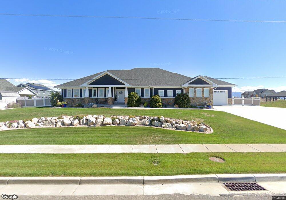
3559 S 2000 W Syracuse, UT 84075
Estimated Value: $572,000 - $1,221,569
3
Beds
2
Baths
1,975
Sq Ft
$494/Sq Ft
Est. Value
About This Home
This home is located at 3559 S 2000 W, Syracuse, UT 84075 and is currently estimated at $976,142, approximately $494 per square foot. 3559 S 2000 W is a home located in Davis County with nearby schools including Cook School, Legacy Junior High School, and Clearfield High School.
Ownership History
Date
Name
Owned For
Owner Type
Purchase Details
Closed on
Aug 26, 2022
Sold by
Simmons and Heather
Bought by
Simmons Clayton and Simmons Heather
Current Estimated Value
Home Financials for this Owner
Home Financials are based on the most recent Mortgage that was taken out on this home.
Original Mortgage
$655,500
Outstanding Balance
$626,840
Interest Rate
5.54%
Mortgage Type
New Conventional
Estimated Equity
$349,302
Purchase Details
Closed on
May 11, 2022
Sold by
Sannette Lowe
Bought by
Simmons Clay and Simmons Heather
Purchase Details
Closed on
Oct 17, 2016
Sold by
Nuco Developmet Inc
Bought by
Lowe Richard and Lowe Sannette
Create a Home Valuation Report for This Property
The Home Valuation Report is an in-depth analysis detailing your home's value as well as a comparison with similar homes in the area
Home Values in the Area
Average Home Value in this Area
Purchase History
| Date | Buyer | Sale Price | Title Company |
|---|---|---|---|
| Simmons Clayton | -- | -- | |
| Simmons Clay | -- | Cottonwood Title | |
| Lowe Richard | -- | Founders Title |
Source: Public Records
Mortgage History
| Date | Status | Borrower | Loan Amount |
|---|---|---|---|
| Open | Simmons Clayton | $655,500 |
Source: Public Records
Tax History Compared to Growth
Tax History
| Year | Tax Paid | Tax Assessment Tax Assessment Total Assessment is a certain percentage of the fair market value that is determined by local assessors to be the total taxable value of land and additions on the property. | Land | Improvement |
|---|---|---|---|---|
| 2025 | $6,881 | $663,850 | $242,587 | $421,263 |
| 2024 | $6,574 | $638,550 | $241,134 | $397,416 |
| 2023 | $5,633 | $997,000 | $438,461 | $558,539 |
| 2022 | $4,920 | $477,400 | $312,051 | $165,349 |
| 2021 | $4,967 | $746,000 | $459,460 | $286,540 |
| 2020 | $4,814 | $700,000 | $401,401 | $298,599 |
| 2019 | $4,772 | $685,000 | $377,427 | $307,573 |
| 2018 | $4,513 | $643,000 | $369,461 | $273,539 |
| 2016 | $997 | $74,496 | $74,496 | $0 |
Source: Public Records
Map
Nearby Homes
- 1886 W Red Maple Dr
- 1842 W Parkview Dr
- 2086 White Pine Dr
- 2067 W 3290 S
- 1713 W Parkview Dr
- 1651 W White Pine Dr
- 2051 W Lydia Ln
- 3253 S Lincoln Ln
- Zion Plan at Shoreline - Parkview
- Glacier Plan at Shoreline - Parkview
- Stonehaven Plan at Shoreline - Parkview
- Teton Plan at Shoreline - Parkview
- Everglade Plan at Shoreline - Parkview
- Yosemite Plan at Shoreline - Parkview
- Amesbury Plan at Shoreline - Parkview
- Redwood Plan at Shoreline - Parkview
- Bryce Plan at Shoreline - Parkview
- Denali Plan at Shoreline - Parkview
- Hampton Estate Plan at Shoreline - Parkview
- 1711 W Ross Rd
- 1971 W Mulberry Way Unit 357
- 1978 W Still Water Dr Unit 102
- 1981 W Mulberry Way
- 1981 W Mulberry Way Unit 356
- 1961 W Mulberry Way
- 1951 W Mulberry Way
- 1931 W Mulberry Way
- 3508 S Birch Ln
- 3507 S Birch Ln
- 1921 W Mulberry Way
- 3498 S Birch Ln
- 3506 S Linden Way Unit 344
- 3497 S Birch Ln
- 3497 S Birch Ln Unit 346
- 1967 W Still Water Dr Unit 108
- 1911 W Mulberry Way Unit 362
- 1911 W Mulberry Way
- 3496 S Linden Way
- 3478 S Birch Ln
- 3477 S Birch Ln