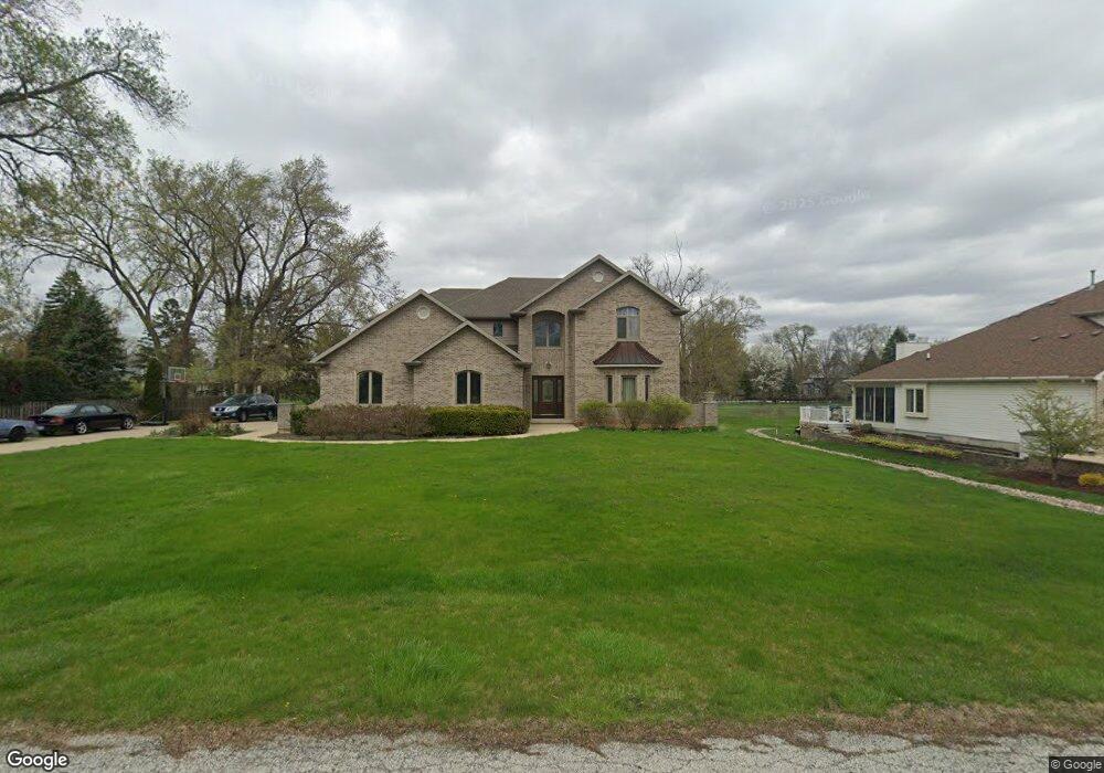
356 65th St Willowbrook, IL 60527
Estimated Value: $807,000 - $1,010,000
Studio
--
Bath
3,200
Sq Ft
$282/Sq Ft
Est. Value
About This Home
This home is located at 356 65th St, Willowbrook, IL 60527 and is currently estimated at $900,928, approximately $281 per square foot. 356 65th St is a home located in DuPage County with nearby schools including Holmes Elementary School, Maercker Elementary School, and Westview Hills Middle School.
Ownership History
Date
Name
Owned For
Owner Type
Purchase Details
Closed on
Dec 21, 1998
Sold by
Michael Jimmie H and Michael Beverly T
Bought by
Saucedo Gerard and Saucedo Margarita
Current Estimated Value
Home Financials for this Owner
Home Financials are based on the most recent Mortgage that was taken out on this home.
Original Mortgage
$89,600
Interest Rate
7.12%
Create a Home Valuation Report for This Property
The Home Valuation Report is an in-depth analysis detailing your home's value as well as a comparison with similar homes in the area
Home Values in the Area
Average Home Value in this Area
Purchase History
| Date | Buyer | Sale Price | Title Company |
|---|---|---|---|
| Saucedo Gerard | $112,000 | -- |
Source: Public Records
Mortgage History
| Date | Status | Borrower | Loan Amount |
|---|---|---|---|
| Closed | Saucedo Gerard | $89,600 |
Source: Public Records
Tax History
| Year | Tax Paid | Tax Assessment Tax Assessment Total Assessment is a certain percentage of the fair market value that is determined by local assessors to be the total taxable value of land and additions on the property. | Land | Improvement |
|---|---|---|---|---|
| 2024 | $18,556 | $296,447 | $119,451 | $176,996 |
| 2023 | $17,785 | $272,520 | $109,810 | $162,710 |
| 2022 | $17,395 | $266,910 | $107,550 | $159,360 |
| 2021 | $17,051 | $266,000 | $106,330 | $159,670 |
| 2020 | $15,374 | $260,730 | $104,220 | $156,510 |
| 2019 | $14,863 | $250,170 | $100,000 | $150,170 |
| 2018 | $15,156 | $257,510 | $99,490 | $158,020 |
| 2017 | $14,582 | $247,800 | $95,740 | $152,060 |
| 2016 | $14,251 | $236,490 | $91,370 | $145,120 |
| 2015 | $14,114 | $222,490 | $85,960 | $136,530 |
| 2014 | $13,719 | $216,330 | $83,580 | $132,750 |
| 2013 | $14,263 | $230,000 | $83,190 | $146,810 |
Source: Public Records
Map
Nearby Homes
- 6136 Bentley Ave
- 1224 Ridge Rd
- 335 63rd St
- 318 Arabian Cir
- 6503 Clarendon Hills Rd
- 1013 Torrey Pines Ct
- 6648 Weather Hill Dr
- 1156 Bristlecone Ct
- 350 61st (Lot 5) St
- 346 61st (Lot 3) St
- 47 W Pier Dr Unit 102
- 200 Brookside Ln Unit A
- 230 Windsor Ln Unit A
- 601 Lake Hinsdale Dr Unit 101
- 601 Lake Hinsdale Dr Unit 112
- 107 65th Lake Dr Unit 202
- 1313 Cass Ln E Unit 302
- 6340 Americana Dr Unit 904
- 6340 Americana Dr Unit 701
- 73 W Pier Dr Unit 201
- 330 65th St
- 6445 S Richmond Ave
- 6501 S Richmond Ave
- 6441 S Richmond Ave
- 411 65th St
- 6523 S Richmond Ave
- 6423 S Richmond Ave
- 6523 S Richmond Ave
- 6446 Western Ave
- 6446 Western Ave
- 6440 Western Ave
- 6432 Western Ave
- 315 65th St
- 6464 S Richmond Ave
- 6417 S Richmond Ave
- 6444 S Richmond Ave
- 6525 S Richmond Ave
- 6420 Western Ave
- 501 65th St
- 6410 Western Ave
Your Personal Tour Guide
Ask me questions while you tour the home.