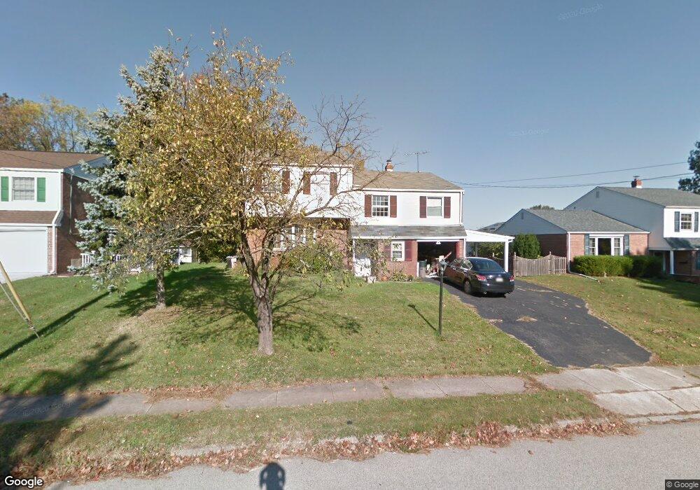
356 Abrams Mill Rd King of Prussia, PA 19406
Estimated Value: $389,000 - $652,000
4
Beds
2
Baths
2,744
Sq Ft
$185/Sq Ft
Est. Value
About This Home
This home is located at 356 Abrams Mill Rd, King of Prussia, PA 19406 and is currently estimated at $508,858, approximately $185 per square foot. 356 Abrams Mill Rd is a home located in Montgomery County with nearby schools including Caley Elementary School, Upper Merion Middle School, and Upper Merion High School.
Ownership History
Date
Name
Owned For
Owner Type
Purchase Details
Closed on
Aug 29, 2025
Sold by
Lyons Judith Ann
Bought by
Your Dream Home Llc
Current Estimated Value
Home Financials for this Owner
Home Financials are based on the most recent Mortgage that was taken out on this home.
Original Mortgage
$504,100
Interest Rate
6.3%
Mortgage Type
Construction
Purchase Details
Closed on
Oct 20, 2005
Sold by
Lyons Helen
Bought by
Lyons Helen R and Lyons Judith Ann
Create a Home Valuation Report for This Property
The Home Valuation Report is an in-depth analysis detailing your home's value as well as a comparison with similar homes in the area
Home Values in the Area
Average Home Value in this Area
Purchase History
| Date | Buyer | Sale Price | Title Company |
|---|---|---|---|
| Your Dream Home Llc | $390,000 | Fortune Title | |
| Lyons Helen R | -- | None Available |
Source: Public Records
Mortgage History
| Date | Status | Borrower | Loan Amount |
|---|---|---|---|
| Previous Owner | Your Dream Home Llc | $504,100 |
Source: Public Records
Tax History Compared to Growth
Tax History
| Year | Tax Paid | Tax Assessment Tax Assessment Total Assessment is a certain percentage of the fair market value that is determined by local assessors to be the total taxable value of land and additions on the property. | Land | Improvement |
|---|---|---|---|---|
| 2025 | $5,703 | $185,060 | -- | -- |
| 2024 | $5,703 | $185,060 | -- | -- |
| 2023 | $5,501 | $185,060 | $0 | $0 |
| 2022 | $5,266 | $185,060 | $0 | $0 |
| 2021 | $5,102 | $185,060 | $0 | $0 |
| 2020 | $4,876 | $185,060 | $0 | $0 |
| 2019 | $4,793 | $185,060 | $0 | $0 |
| 2018 | $4,793 | $185,060 | $0 | $0 |
| 2017 | $4,621 | $185,060 | $0 | $0 |
| 2016 | $4,549 | $180,660 | $56,500 | $124,160 |
| 2015 | $4,276 | $180,660 | $56,500 | $124,160 |
| 2014 | $4,276 | $180,660 | $56,500 | $124,160 |
Source: Public Records
Map
Nearby Homes
- 548 Susan Dr
- 735 Champlain Dr
- 245 Chapel Ln Unit 80B
- 251 Chapel Ln Unit 83B
- 243 Chapel Ln Unit 79A
- 176 Riversedge Dr
- 143 Riversedge Dr Unit CONDO 143
- 121 Woodstream Dr Unit CONDO 121
- 345 W Signal Hill Rd
- 1914 Yorktown S
- 2012 Yorktown S
- 1905 Yorktown N
- 2017 Yorktown S
- 526 Bassett Ln
- 167 Woodstream Dr Unit CONDO 167
- 330 Crossfield Rd
- 394 Stonybrook Rd
- 603 Nantucket Cir
- 307 Brandon Rd
- 440 Rittenhouse Blvd
- 352 Abrams Mill Rd
- 360 Abrams Mill Rd
- 348 Abrams Mill Rd
- 364 Abrams Mill Rd
- 728 Suellen Dr
- 310 Caley Ct
- 314 Caley Ct
- 310 Caley Ct
- 331 Sharon Ct
- 344 Abrams Mill Rd
- 347 Abrams Mill Rd
- 729 Suellen Dr
- 368 Abrams Mill Rd
- 306 Caley Ct
- 726 Suellen Dr
- 336 Sharon Ct
- 318 Caley Ct
- 325 Sharon Ct
- 340 Abrams Mill Rd
- 725 Springdell Rd