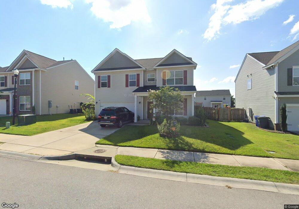
356 Council Loop Columbia, SC 29209
Southeast Columbia NeighborhoodEstimated Value: $306,000 - $329,000
4
Beds
3
Baths
3,345
Sq Ft
$94/Sq Ft
Est. Value
About This Home
This home is located at 356 Council Loop, Columbia, SC 29209 and is currently estimated at $314,414, approximately $93 per square foot. 356 Council Loop is a home located in Richland County with nearby schools including Annie Burnside Elementary School, Crayton Middle School, and A. C. Flora High School.
Ownership History
Date
Name
Owned For
Owner Type
Purchase Details
Closed on
Mar 1, 2023
Sold by
Cedeno Oscar
Bought by
Laster James S and White-Seay Shana L
Current Estimated Value
Home Financials for this Owner
Home Financials are based on the most recent Mortgage that was taken out on this home.
Original Mortgage
$288,871
Outstanding Balance
$279,802
Interest Rate
6.13%
Mortgage Type
FHA
Estimated Equity
$34,612
Purchase Details
Closed on
Feb 20, 2020
Sold by
Essex Homes Southeast Inc
Bought by
Cedeno Oscar and Williams Jennifer I
Home Financials for this Owner
Home Financials are based on the most recent Mortgage that was taken out on this home.
Original Mortgage
$235,835
Interest Rate
3.6%
Mortgage Type
New Conventional
Create a Home Valuation Report for This Property
The Home Valuation Report is an in-depth analysis detailing your home's value as well as a comparison with similar homes in the area
Home Values in the Area
Average Home Value in this Area
Purchase History
| Date | Buyer | Sale Price | Title Company |
|---|---|---|---|
| Laster James S | $294,200 | -- | |
| Cedeno Oscar | $227,640 | None Available |
Source: Public Records
Mortgage History
| Date | Status | Borrower | Loan Amount |
|---|---|---|---|
| Open | Laster James S | $288,871 | |
| Previous Owner | Cedeno Oscar | $235,835 |
Source: Public Records
Tax History
| Year | Tax Paid | Tax Assessment Tax Assessment Total Assessment is a certain percentage of the fair market value that is determined by local assessors to be the total taxable value of land and additions on the property. | Land | Improvement |
|---|---|---|---|---|
| 2024 | $2,105 | $294,200 | $45,000 | $249,200 |
| 2023 | $2,030 | $9,104 | $0 | $0 |
| 2022 | $1,649 | $227,600 | $33,500 | $194,100 |
| 2021 | $1,704 | $9,100 | $0 | $0 |
| 2020 | $6,716 | $13,630 | $0 | $0 |
Source: Public Records
Map
Nearby Homes
- 173 Council Loop
- 300 E Lake Trail
- 225 E Lake Trail
- 174 Preston Green Dr
- 164 Springway Dr
- 267 Ashewood Commons Dr
- 11 Paperbark Ct
- 31 Silverleaf Ct
- 267 Ashewood Lake Dr
- 123 Gayle Pond Trace
- 25 Willow Hurst Ct
- 1606 Blaine St
- 7801 Skylark Dr
- 628 Burnside Dr
- 7520 Pell St
- 404 Hampton Forest Dr
- 1152 Rockwood Rd
- 411 Hampton Forest Dr
- 231 Forest Green Dr
- 235 Forest Green Dr
- 352 Council Loop
- 360 Council Loop
- 180 Council Loop
- 178 Council Loop
- 364 Council Loop
- 184 Council Loop
- 357 Council Loop
- 353 Council Loop
- 637 Scribes Ln
- 349 Council Loop
- 361 Council Loop
- 344 Council Loop
- 368 Council Loop
- 176 Council Loop
- 345 Council Loop
- 365 Council Loop
- 188 Council Loop
- 172 Council Loop
- 633 Scribes Ln
- 340 Council Loop
Your Personal Tour Guide
Ask me questions while you tour the home.