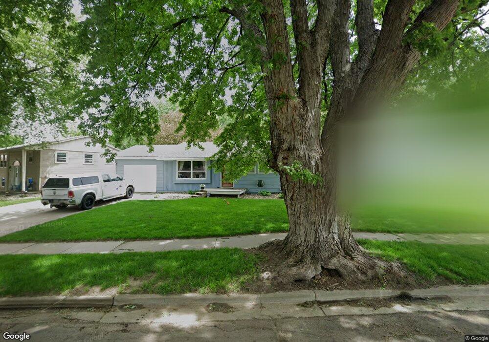
356 N Meyer Ln Sioux Falls, SD 57103
Oak View NeighborhoodEstimated Value: $265,259 - $299,000
3
Beds
3
Baths
1,914
Sq Ft
$150/Sq Ft
Est. Value
About This Home
This home is located at 356 N Meyer Ln, Sioux Falls, SD 57103 and is currently estimated at $286,815, approximately $149 per square foot. 356 N Meyer Ln is a home located in Minnehaha County with nearby schools including Anne Sullivan Elementary School, Whittier Middle School, and Washington High School.
Ownership History
Date
Name
Owned For
Owner Type
Purchase Details
Closed on
Apr 30, 2013
Sold by
Herreid Crystal A
Bought by
Leonard Andrew W and Leonard Jayne L
Current Estimated Value
Home Financials for this Owner
Home Financials are based on the most recent Mortgage that was taken out on this home.
Original Mortgage
$122,735
Outstanding Balance
$84,639
Interest Rate
3.12%
Mortgage Type
FHA
Estimated Equity
$202,176
Purchase Details
Closed on
Aug 23, 2011
Sold by
Burns Rogan M and Burns Rogan
Bought by
Herreid Crystal A
Create a Home Valuation Report for This Property
The Home Valuation Report is an in-depth analysis detailing your home's value as well as a comparison with similar homes in the area
Home Values in the Area
Average Home Value in this Area
Purchase History
| Date | Buyer | Sale Price | Title Company |
|---|---|---|---|
| Leonard Andrew W | $120,000 | -- | |
| Herreid Crystal A | -- | -- |
Source: Public Records
Mortgage History
| Date | Status | Borrower | Loan Amount |
|---|---|---|---|
| Open | Leonard Andrew W | $122,735 |
Source: Public Records
Tax History
| Year | Tax Paid | Tax Assessment Tax Assessment Total Assessment is a certain percentage of the fair market value that is determined by local assessors to be the total taxable value of land and additions on the property. | Land | Improvement |
|---|---|---|---|---|
| 2024 | $3,064 | $225,300 | $24,800 | $200,500 |
| 2023 | $3,165 | $221,700 | $24,800 | $196,900 |
| 2022 | $2,731 | $179,400 | $24,800 | $154,600 |
| 2021 | $2,253 | $160,500 | $0 | $0 |
| 2020 | $2,253 | $140,900 | $0 | $0 |
| 2019 | $2,313 | $142,467 | $0 | $0 |
| 2018 | $2,188 | $137,424 | $0 | $0 |
| 2017 | $1,976 | $135,412 | $24,730 | $110,682 |
| 2016 | $1,976 | $121,756 | $24,730 | $97,026 |
| 2015 | $1,999 | $118,625 | $24,031 | $94,594 |
| 2014 | -- | $118,625 | $24,031 | $94,594 |
Source: Public Records
Map
Nearby Homes
- 108 S Sycamore Ave
- 301 N Locust Ave
- 208 N Fanelle Ave
- 107 S Hampton Ave
- 701 N Savannah Dr
- 119 N La Salle Cir
- 813 N Marquette Ave
- 800 N Savannah Dr
- 701 S Rohl Dr
- 707 709 N Marquette Ave
- 4620 E 3rd St Unit 5
- 4620 E 3rd St Unit 8
- 4912 E Brennan Dr
- 612 N Sandberg Dr
- 709 S Annway Dr
- 704 S Bahnson Ave
- 905 S Charlotte Ave
- 600 S Sneve Ave
- 3601 E Madison St
- 208 N Dewberry Ave
- 352 N Meyer Ln
- 4101 E Ronning Dr
- 4105 E Ronning Dr
- 348 N Meyer Ln
- 349 N Holiday Ave
- 345 N Holiday Ave
- 353 N Holiday Ave
- 349 N Meyer Ln
- 4109 E Ronning Dr
- 344 N Meyer Ln
- 4004 E Ronning Dr
- 357 N Holiday Ave
- 4000 E Ronning Dr
- 341 N Holiday Ave
- 4001 E Ronning Dr
- 345 N Meyer Ln
- 4113 E Ronning Dr
- 340 N Meyer Ln
- 3924 E Ronning Dr
- 4117 E Ronning Dr
Your Personal Tour Guide
Ask me questions while you tour the home.