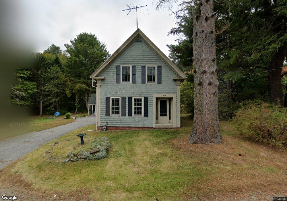
356 North Ave Haverhill, MA 01830
Upper Main Street NeighborhoodEstimated Value: $546,000 - $648,000
4
Beds
2
Baths
1,680
Sq Ft
$352/Sq Ft
Est. Value
About This Home
This home is located at 356 North Ave, Haverhill, MA 01830 and is currently estimated at $590,527, approximately $351 per square foot. 356 North Ave is a home located in Essex County with nearby schools including Pentucket Lake Elementary School and Haverhill High School.
Ownership History
Date
Name
Owned For
Owner Type
Purchase Details
Closed on
Apr 11, 2022
Sold by
Germain Jean M
Bought by
356 North Avenue Rt
Current Estimated Value
Purchase Details
Closed on
Jan 27, 1981
Bought by
Germain Raymond A and Germain Jean M
Create a Home Valuation Report for This Property
The Home Valuation Report is an in-depth analysis detailing your home's value as well as a comparison with similar homes in the area
Home Values in the Area
Average Home Value in this Area
Purchase History
| Date | Buyer | Sale Price | Title Company |
|---|---|---|---|
| 356 North Avenue Rt | -- | None Available | |
| Germain Raymond A | -- | -- |
Source: Public Records
Mortgage History
| Date | Status | Borrower | Loan Amount |
|---|---|---|---|
| Previous Owner | Germain Raymond A | $147,000 | |
| Previous Owner | Germain Raymond A | $131,000 | |
| Previous Owner | Germain Raymond A | $98,500 | |
| Previous Owner | Germain Raymond A | $49,500 |
Source: Public Records
Tax History Compared to Growth
Tax History
| Year | Tax Paid | Tax Assessment Tax Assessment Total Assessment is a certain percentage of the fair market value that is determined by local assessors to be the total taxable value of land and additions on the property. | Land | Improvement |
|---|---|---|---|---|
| 2025 | $5,126 | $478,600 | $220,500 | $258,100 |
| 2024 | $4,733 | $444,800 | $201,100 | $243,700 |
| 2023 | $4,729 | $424,100 | $201,100 | $223,000 |
| 2022 | $4,606 | $362,100 | $183,700 | $178,400 |
| 2021 | $4,433 | $329,800 | $172,100 | $157,700 |
| 2020 | $4,342 | $319,300 | $164,400 | $154,900 |
| 2019 | $4,157 | $298,000 | $143,100 | $154,900 |
| 2018 | $4,003 | $280,700 | $135,400 | $145,300 |
| 2017 | $3,983 | $265,700 | $131,500 | $134,200 |
| 2016 | $3,862 | $251,400 | $119,900 | $131,500 |
| 2015 | $3,859 | $251,400 | $119,900 | $131,500 |
Source: Public Records
Map
Nearby Homes
- 440 North Ave Unit 60
- 440 North Ave Unit 145
- 440 North Ave Unit 234
- 440 North Ave Unit 110
- 55 Ledge Rd
- 171 North Ave
- 116 Crosby St
- 113 Brickett Hill Cir Unit 113
- 175 Brickett Hill Cir Unit 175
- 119 Brickett Hill Cir Unit 119
- 120 Brickett Hill Cir Unit 120
- 8 Iris Way Unit 8
- 140 North Ave
- 994 Main St
- 7 Squaw Creek Dr
- 1022 Main St
- 23 Winona Ave
- 19 King St
- 70 Westminster Ave
- 0 Plaistow Rd Unit 73184617
- 401 North Ave
- 324 North Ave
- 322 North Ave
- 440 N Avenue Bld 11 Unit 256
- 318 North Ave
- 314 North Ave
- 440 Noth Ave Unit 29
- 310 North Ave
- 309 North Ave
- 4 Brady Cir
- 440 N Ave Blding 5 Unit 107
- 13 Abby Rd
- 421 North Ave
- 440 North Ave Unit 79
- 440 North Ave Unit 94
- 440 N Avenue Bdlg 4 Unit 85
- 437 North Ave
- 440 North Ave Unit 269
- 440 North Ave Unit 199
- 440 North Ave Unit 144