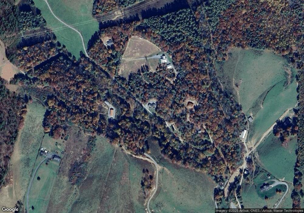
356 Rourke Ridge Rd Deep Gap, NC 28618
Estimated Value: $399,113 - $489,000
3
Beds
3
Baths
2,942
Sq Ft
$149/Sq Ft
Est. Value
About This Home
This home is located at 356 Rourke Ridge Rd, Deep Gap, NC 28618 and is currently estimated at $438,278, approximately $148 per square foot. 356 Rourke Ridge Rd is a home located in Watauga County with nearby schools including Parkway Elementary School and Watauga High School.
Ownership History
Date
Name
Owned For
Owner Type
Purchase Details
Closed on
Dec 23, 2020
Sold by
Everett Haley H
Bought by
Everett Jeffrey Dwayne
Current Estimated Value
Home Financials for this Owner
Home Financials are based on the most recent Mortgage that was taken out on this home.
Original Mortgage
$199,000
Outstanding Balance
$178,474
Interest Rate
3.37%
Mortgage Type
New Conventional
Estimated Equity
$259,804
Purchase Details
Closed on
Jul 8, 2005
Sold by
Lambeth Brian Channing and Lambeth Bobbi L
Bought by
Everett Jeffrey Dwayne and Everett Haley Hayes
Home Financials for this Owner
Home Financials are based on the most recent Mortgage that was taken out on this home.
Original Mortgage
$163,500
Interest Rate
5.25%
Mortgage Type
Adjustable Rate Mortgage/ARM
Create a Home Valuation Report for This Property
The Home Valuation Report is an in-depth analysis detailing your home's value as well as a comparison with similar homes in the area
Home Values in the Area
Average Home Value in this Area
Purchase History
| Date | Buyer | Sale Price | Title Company |
|---|---|---|---|
| Everett Jeffrey Dwayne | -- | None Available | |
| Everett Jeffrey Dwayne | $163,500 | None Available |
Source: Public Records
Mortgage History
| Date | Status | Borrower | Loan Amount |
|---|---|---|---|
| Open | Everett Jeffrey Dwayne | $199,000 | |
| Closed | Everett Jeffrey Dwayne | $163,500 |
Source: Public Records
Tax History
| Year | Tax Paid | Tax Assessment Tax Assessment Total Assessment is a certain percentage of the fair market value that is determined by local assessors to be the total taxable value of land and additions on the property. | Land | Improvement |
|---|---|---|---|---|
| 2025 | $1,066 | $261,600 | $27,000 | $234,600 |
| 2024 | $11 | $261,600 | $27,000 | $234,600 |
| 2023 | $1,043 | $261,600 | $27,000 | $234,600 |
| 2022 | $1,043 | $261,600 | $27,000 | $234,600 |
| 2021 | $826 | $164,600 | $16,900 | $147,700 |
| 2020 | $826 | $164,600 | $16,900 | $147,700 |
| 2019 | $826 | $164,600 | $16,900 | $147,700 |
| 2018 | $743 | $164,600 | $16,900 | $147,700 |
| 2017 | $743 | $164,600 | $16,900 | $147,700 |
| 2013 | -- | $147,400 | $16,900 | $130,500 |
Source: Public Records
Map
Nearby Homes
- 7143 Old Us 421 S
- 612 Wildcat Rd
- 132 Thistle Knob Rd
- 584 Cedar Trail
- 24 Ben Miller Rd
- TBD Moon Beam Ln
- 398 Campbell Glen Ln
- TBD Moonbeam Ln Unit 24, 25
- 48 Wildcat Wilderness Pkwy
- Lot 24 Ben Miller Rd Unit 24
- TBD Lots 2 & 3 Eden's Gate Rd
- 368 Wildcat Estates Dr
- Lot 3 Cedar Cove Ln
- Lot 69 Angelfire Trail
- TBD Angelfire Trail
- TBD lot 170 Wildcat Wilderness Rd
- TBD Forest Ridge
- TBD Lot 61 Wildcat Wilderness Pkwy
- Lot-142 Angelfire Trail
- TBD Ivy Ridge Rd
- 472 Rourke Ridge Rd
- 228 Rourke Ridge Rd
- TBD Rourke Ridge Rd
- 0 Ridgewood Rd
- 470 Rourke Ridge Rd
- 170 Rourke Ridge Rd
- 110 Rourke Ridge Rd
- 8819 Us Highway 421 S
- 7297 Old 421 S
- 272 Ridgewood Rd
- 264 Ridgewood Rd
- 8821 Us Highway 421 S
- 6939 Old 421 S
- 7143 Old 421 S
- 7179 Old 421 S
- 7045 Old 421 S
- 7043 Old 421 S
- 6997 Old 421 S
- 7110 Old 421 S
- 7222 Old 421 S Unit 7224
Your Personal Tour Guide
Ask me questions while you tour the home.
