Estimated Value: $175,000 - $197,000
3
Beds
2
Baths
1,288
Sq Ft
$146/Sq Ft
Est. Value
About This Home
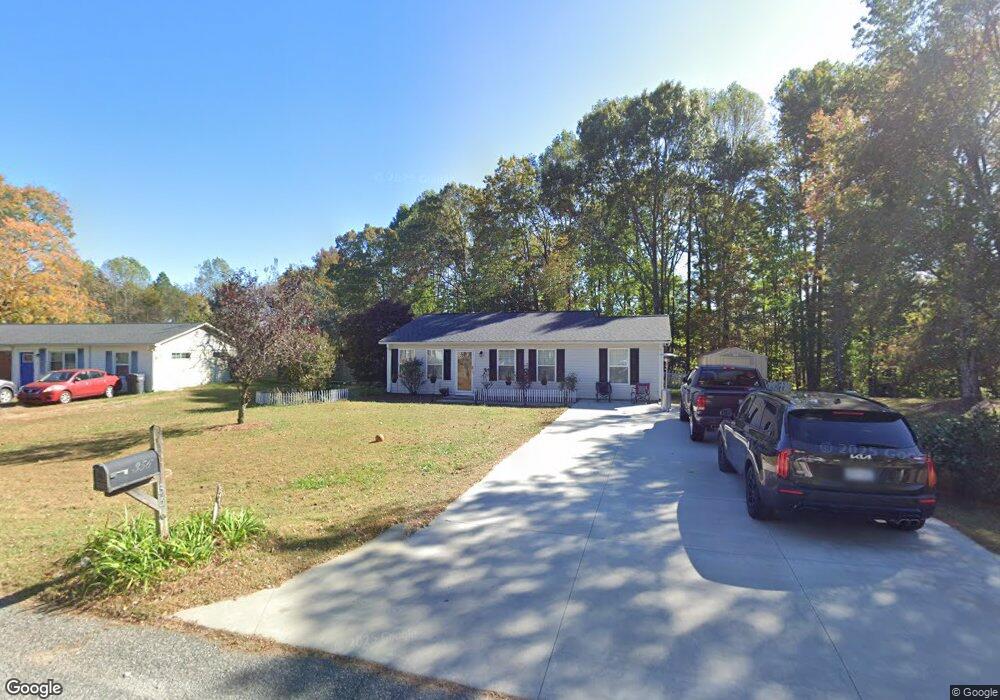
This home is located at 356 Weatherford Dr, King, NC 27021 and is currently estimated at $188,013, approximately $145 per square foot. 356 Weatherford Dr is a home located in Stokes County with nearby schools including Poplar Springs Elementary School, Springdale Elementary School, and Mt. Pleasant Middle School of the Visual & Performing Arts.
Ownership History
Date
Name
Owned For
Owner Type
Purchase Details
Closed on
Jun 1, 2010
Sold by
Guynn Natalie Williams
Bought by
Guynn Randall David
Current Estimated Value
Purchase Details
Closed on
Aug 9, 2006
Sold by
Wrenn Mickey S and Wrenn Betsy K
Bought by
Guynn Randall David and Guynn Natalie Williams
Home Financials for this Owner
Home Financials are based on the most recent Mortgage that was taken out on this home.
Original Mortgage
$77,287
Outstanding Balance
$46,351
Interest Rate
6.74%
Mortgage Type
FHA
Estimated Equity
$141,662
Create a Home Valuation Report for This Property
The Home Valuation Report is an in-depth analysis detailing your home's value as well as a comparison with similar homes in the area
Home Values in the Area
Average Home Value in this Area
Purchase History
| Date | Buyer | Sale Price | Title Company |
|---|---|---|---|
| Guynn Randall David | -- | None Available | |
| Guynn Randall David | $78,500 | None Available |
Source: Public Records
Mortgage History
| Date | Status | Borrower | Loan Amount |
|---|---|---|---|
| Open | Guynn Randall David | $77,287 |
Source: Public Records
Tax History Compared to Growth
Tax History
| Year | Tax Paid | Tax Assessment Tax Assessment Total Assessment is a certain percentage of the fair market value that is determined by local assessors to be the total taxable value of land and additions on the property. | Land | Improvement |
|---|---|---|---|---|
| 2025 | $951 | $133,000 | $35,000 | $98,000 |
| 2024 | $951 | $85,500 | $28,000 | $57,500 |
| 2023 | $693 | $85,500 | $28,000 | $57,500 |
| 2022 | $633 | $85,500 | $28,000 | $57,500 |
| 2021 | $633 | $85,500 | $28,000 | $57,500 |
| 2020 | $563 | $76,100 | $25,000 | $51,100 |
| 2019 | $563 | $76,100 | $25,000 | $51,100 |
| 2018 | $563 | $76,100 | $25,000 | $51,100 |
| 2017 | $559 | $76,100 | $25,000 | $51,100 |
| 2016 | $549 | $74,700 | $25,000 | $49,700 |
| 2015 | $545 | $74,700 | $25,000 | $49,700 |
| 2014 | $560 | $74,700 | $25,000 | $49,700 |
Source: Public Records
Map
Nearby Homes
- 327 Weatherford Dr
- 100 Ridgecrest Dr
- 113 Ravenwood Ct
- 6064 S Nc Highway 66
- 1121 Westmoreland Farm Rd
- 1085 Ashburn Dr
- 108 Nova Ln
- 103 Jasper Ct
- 1739 Denny Rd
- 1255 Mountain View Rd
- 310 Cedardale Ln
- 5.25 Ac Capella Ridge Rd Unit 5.25 Ac
- .64 Ac Kentland Dr Unit .64 Ac
- 1129 Kentland Dr
- 1025 Wilburn Ln
- 1160 Capella Ridge Rd
- +/- 17.06 Johnson Rd
- 1208 Kentland Dr
- 1249 Kentland Dr
- 4.45acres Gib Ferguson Rd
- 360 Weatherford Dr
- 352 Weatherford Dr
- 364 Weatherford Dr
- 348 Weatherford Dr
- XX Weatherford Dr
- 000 Weatherford Dr
- 351 Weatherford Dr
- 347 Weatherford Dr
- 355 Weatherford Dr
- 368 Weatherford Dr
- 344 Weatherford Dr
- 343 Weatherford Dr
- 363 Weatherford Dr
- 339 Weatherford Dr
- 1319 Traffic Ln
- 340 Weatherford Dr
- 372 Weatherford Dr
- 338 Ridgecrest Dr
- 342 Ridgecrest Dr
- 334 Ridgecrest Dr