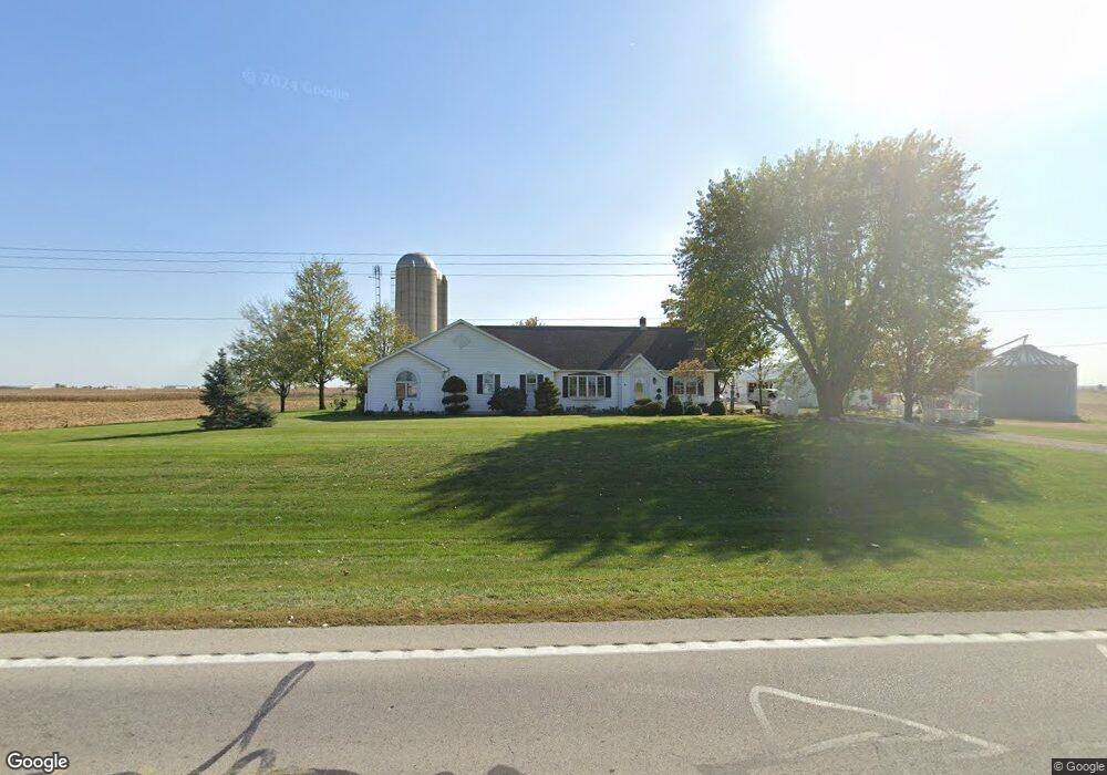
3564 State Route 119 Saint Henry, OH 45883
Estimated Value: $357,638 - $478,000
3
Beds
2
Baths
2,054
Sq Ft
$200/Sq Ft
Est. Value
About This Home
This home is located at 3564 State Route 119, Saint Henry, OH 45883 and is currently estimated at $409,910, approximately $199 per square foot. 3564 State Route 119 is a home located in Mercer County with nearby schools including St. Henry Elementary School, St. Henry Middle School, and St. Henry High School.
Ownership History
Date
Name
Owned For
Owner Type
Purchase Details
Closed on
Jul 12, 2023
Sold by
Unrast Gerald R and Unrast Kathryn C
Bought by
Gerald R Unrast And Kathryn C Unrast Irrevoca and Unrast
Current Estimated Value
Purchase Details
Closed on
Apr 2, 2020
Sold by
Unrast Gerald R and Unrast Kathryn C
Bought by
Unrast Gerald R and Unrast Revocable Livi Gerald R
Purchase Details
Closed on
Dec 20, 1993
Bought by
Unrast Gerald R and Unrast Kathryn C
Create a Home Valuation Report for This Property
The Home Valuation Report is an in-depth analysis detailing your home's value as well as a comparison with similar homes in the area
Home Values in the Area
Average Home Value in this Area
Purchase History
| Date | Buyer | Sale Price | Title Company |
|---|---|---|---|
| Gerald R Unrast And Kathryn C Unrast Irrevoca | -- | None Listed On Document | |
| Unrast Gerald R | -- | None Available | |
| Unrast Gerald R | -- | -- |
Source: Public Records
Tax History Compared to Growth
Tax History
| Year | Tax Paid | Tax Assessment Tax Assessment Total Assessment is a certain percentage of the fair market value that is determined by local assessors to be the total taxable value of land and additions on the property. | Land | Improvement |
|---|---|---|---|---|
| 2024 | $3,570 | $103,960 | $12,290 | $91,670 |
| 2023 | $3,570 | $103,960 | $12,290 | $91,670 |
| 2022 | $3,007 | $80,960 | $7,490 | $73,470 |
| 2021 | $3,062 | $80,960 | $7,490 | $73,470 |
| 2020 | $3,044 | $80,960 | $7,490 | $73,470 |
| 2019 | $2,402 | $62,690 | $6,650 | $56,040 |
| 2018 | $2,508 | $62,690 | $6,650 | $56,040 |
| 2017 | $3,220 | $62,690 | $6,650 | $56,040 |
| 2016 | $2,231 | $54,710 | $6,690 | $48,020 |
| 2015 | $2,168 | $54,710 | $6,690 | $48,020 |
| 2014 | $2,128 | $54,710 | $6,690 | $48,020 |
| 2013 | $2,038 | $50,200 | $6,130 | $44,070 |
Source: Public Records
Map
Nearby Homes
- 0 Ohio 118
- 4543 Lange Rd
- 420 S 1st St
- 820 Mary Ln
- 401 N Cedar St
- 426 E Walnut St
- 314 E North St
- 821 Butler St
- 402 E Elizabeth St
- 912 Emerald Ave
- 501 N 2nd St
- 721 Lilac Dr
- 4475 Ohio 705
- 304 S Wayne St
- 201 W Wiggs St
- 207 W Butler St
- 1291 State Route 219
- 63 Cassella-Montezuma Rd
- 45 Cassella Montezuma Rd
- 5383 U S 127
- 3708 State Route 119
- 3708 State Route 119
- 2634 Wessel Rd
- 2664 Wessel Rd
- 3356 State Route 119
- 2720 Wessel Rd
- 3856 State Route 119
- 2258 Post Rd
- 3284 State Route 119
- 2732 Post Rd
- 3209 State Route 119
- 2760 Post Rd
- 3197 State Route 119
- 2806 Post Rd
- 2688 Fleetfoot Rd
- 542 W Kremer Hoying Rd
- 541 W Kremer Hoying Rd
- 172 S Westview Ave
- 541 Western Ave
- 221 N Westview Ave