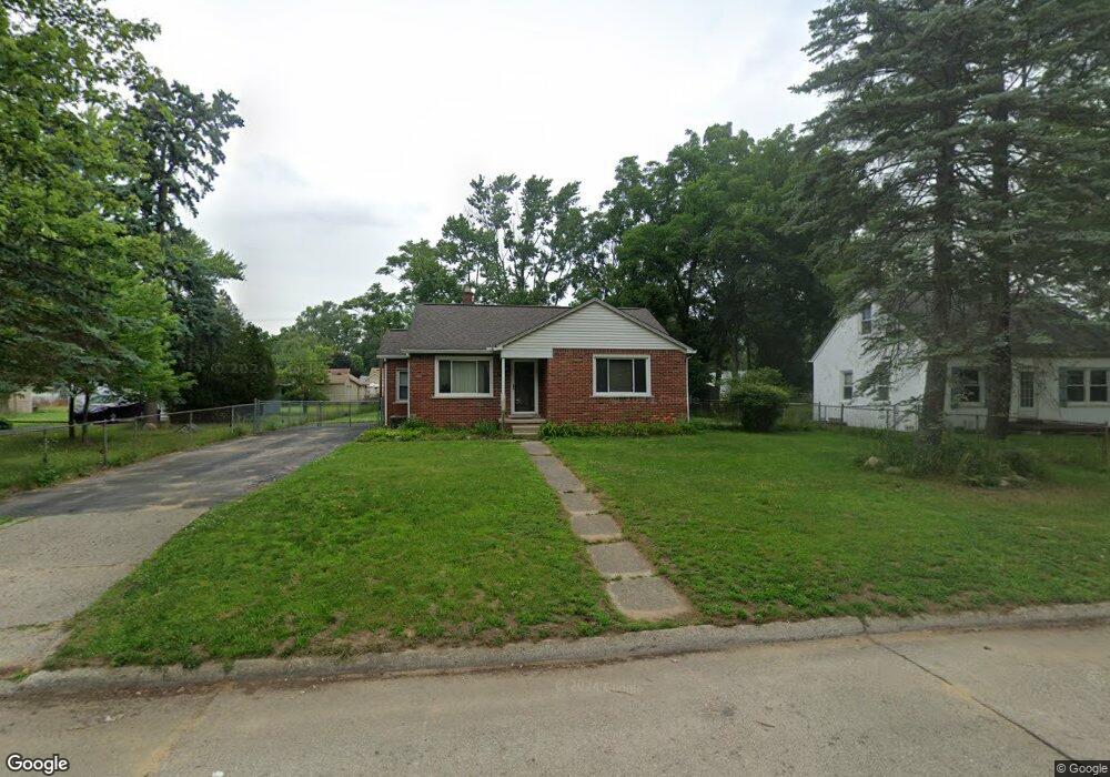
35640 Columbia St Westland, MI 48186
Estimated Value: $141,000 - $182,069
2
Beds
1
Bath
1,098
Sq Ft
$155/Sq Ft
Est. Value
About This Home
This home is located at 35640 Columbia St, Westland, MI 48186 and is currently estimated at $169,767, approximately $154 per square foot. 35640 Columbia St is a home located in Wayne County with nearby schools including Albert Schweitzer Elementary School, Adams Middle School, and Benjamin Franklin Middle School.
Ownership History
Date
Name
Owned For
Owner Type
Purchase Details
Closed on
May 5, 2009
Sold by
Secretary Of Housing & Urban Development
Bought by
Deleon Kenneth
Current Estimated Value
Purchase Details
Closed on
Nov 11, 2008
Sold by
Chase Home Finance Llc
Bought by
The Secretary Of Housing & Urban Develop
Purchase Details
Closed on
May 8, 2008
Sold by
Floyd Monty L and Floyd Marlene
Bought by
Chase Home Finance Llc
Purchase Details
Closed on
Oct 12, 2000
Sold by
Patrick M Harder
Bought by
Monty L Floyd
Purchase Details
Closed on
Sep 17, 1997
Sold by
Hunt Heather E and Hunt Lee A
Bought by
Patrick M Harder
Create a Home Valuation Report for This Property
The Home Valuation Report is an in-depth analysis detailing your home's value as well as a comparison with similar homes in the area
Home Values in the Area
Average Home Value in this Area
Purchase History
| Date | Buyer | Sale Price | Title Company |
|---|---|---|---|
| Deleon Kenneth | $46,500 | None Available | |
| The Secretary Of Housing & Urban Develop | -- | None Available | |
| Chase Home Finance Llc | $126,097 | None Available | |
| Monty L Floyd | $114,000 | -- | |
| Patrick M Harder | $82,500 | -- |
Source: Public Records
Tax History Compared to Growth
Tax History
| Year | Tax Paid | Tax Assessment Tax Assessment Total Assessment is a certain percentage of the fair market value that is determined by local assessors to be the total taxable value of land and additions on the property. | Land | Improvement |
|---|---|---|---|---|
| 2025 | $1,589 | $86,000 | $0 | $0 |
| 2024 | $1,589 | $80,400 | $0 | $0 |
| 2023 | $1,517 | $63,200 | $0 | $0 |
| 2022 | $1,771 | $59,600 | $0 | $0 |
| 2021 | $1,730 | $57,000 | $0 | $0 |
| 2020 | $1,708 | $49,200 | $0 | $0 |
| 2019 | $1,643 | $45,100 | $0 | $0 |
| 2018 | $1,248 | $41,000 | $0 | $0 |
| 2017 | $589 | $37,200 | $0 | $0 |
| 2016 | $1,597 | $37,200 | $0 | $0 |
| 2015 | $3,042 | $33,540 | $0 | $0 |
| 2013 | $2,947 | $29,960 | $0 | $0 |
| 2012 | $1,507 | $31,330 | $0 | $0 |
Source: Public Records
Map
Nearby Homes
- 35833 Farragut Ave
- 35801 Glenwood Rd
- 35408 Farragut Ave
- 36012 Manila Ave
- 36255 Manila Ave
- 1853 S Linville Ave
- 35130 June Dr
- 1811 S Harvey Ave
- 2314 S Christine
- 1825 Liddicot Ave
- 36675 Thinbark St
- 32730 Palmer Rd
- 36650 Thinbark St
- 2304 2nd St
- 1909 S Christine
- 3462 Pershing St
- 2439 Stieber St Unit 94
- 35718 Main St
- 3747 Williams St
- 1510 S Crown St
- 35700 Columbia St
- 35620 Columbia St
- 35714 Columbia St
- 35653 Farragut St
- 35610 Columbia St
- 35665 Farragut St
- 35675 Farragut St
- 35643 Farragut St
- 35653 Columbia Ave
- 35653 Columbia Ave
- 35643 Farragut Ave
- 35715 Farragut St
- 35629 Columbia St
- 35631 Farragut St
- 35629 Columbia Ave
- 35734 Columbia St
- 35600 Columbia St
- 35625 Columbia St
- 35725 Farragut St
- 35711 Columbia St