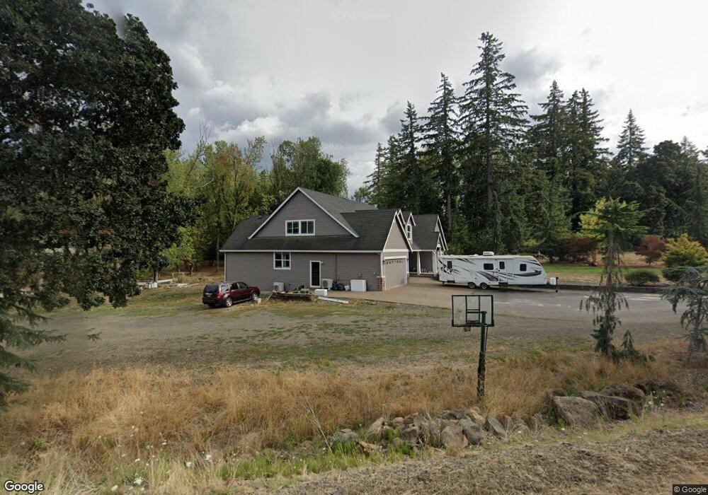
35640 S Highway 213 Molalla, OR 97038
Estimated Value: $758,000 - $882,000
3
Beds
2
Baths
3,381
Sq Ft
$245/Sq Ft
Est. Value
About This Home
This home is located at 35640 S Highway 213, Molalla, OR 97038 and is currently estimated at $829,059, approximately $245 per square foot. 35640 S Highway 213 is a home with nearby schools including Butte Creek Elementary School and Silverton High School.
Ownership History
Date
Name
Owned For
Owner Type
Purchase Details
Closed on
Oct 24, 2006
Sold by
Barsukoff Kuzma
Bought by
Sharipoff Palagia A and Barsukoff Mosya K
Current Estimated Value
Home Financials for this Owner
Home Financials are based on the most recent Mortgage that was taken out on this home.
Original Mortgage
$329,000
Outstanding Balance
$194,546
Interest Rate
6.39%
Mortgage Type
Construction
Estimated Equity
$634,513
Create a Home Valuation Report for This Property
The Home Valuation Report is an in-depth analysis detailing your home's value as well as a comparison with similar homes in the area
Home Values in the Area
Average Home Value in this Area
Purchase History
| Date | Buyer | Sale Price | Title Company |
|---|---|---|---|
| Sharipoff Palagia A | -- | First American Title Insuran |
Source: Public Records
Mortgage History
| Date | Status | Borrower | Loan Amount |
|---|---|---|---|
| Open | Sharipoff Palagia A | $329,000 |
Source: Public Records
Tax History Compared to Growth
Tax History
| Year | Tax Paid | Tax Assessment Tax Assessment Total Assessment is a certain percentage of the fair market value that is determined by local assessors to be the total taxable value of land and additions on the property. | Land | Improvement |
|---|---|---|---|---|
| 2025 | $6,893 | $510,166 | -- | -- |
| 2024 | $6,678 | $495,307 | -- | -- |
| 2023 | $6,678 | $480,881 | $0 | $0 |
| 2022 | $6,347 | $466,875 | $0 | $0 |
| 2021 | $6,078 | $453,277 | $0 | $0 |
| 2020 | $5,936 | $440,075 | $0 | $0 |
| 2019 | $5,756 | $427,258 | $0 | $0 |
| 2018 | $5,612 | $414,814 | $0 | $0 |
| 2017 | $5,352 | $402,732 | $0 | $0 |
| 2016 | $5,177 | $391,002 | $0 | $0 |
| 2015 | $5,022 | $379,614 | $0 | $0 |
| 2014 | $4,882 | $368,557 | $0 | $0 |
Source: Public Records
Map
Nearby Homes
- 10285 S Rosewood Way
- 36175 S Highway 213
- 35267 S Acer Ln
- 9924 S Wildcat Rd
- 37658 S Highway 213
- 37486 S Highway 213 (Adj To)
- 37486 S Hwy 213 (Adj To)
- 0 S Wilhoit Rd
- 0 Crooked Finger Rd NE Unit 827344
- 0 Crooked Finger Rd NE Unit 265826977
- 000 Crooked Finger Rd NE
- Lot 1600 Crooked Finger Rd NE
- 0 Off of Crooked Finge Rd
- 8438 Cascade Hwy NE
- 7138 Grandview Ave
- 7118 Grandview Ave
- 15215 Woodburn Monitor Rd NE
- 15145 Woodburn Monitor Rd NE
- 32604 S Krupicka Way
- 31514 S Bear Meadow Ct
- 10070 Marquam Cir
- 10080 Marquam Cir
- 10090 Marquam Cir
- 35500 S Highway 213
- 35556 S Highway 213
- 10058 Marquam Cir
- 35538 S Highway 213
- 35463 S Highway 213
- 10098 S Marquam Cr
- 35400 S Highway 213
- 10098 Marquam Cir
- 35400 Oregon 213
- 10075 Marquam Cir
- 35725 S Highway 213
- 35558 S Highway 213
- 35350 S Highway 213
- 10028 Marquam Cir
- 10087 Marquam Cir
- 10045 Marquam Cir
- 10109 Marquam Cir