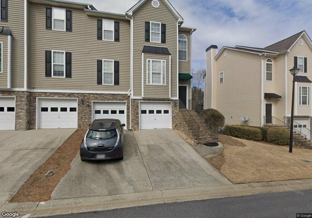
3565 Deep Cove Dr Unit 12 Cumming, GA 30041
Estimated Value: $366,000 - $426,076
4
Beds
3
Baths
1,881
Sq Ft
$212/Sq Ft
Est. Value
About This Home
This home is located at 3565 Deep Cove Dr Unit 12, Cumming, GA 30041 and is currently estimated at $399,019, approximately $212 per square foot. 3565 Deep Cove Dr Unit 12 is a home located in Forsyth County with nearby schools including Mashburn Elementary School, Lakeside Middle School, and Forsyth Central High School.
Ownership History
Date
Name
Owned For
Owner Type
Purchase Details
Closed on
Jul 28, 2020
Sold by
Chitwood Meredith
Bought by
Dimmick Barbara E
Current Estimated Value
Home Financials for this Owner
Home Financials are based on the most recent Mortgage that was taken out on this home.
Original Mortgage
$191,250
Outstanding Balance
$169,652
Interest Rate
3%
Mortgage Type
New Conventional
Estimated Equity
$229,367
Purchase Details
Closed on
May 18, 2018
Sold by
Miller Joshua Lee
Bought by
Buice Meredith and Faircloth Marcia
Home Financials for this Owner
Home Financials are based on the most recent Mortgage that was taken out on this home.
Original Mortgage
$230,743
Interest Rate
4.99%
Mortgage Type
FHA
Purchase Details
Closed on
Mar 21, 2014
Sold by
Housing And Urban Developm
Bought by
Miller Joshua Lee
Home Financials for this Owner
Home Financials are based on the most recent Mortgage that was taken out on this home.
Original Mortgage
$156,750
Interest Rate
4.36%
Mortgage Type
New Conventional
Purchase Details
Closed on
Apr 2, 2013
Sold by
Citimortgage Inc
Bought by
Housing And Urban Development
Purchase Details
Closed on
Jul 29, 2008
Sold by
Home Rental Solutions Llc
Bought by
Collis Jim M and Collis Melissa W
Home Financials for this Owner
Home Financials are based on the most recent Mortgage that was taken out on this home.
Original Mortgage
$188,049
Interest Rate
6.49%
Mortgage Type
FHA
Purchase Details
Closed on
Dec 4, 2007
Sold by
Alliance Resource Mgmt Llc
Bought by
Home Rental Solutions Llc
Purchase Details
Closed on
Oct 20, 2005
Sold by
Foley Shaun G
Bought by
Alliance Resource Mgnt Llc
Home Financials for this Owner
Home Financials are based on the most recent Mortgage that was taken out on this home.
Original Mortgage
$184,747
Interest Rate
5.76%
Mortgage Type
New Conventional
Purchase Details
Closed on
May 31, 2001
Sold by
F T S Properties Inc
Bought by
Foley Shaun S
Home Financials for this Owner
Home Financials are based on the most recent Mortgage that was taken out on this home.
Original Mortgage
$178,350
Interest Rate
7.11%
Mortgage Type
New Conventional
Create a Home Valuation Report for This Property
The Home Valuation Report is an in-depth analysis detailing your home's value as well as a comparison with similar homes in the area
Home Values in the Area
Average Home Value in this Area
Purchase History
| Date | Buyer | Sale Price | Title Company |
|---|---|---|---|
| Dimmick Barbara E | $255,000 | -- | |
| Buice Meredith | $235,000 | -- | |
| Miller Joshua Lee | $165,000 | -- | |
| Housing And Urban Development | $212,676 | -- | |
| Collis Jim M | $191,000 | -- | |
| Home Rental Solutions Llc | $205,875 | -- | |
| Alliance Resource Mgnt Llc | $210,000 | -- | |
| Foley Shaun S | $183,900 | -- |
Source: Public Records
Mortgage History
| Date | Status | Borrower | Loan Amount |
|---|---|---|---|
| Open | Dimmick Barbara E | $191,250 | |
| Previous Owner | Buice Meredith | $230,743 | |
| Previous Owner | Miller Joshua Lee | $156,750 | |
| Previous Owner | Collis Jim M | $188,049 | |
| Previous Owner | Alliance Resource Mgnt Llc | $184,747 | |
| Previous Owner | Foley Shaun S | $178,350 |
Source: Public Records
Tax History Compared to Growth
Tax History
| Year | Tax Paid | Tax Assessment Tax Assessment Total Assessment is a certain percentage of the fair market value that is determined by local assessors to be the total taxable value of land and additions on the property. | Land | Improvement |
|---|---|---|---|---|
| 2025 | $1,044 | $172,908 | $58,000 | $114,908 |
| 2024 | $1,044 | $139,572 | $54,000 | $85,572 |
| 2023 | $3,523 | $143,148 | $44,000 | $99,148 |
| 2022 | $3,016 | $99,892 | $28,000 | $71,892 |
| 2021 | $2,758 | $99,892 | $28,000 | $71,892 |
| 2020 | $2,563 | $92,804 | $28,000 | $64,804 |
| 2019 | $2,465 | $89,132 | $18,000 | $71,132 |
| 2018 | $2,205 | $79,732 | $18,000 | $61,732 |
| 2017 | $2,007 | $72,312 | $18,000 | $54,312 |
| 2016 | $1,837 | $66,192 | $12,000 | $54,192 |
| 2015 | $1,716 | $61,712 | $10,000 | $51,712 |
| 2014 | $1,519 | $57,360 | $10,000 | $47,360 |
Source: Public Records
Map
Nearby Homes
- 2995 Hamilton Rd
- 3705 Tradewinds Dr
- 3706 Tradewinds Dr
- 2935 Hamilton Rd Unit IV
- 3200 Rim Cove Dr Unit 172
- 3200 Rim Cove Dr Unit 116
- 3235 Southshore Ct
- 3430 Lake Shore Dr
- 2650 Merry Rd
- 2835 Evan Manor Ln
- LOT 51 Brook Valley Dr
- LOT 50 Brook Valley Dr
- LOT 48 Brook Valley Dr
- LOT 52 Brook Valley Dr
- LOT 47 Brook Valley Dr
- LOT 54 Brook Valley Dr
- 2420 Wanda Woods Rd
- 2575 Maple Park Place
- 2802 Buford Dam Rd
- 2765 Port Bow Ln
- 3565 Deep Cove Dr
- 3430 Deep Cove Dr
- 3555 Deep Cove Dr Unit 11
- 3555 Deep Cove Dr
- 3530 Windridge Ct
- 3585 Deep Cove Dr
- 3545 Deep Cove Dr
- 3540 Windridge Ct
- 3540 Windridge Ct Unit 7
- 3595 Deep Cove Dr
- 3535 Deep Cove Dr
- 3550 Windridge Ct
- 3560 Deep Cove Dr
- 3570 Deep Cove Dr
- 3550 Deep Cove Dr
- 3580 Deep Cove Dr
- 3590 Deep Cove Dr
- 3545 Windridge Ct
- 3615 Deep Cove Dr
- 3610 Deep Cove Dr Unit 3610