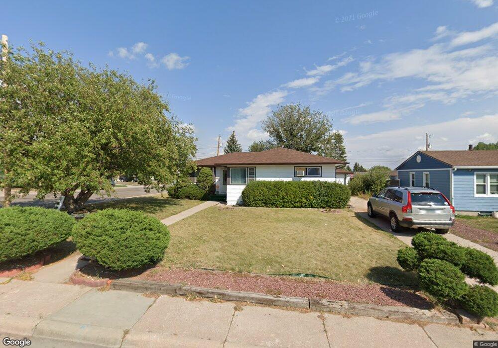
3569 Amherst Rd Cheyenne, WY 82001
Estimated Value: $352,000 - $390,000
5
Beds
2
Baths
1,138
Sq Ft
$324/Sq Ft
Est. Value
About This Home
This home is located at 3569 Amherst Rd, Cheyenne, WY 82001 and is currently estimated at $368,709, approximately $323 per square foot. 3569 Amherst Rd is a home located in Laramie County with nearby schools including Henderson Elementary School, Carey Junior High School, and East High School.
Ownership History
Date
Name
Owned For
Owner Type
Purchase Details
Closed on
Jun 18, 2019
Sold by
Kang Hyong T and Kang Ran Hee
Bought by
Brubaker Eric A
Current Estimated Value
Home Financials for this Owner
Home Financials are based on the most recent Mortgage that was taken out on this home.
Original Mortgage
$235,000
Outstanding Balance
$206,622
Interest Rate
4.1%
Mortgage Type
VA
Estimated Equity
$162,087
Create a Home Valuation Report for This Property
The Home Valuation Report is an in-depth analysis detailing your home's value as well as a comparison with similar homes in the area
Home Values in the Area
Average Home Value in this Area
Purchase History
| Date | Buyer | Sale Price | Title Company |
|---|---|---|---|
| Brubaker Eric A | -- | First American |
Source: Public Records
Mortgage History
| Date | Status | Borrower | Loan Amount |
|---|---|---|---|
| Open | Brubaker Eric A | $235,000 |
Source: Public Records
Tax History Compared to Growth
Tax History
| Year | Tax Paid | Tax Assessment Tax Assessment Total Assessment is a certain percentage of the fair market value that is determined by local assessors to be the total taxable value of land and additions on the property. | Land | Improvement |
|---|---|---|---|---|
| 2025 | $1,942 | $23,715 | $3,385 | $20,330 |
| 2024 | $1,942 | $30,465 | $4,514 | $25,951 |
| 2023 | $1,979 | $30,994 | $4,514 | $26,480 |
| 2022 | $1,653 | $25,906 | $4,514 | $21,392 |
| 2021 | $1,554 | $24,481 | $4,514 | $19,967 |
| 2020 | $1,553 | $21,531 | $4,514 | $17,017 |
| 2019 | $1,515 | $20,987 | $4,514 | $16,473 |
| 2018 | $1,358 | $18,993 | $4,157 | $14,836 |
| 2017 | $1,335 | $18,500 | $4,157 | $14,343 |
| 2016 | $1,258 | $17,417 | $3,939 | $13,478 |
| 2015 | $1,176 | $16,281 | $3,939 | $12,342 |
| 2014 | $1,286 | $17,691 | $3,939 | $13,752 |
Source: Public Records
Map
Nearby Homes
- 3628 Amherst Rd
- 3561 Boston Rd
- 1702 Newton Dr
- 3529 Concord Rd
- 3333 Duff Ave
- 1813 Newton Dr
- 1813 Andover Dr
- 1801 Milton Dr
- 1731 E Pershing Blvd
- 1408 E 22nd St
- 1751 E Pershing Blvd
- 3700 Essex Rd
- 1610 E 20th St
- 1808 E 21st St
- 1958 Newton Dr
- 3444 Dover Rd
- 2122 Morrie Ave
- 1209 E 20th St
- 1323 E 19th St Unit 1-4
- 1793 Spring Ct
- 3565 Amherst Rd
- 3561 Amherst Rd
- 3568 Boston Rd
- 1508 Newton Dr
- 1502 Newton Dr
- 3564 Boston Rd
- 3553 Amherst Rd
- 3560 Boston Rd
- 3634 Amherst Rd
- 1512 Newton Dr
- 3624 Amherst Rd
- 3552 Boston Rd
- 3549 Amherst Rd
- 1502 Andover Dr
- 1520 Newton Dr
- 1509 Andover Dr
- 3618 Amherst Rd
- 3548 Boston Rd
- 1506 Andover Dr
- 3545 Amherst Rd