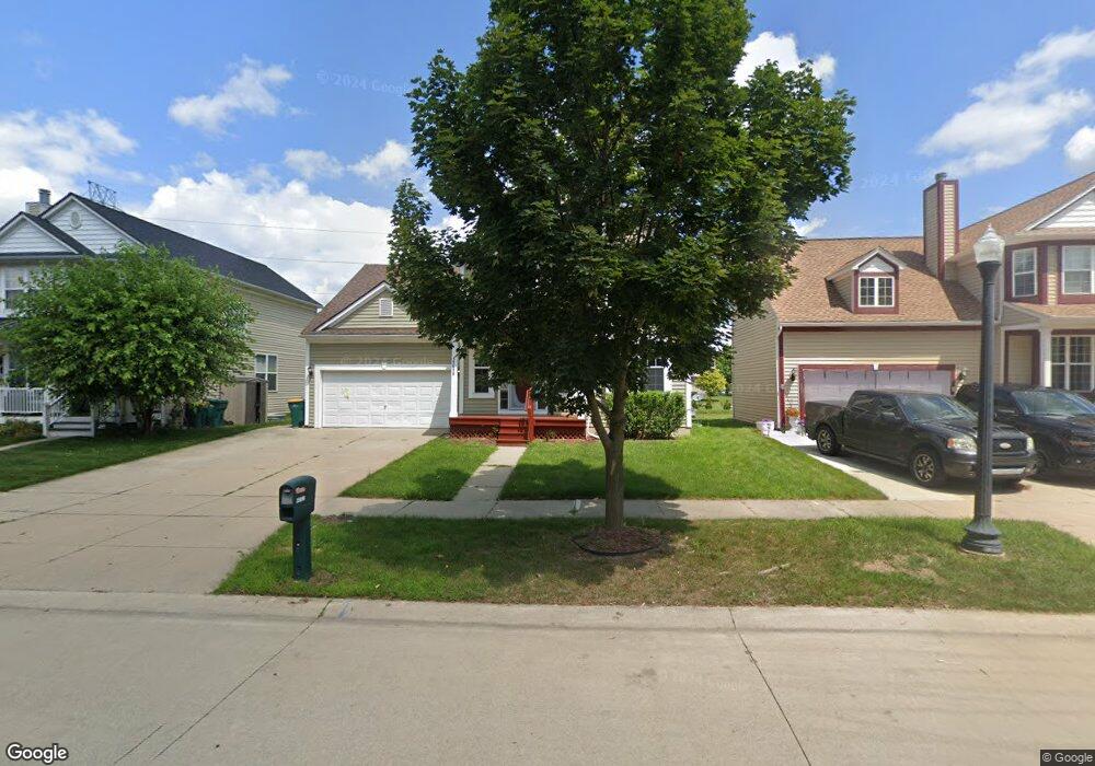
35698 Hawthorne Dr Unit Bldg-Unit Romulus, MI 48174
Estimated Value: $318,000 - $356,000
4
Beds
3
Baths
2,022
Sq Ft
$167/Sq Ft
Est. Value
About This Home
This home is located at 35698 Hawthorne Dr Unit Bldg-Unit, Romulus, MI 48174 and is currently estimated at $336,694, approximately $166 per square foot. 35698 Hawthorne Dr Unit Bldg-Unit is a home located in Wayne County with nearby schools including Wick Elementary School, Romulus Middle School, and Romulus Senior High School.
Ownership History
Date
Name
Owned For
Owner Type
Purchase Details
Closed on
Aug 1, 2024
Sold by
408 Marigold Llc
Bought by
Stephenson Sharron
Current Estimated Value
Home Financials for this Owner
Home Financials are based on the most recent Mortgage that was taken out on this home.
Original Mortgage
$279,812
Outstanding Balance
$276,640
Interest Rate
6.86%
Mortgage Type
FHA
Estimated Equity
$60,054
Purchase Details
Closed on
Jul 7, 2014
Sold by
The Bank Of New York Mellon
Bought by
408 Marigold Llc
Purchase Details
Closed on
Oct 24, 2013
Sold by
Wright Joseph K and Wright Erin C
Bought by
The Bank Of New York Mellon and The Bank Of New York
Purchase Details
Closed on
Dec 30, 2004
Sold by
F J Pinehollow Inc
Bought by
Wright Joseph K
Purchase Details
Closed on
Nov 10, 2003
Sold by
Elro Corp
Bought by
F J Pinehollow Inc
Create a Home Valuation Report for This Property
The Home Valuation Report is an in-depth analysis detailing your home's value as well as a comparison with similar homes in the area
Home Values in the Area
Average Home Value in this Area
Purchase History
| Date | Buyer | Sale Price | Title Company |
|---|---|---|---|
| Stephenson Sharron | $305,000 | Crossroads Title | |
| 408 Marigold Llc | $83,475 | Bay National Title Company | |
| The Bank Of New York Mellon | $205,001 | None Available | |
| Wright Joseph K | -- | Multiple | |
| F J Pinehollow Inc | $47,500 | Greco |
Source: Public Records
Mortgage History
| Date | Status | Borrower | Loan Amount |
|---|---|---|---|
| Open | Stephenson Sharron | $279,812 |
Source: Public Records
Tax History Compared to Growth
Tax History
| Year | Tax Paid | Tax Assessment Tax Assessment Total Assessment is a certain percentage of the fair market value that is determined by local assessors to be the total taxable value of land and additions on the property. | Land | Improvement |
|---|---|---|---|---|
| 2025 | $3,539 | $148,300 | $0 | $0 |
| 2024 | $3,539 | $139,600 | $0 | $0 |
| 2023 | $3,379 | $127,100 | $0 | $0 |
| 2022 | $3,779 | $113,300 | $0 | $0 |
| 2021 | $3,673 | $103,100 | $0 | $0 |
| 2020 | $3,602 | $93,600 | $0 | $0 |
| 2019 | $3,571 | $83,400 | $0 | $0 |
| 2018 | $2,600 | $76,100 | $0 | $0 |
| 2017 | $1,239 | $75,400 | $0 | $0 |
| 2016 | $3,177 | $60,700 | $0 | $0 |
| 2015 | $4,720 | $47,200 | $0 | $0 |
| 2013 | $4,240 | $46,200 | $0 | $0 |
| 2012 | $1,429 | $51,000 | $5,000 | $46,000 |
Source: Public Records
Map
Nearby Homes
- 35901 Abbey Ct
- 7197 Cambridge Dr
- 35773 Surrey Dr
- 35209 Atlas St
- 35344 Ecorse Rd
- 000 Waynecorse
- 00 Cypress St
- 35841 Vinewood St
- 35872 Vinewood St
- 35511 Beverly Rd
- 35740 Beverly Rd
- 0000 Park Place
- 6358 Dexter St
- 6130 Wayne Rd
- Lot 215 2nd St
- Lot 214 2nd St
- 9405 Chamberlain St
- Lot 227 Dexter St
- Lot 226 Dexter St
- 7063 Sargent St
- 35698 Hawthorne Dr
- 35672 Hawthorne Dr
- 35722 Hawthorne Dr
- 35646 Hawthorne Dr
- 35746 Hawthorne Dr
- 35772 Hawthorne Dr
- 35622 Hawthorne Dr
- 35671 Concord Dr
- 35619 Concord Dr
- 35643 Concord Dr
- 35695 Concord Dr
- 35620 Concord Dr
- 35798 Hawthorne Dr
- 35598 Hawthorne Dr
- 7785 Surrey Dr
- 35570 Hawthorne Dr
- 35599 Hawthorne Dr
- 35822 Hawthorne Dr
- 35624 Sussex Ct
- 7797 Surrey Dr