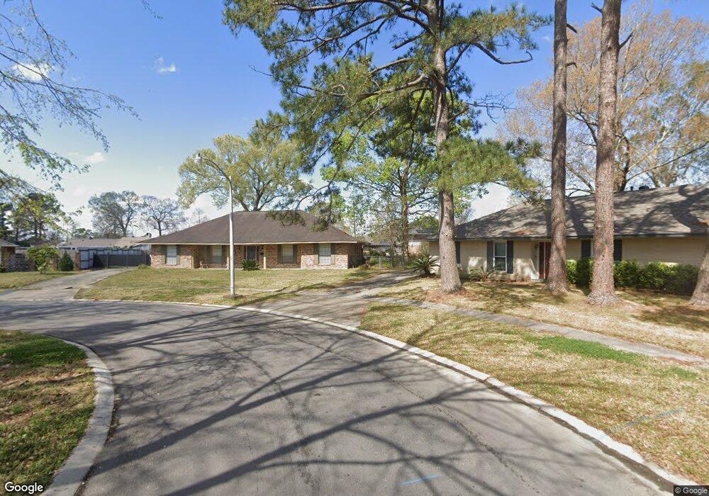
357 Dunstan Cir Baton Rouge, LA 70815
Broadmoor/Sherwood NeighborhoodEstimated Value: $222,000 - $272,000
--
Bed
--
Bath
2,418
Sq Ft
$103/Sq Ft
Est. Value
About This Home
This home is located at 357 Dunstan Cir, Baton Rouge, LA 70815 and is currently estimated at $249,557, approximately $103 per square foot. 357 Dunstan Cir is a home located in East Baton Rouge Parish with nearby schools including Twin Oaks Elementary School, Southeast Middle School, and Broadmoor Senior High School.
Ownership History
Date
Name
Owned For
Owner Type
Purchase Details
Closed on
Jun 25, 1998
Sold by
Oconnor Oconnor Michael J
Bought by
Black Jerrold and Black Linda
Current Estimated Value
Home Financials for this Owner
Home Financials are based on the most recent Mortgage that was taken out on this home.
Original Mortgage
$121,400
Outstanding Balance
$24,625
Interest Rate
7.21%
Estimated Equity
$224,932
Create a Home Valuation Report for This Property
The Home Valuation Report is an in-depth analysis detailing your home's value as well as a comparison with similar homes in the area
Home Values in the Area
Average Home Value in this Area
Purchase History
| Date | Buyer | Sale Price | Title Company |
|---|---|---|---|
| Black Jerrold | $134,900 | -- |
Source: Public Records
Mortgage History
| Date | Status | Borrower | Loan Amount |
|---|---|---|---|
| Open | Black Jerrold | $121,400 |
Source: Public Records
Tax History Compared to Growth
Tax History
| Year | Tax Paid | Tax Assessment Tax Assessment Total Assessment is a certain percentage of the fair market value that is determined by local assessors to be the total taxable value of land and additions on the property. | Land | Improvement |
|---|---|---|---|---|
| 2024 | $2,118 | $24,180 | $3,000 | $21,180 |
| 2023 | $2,118 | $20,550 | $3,000 | $17,550 |
| 2022 | $2,529 | $20,550 | $3,000 | $17,550 |
| 2021 | $2,472 | $20,550 | $3,000 | $17,550 |
| 2020 | $2,502 | $20,550 | $3,000 | $17,550 |
| 2019 | $2,465 | $19,350 | $3,000 | $16,350 |
| 2018 | $2,436 | $19,350 | $3,000 | $16,350 |
| 2017 | $990 | $7,500 | $3,000 | $4,500 |
| 2016 | $901 | $13,628 | $3,000 | $10,628 |
| 2015 | $1,175 | $15,900 | $3,000 | $12,900 |
| 2014 | $1,171 | $15,900 | $3,000 | $12,900 |
| 2013 | -- | $15,900 | $3,000 | $12,900 |
Source: Public Records
Map
Nearby Homes
- 12875 King John Place
- 305 Woodcliff Dr
- 13212 Avants Ave
- 13243 Avants Ave
- 12511 E Robinhood Dr
- 12651 Parnell Ave
- 13070 Wallis St
- 12424 Cate Ave Unit 12426
- 12435 Parnell Dr
- 522 S Flannery Rd Unit A
- 12547 Lorna Ave
- 13358 Wenham Ave
- 388 Wingate Dr
- 13343 E Parnell Ave
- 379 Wilton Dr
- 346 Wilton Dr
- 578 S Flannery Rd
- 1466 Harco Dr
- 371 Kay Dr
- 12343 Mollylea Dr