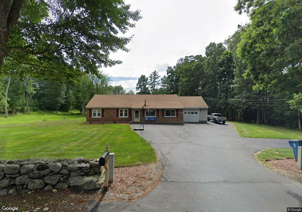
357 Forest St Dunstable, MA 01827
Estimated Value: $492,349 - $617,000
3
Beds
2
Baths
1,624
Sq Ft
$349/Sq Ft
Est. Value
About This Home
This home is located at 357 Forest St, Dunstable, MA 01827 and is currently estimated at $566,587, approximately $348 per square foot. 357 Forest St is a home located in Middlesex County with nearby schools including Groton Dunstable Regional High School and Academy of Notre Dame - Upper School.
Ownership History
Date
Name
Owned For
Owner Type
Purchase Details
Closed on
Jul 28, 2003
Sold by
Dumont John M
Bought by
Dumont Diane L and Dumont John M
Current Estimated Value
Home Financials for this Owner
Home Financials are based on the most recent Mortgage that was taken out on this home.
Original Mortgage
$71,000
Outstanding Balance
$29,160
Interest Rate
5.27%
Mortgage Type
Purchase Money Mortgage
Estimated Equity
$537,427
Purchase Details
Closed on
Sep 30, 1998
Sold by
Castaneda Francisco L and Castaneda Annette R
Bought by
Dumont John M
Home Financials for this Owner
Home Financials are based on the most recent Mortgage that was taken out on this home.
Original Mortgage
$50,000
Interest Rate
6.89%
Mortgage Type
Purchase Money Mortgage
Create a Home Valuation Report for This Property
The Home Valuation Report is an in-depth analysis detailing your home's value as well as a comparison with similar homes in the area
Home Values in the Area
Average Home Value in this Area
Purchase History
| Date | Buyer | Sale Price | Title Company |
|---|---|---|---|
| Dumont Diane L | -- | -- | |
| Dumont John M | $160,000 | -- |
Source: Public Records
Mortgage History
| Date | Status | Borrower | Loan Amount |
|---|---|---|---|
| Open | Dumont Diane L | $71,000 | |
| Closed | Dumont Diane L | $25,000 | |
| Previous Owner | Dumont John M | $20,000 | |
| Previous Owner | Dumont John M | $50,000 | |
| Previous Owner | Dumont John M | $35,000 |
Source: Public Records
Tax History
| Year | Tax Paid | Tax Assessment Tax Assessment Total Assessment is a certain percentage of the fair market value that is determined by local assessors to be the total taxable value of land and additions on the property. | Land | Improvement |
|---|---|---|---|---|
| 2025 | $5,790 | $421,100 | $218,600 | $202,500 |
| 2024 | $5,509 | $394,600 | $200,800 | $193,800 |
| 2023 | $5,719 | $382,000 | $200,800 | $181,200 |
| 2022 | $5,447 | $357,200 | $200,800 | $156,400 |
| 2021 | $4,962 | $302,400 | $183,800 | $118,600 |
| 2020 | $4,944 | $293,600 | $183,800 | $109,800 |
| 2019 | $4,804 | $281,600 | $183,800 | $97,800 |
| 2018 | $4,804 | $273,900 | $183,100 | $90,800 |
| 2017 | $4,599 | $270,200 | $183,100 | $87,100 |
| 2016 | $4,336 | $262,000 | $174,900 | $87,100 |
| 2015 | $3,890 | $232,500 | $147,200 | $85,300 |
| 2014 | $3,668 | $232,600 | $147,200 | $85,400 |
Source: Public Records
Map
Nearby Homes
- 0 Lowell St
- 16 Cannongate Rd Unit 16
- 160 Westford Rd
- 153 Off Pond St
- 103 Pondview Place Unit 103
- 0 Dunstable Rd
- 319 Pleasant St
- 62 Brook St
- 14 Centercrest Dr Unit 14
- 2 Strawberry Bank Rd Unit 17
- 22 Highland Rd
- 4 Heritage Village Dr
- 34 Shakespeare St
- 56 Frost Rd
- 6 Green Heron Ln Unit U22
- 24 Old Tyng Rd
- 38 Georgetown Dr
- 3 Black Oak Dr Unit C
- 11 Lojko Dr
- 20 Georgetown Dr
Your Personal Tour Guide
Ask me questions while you tour the home.