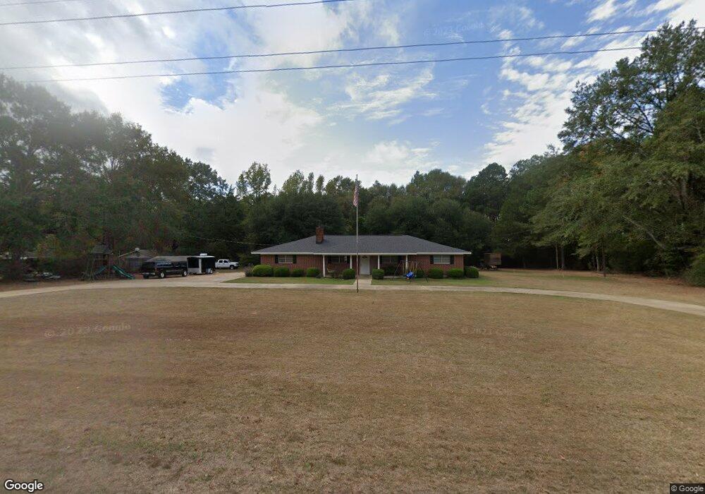
357 Highway 821 Choudrant, LA 71227
Estimated Value: $218,000 - $296,000
3
Beds
2
Baths
1,980
Sq Ft
$124/Sq Ft
Est. Value
About This Home
This home is located at 357 Highway 821, Choudrant, LA 71227 and is currently estimated at $245,079, approximately $123 per square foot. 357 Highway 821 is a home located in Lincoln Parish with nearby schools including Choudrant Elementary School, Choudrant High School, and Ruston Junior High School.
Ownership History
Date
Name
Owned For
Owner Type
Purchase Details
Closed on
Jul 20, 2020
Sold by
Roach Robert D
Bought by
Owens Mark A and Owens Leslie D
Current Estimated Value
Home Financials for this Owner
Home Financials are based on the most recent Mortgage that was taken out on this home.
Original Mortgage
$173,737
Outstanding Balance
$152,678
Interest Rate
3.1%
Mortgage Type
New Conventional
Estimated Equity
$92,401
Create a Home Valuation Report for This Property
The Home Valuation Report is an in-depth analysis detailing your home's value as well as a comparison with similar homes in the area
Purchase History
| Date | Buyer | Sale Price | Title Company |
|---|---|---|---|
| Owens Mark A | $171,000 | None Available |
Source: Public Records
Mortgage History
| Date | Status | Borrower | Loan Amount |
|---|---|---|---|
| Open | Owens Mark A | $173,737 |
Source: Public Records
Tax History
| Year | Tax Paid | Tax Assessment Tax Assessment Total Assessment is a certain percentage of the fair market value that is determined by local assessors to be the total taxable value of land and additions on the property. | Land | Improvement |
|---|---|---|---|---|
| 2025 | $1,379 | $16,923 | $1,150 | $15,773 |
| 2024 | $1,379 | $16,922 | $1,150 | $15,772 |
| 2023 | $1,228 | $14,377 | $1,600 | $12,777 |
| 2022 | $1,220 | $14,377 | $1,600 | $12,777 |
| 2021 | $1,201 | $14,377 | $1,600 | $12,777 |
| 2020 | $1,118 | $13,291 | $1,600 | $11,691 |
| 2019 | $1,138 | $13,318 | $1,984 | $11,334 |
| 2018 | $1,138 | $13,318 | $1,984 | $11,334 |
| 2017 | $1,141 | $13,318 | $1,984 | $11,334 |
| 2016 | $1,164 | $0 | $0 | $0 |
| 2015 | $1,091 | $11,496 | $1,774 | $9,722 |
| 2013 | $1,106 | $11,496 | $1,774 | $9,722 |
Source: Public Records
Map
Nearby Homes
- 120 Lanes End Dr
- 0 Par Road 41
- 448 Loblolly Ln
- 00 Par Road 43
- 165 Loblolly Ln
- 490 New Hope Rd Unit 514 New Hope Rd., 00
- 120 Douglas Ln
- 929 Highway 145
- 190 Loring Bend
- 1094 Roach Rd
- 120 Hill Creek Dr
- 201 Vintage Ln
- 1950 Louisiana 821
- 281 Williams Rd
- 546 Louisiana 145
- 522 Louisiana 145
- 1061 Whitehead Rd
- 219 Lamar Rd
- 0 Spillers Rd
- 396 Louisiana 145 Unit 406 Highway 145, 40
- 324 Highway 821
- 354 Highway 821
- 407 Highway 821
- 425 Highway 821
- 215 Highway 821
- 107 Brooks Rd
- 193 Highway 821
- 191 Highway 821
- 543 Highway 821
- 2607 Whitehead Rd
- 2671 Whitehead Rd
- 166 Highway 821
- 144 Highway 821
- 136 Highway 821
- 403 Ambrose Rd
- 232 Brooks Rd
- 576 Highway 821
- 227 Ambrose Rd
- 123 Highway 821
- 135 Ambrose Rd
Your Personal Tour Guide
Ask me questions while you tour the home.