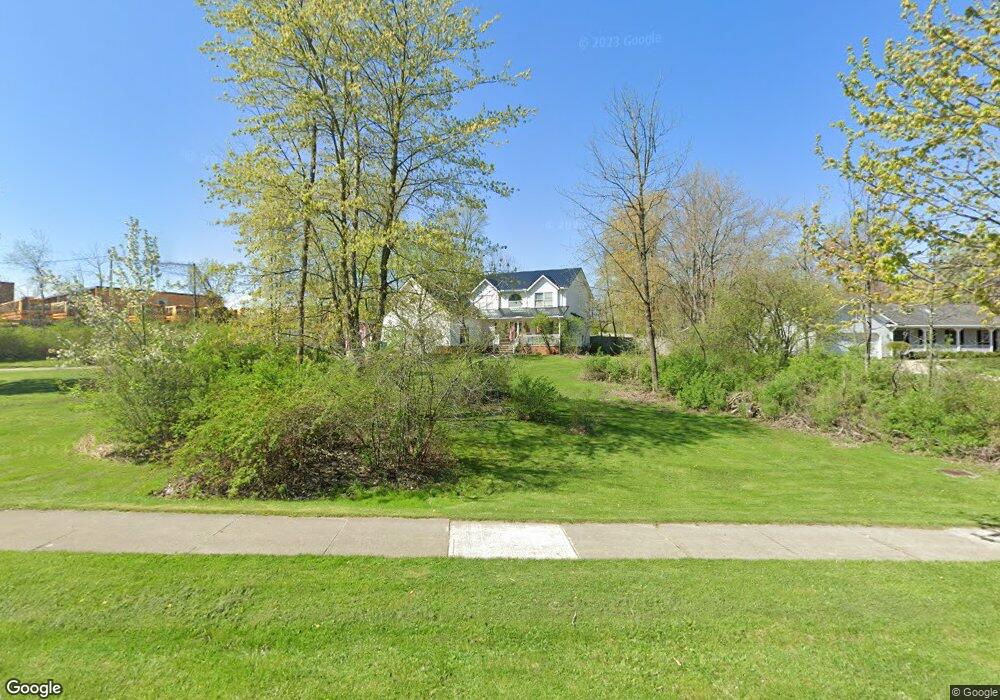
357 Maple Ave Chardon, OH 44024
Estimated Value: $384,000 - $472,000
3
Beds
3
Baths
2,204
Sq Ft
$187/Sq Ft
Est. Value
About This Home
This home is located at 357 Maple Ave, Chardon, OH 44024 and is currently estimated at $411,993, approximately $186 per square foot. 357 Maple Ave is a home located in Geauga County with nearby schools including Chardon High School and St. Mary Elementary School.
Ownership History
Date
Name
Owned For
Owner Type
Purchase Details
Closed on
Jun 13, 2003
Sold by
Forbes Bruce H and Forbes Tami R
Bought by
Lucarelli Reno and Lucarelli Denise K
Current Estimated Value
Home Financials for this Owner
Home Financials are based on the most recent Mortgage that was taken out on this home.
Original Mortgage
$162,000
Interest Rate
5.78%
Mortgage Type
Purchase Money Mortgage
Purchase Details
Closed on
Oct 19, 1995
Sold by
Chelmsford Properties
Bought by
Yoder Dan D and Yoder Henry D
Home Financials for this Owner
Home Financials are based on the most recent Mortgage that was taken out on this home.
Original Mortgage
$40,000
Interest Rate
6%
Mortgage Type
New Conventional
Purchase Details
Closed on
Jan 1, 1990
Bought by
Chelmsford Prop Inc
Create a Home Valuation Report for This Property
The Home Valuation Report is an in-depth analysis detailing your home's value as well as a comparison with similar homes in the area
Home Values in the Area
Average Home Value in this Area
Purchase History
| Date | Buyer | Sale Price | Title Company |
|---|---|---|---|
| Lucarelli Reno | $203,000 | Cleveland Title | |
| Yoder Dan D | $40,000 | -- | |
| Chelmsford Prop Inc | -- | -- |
Source: Public Records
Mortgage History
| Date | Status | Borrower | Loan Amount |
|---|---|---|---|
| Previous Owner | Lucarelli Reno | $162,000 | |
| Previous Owner | Yoder Dan D | $40,000 |
Source: Public Records
Tax History
| Year | Tax Paid | Tax Assessment Tax Assessment Total Assessment is a certain percentage of the fair market value that is determined by local assessors to be the total taxable value of land and additions on the property. | Land | Improvement |
|---|---|---|---|---|
| 2024 | $5,688 | $114,810 | $30,000 | $84,810 |
| 2023 | $5,688 | $114,810 | $30,000 | $84,810 |
| 2022 | $4,875 | $84,420 | $22,190 | $62,230 |
| 2021 | $4,855 | $84,420 | $22,190 | $62,230 |
| 2020 | $4,765 | $84,420 | $22,190 | $62,230 |
| 2019 | $4,320 | $75,390 | $22,190 | $53,200 |
| 2018 | $4,614 | $75,390 | $22,190 | $53,200 |
| 2017 | $4,320 | $75,390 | $22,190 | $53,200 |
| 2016 | $4,160 | $71,230 | $20,970 | $50,260 |
| 2015 | $4,158 | $71,230 | $20,970 | $50,260 |
| 2014 | $4,015 | $71,230 | $20,970 | $50,260 |
| 2013 | $3,991 | $71,230 | $20,970 | $50,260 |
Source: Public Records
Map
Nearby Homes
- 116 Chardon Ave
- 400 North St
- 234 N Hambden St
- 449 N Hambden St
- 207 Water St
- 0 Clarkwood Dr
- 123 Ferris Ave
- 331 Irma Dr
- 108 Gentry Ct
- 116 Fox Pointe Dr
- VL Wilson Mills Rd
- 13149 Gar Hwy
- 104 Bentwood Dr
- 11200 Aquilla Rd
- 102 Hidden Glen Trail
- 148 Pine Hollow Cir
- 9685 Campton Ridge Dr
- 13009 Kevin Ln
- 10360 Sawmill Dr
- 104 Pine Hollow Cir
- 212 Canfield Dr
- 214 Canfield Dr
- 210 Canfield Dr
- 208 Canfield Dr
- 216 Canfield Dr
- 211 Canfield Dr
- 218 Canfield Dr
- 215 Canfield Dr
- 206 Canfield Dr
- 220 Canfield Dr
- 217 Canfield Dr
- 207 Canfield Dr
- 190 Canfield Dr
- 222 Canfield Dr
- 184 Canfield Dr
- 224 Canfield Dr
- 193 Canfield Dr
- 193 Down Down Canfield Dr
- 193 up up Canfield Dr
- 193 up Canfield Dr