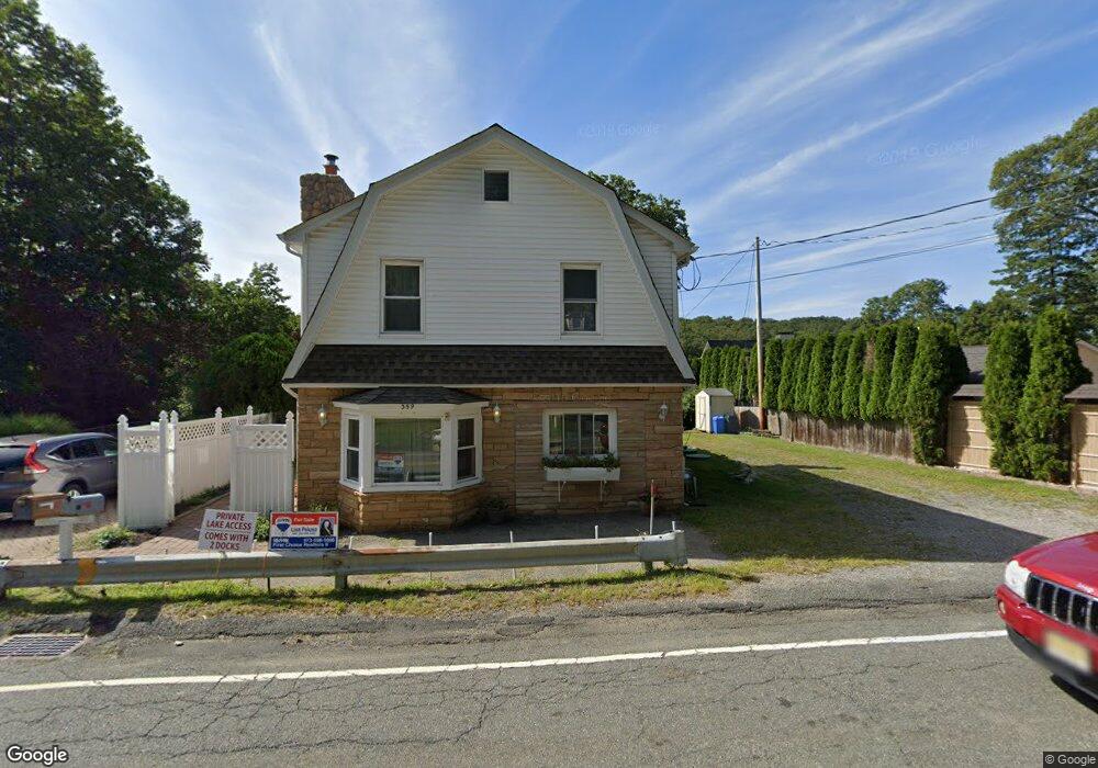
357 Maxim Dr Hopatcong, NJ 07843
Estimated Value: $442,000 - $704,000
--
Bed
--
Bath
1,207
Sq Ft
$466/Sq Ft
Est. Value
About This Home
This home is located at 357 Maxim Dr, Hopatcong, NJ 07843 and is currently estimated at $562,552, approximately $466 per square foot. 357 Maxim Dr is a home located in Sussex County with nearby schools including Hudson Maxim Elementary School, Durban Avenue Elementary School, and Tulsa Trail Elementary School.
Ownership History
Date
Name
Owned For
Owner Type
Purchase Details
Closed on
May 30, 2025
Sold by
Marchetti Jacqueline A and Marchetti Nicholas V
Bought by
Jacqueline A Marchetti Revocable Trust and Marchetti
Current Estimated Value
Purchase Details
Closed on
Apr 21, 2021
Sold by
Marchetti Nicholas V and Marchetti Jacqueline A
Bought by
Marchetti Nicholas V and Marchetti Jacqueline A
Create a Home Valuation Report for This Property
The Home Valuation Report is an in-depth analysis detailing your home's value as well as a comparison with similar homes in the area
Home Values in the Area
Average Home Value in this Area
Purchase History
| Date | Buyer | Sale Price | Title Company |
|---|---|---|---|
| Jacqueline A Marchetti Revocable Trust | -- | None Listed On Document | |
| Marchetti Nicholas V | -- | None Listed On Document | |
| Marchetti Nicholas V | -- | None Listed On Document | |
| Marchetti Nicholas V | -- | None Listed On Document | |
| Marchetti Nicholas V | -- | None Listed On Document |
Source: Public Records
Tax History Compared to Growth
Tax History
| Year | Tax Paid | Tax Assessment Tax Assessment Total Assessment is a certain percentage of the fair market value that is determined by local assessors to be the total taxable value of land and additions on the property. | Land | Improvement |
|---|---|---|---|---|
| 2025 | $11,524 | $552,700 | $339,200 | $213,500 |
| 2024 | $10,756 | $552,700 | $339,200 | $213,500 |
| 2023 | $10,756 | $307,400 | $229,000 | $78,400 |
| 2022 | $10,544 | $307,400 | $229,000 | $78,400 |
| 2021 | $10,366 | $307,400 | $229,000 | $78,400 |
| 2020 | $10,258 | $307,400 | $229,000 | $78,400 |
| 2019 | $10,215 | $307,400 | $229,000 | $78,400 |
| 2018 | $10,193 | $307,400 | $229,000 | $78,400 |
| 2017 | $10,178 | $307,400 | $229,000 | $78,400 |
| 2016 | $10,200 | $307,400 | $229,000 | $78,400 |
| 2015 | $9,969 | $307,400 | $229,000 | $78,400 |
| 2014 | $9,935 | $307,400 | $229,000 | $78,400 |
Source: Public Records
Map
Nearby Homes
- 354 Maxim Dr
- 34 Oklahoma Trail
- 14 Marshall Trail
- 66 Sutton Trail
- 23 Fordham Trail
- 9 Papoose Trail
- 4 Kansas Way
- 114 Rollins Trail
- 35 Mountain Trail
- 208 Maxim Dr
- 4 Bear Pond Trail
- 8 Oneida Ave
- 121 Bucknell Trail
- 207 Dupont Ave
- 656 Lakeside Ave
- 496 River Styx Rd
- 2 Lincoln Trail
- 38 W River Styx Rd
- 10 N River Styx Rd
- 8 Walton Rd